Showing posts with label North Dakota. Show all posts

Thursday, December 26, 2019

Lakota America, A Book Review

The cover of Lakota America features the art of Lakȟóta artist Jim Yellowhawk (Cheyenne River Sioux Tribe; Itázipčho). A simple photo of my copy of this book. 
Lakota America, A Book Review
This Book Fuckin' Moved Me
By Dakota Wind
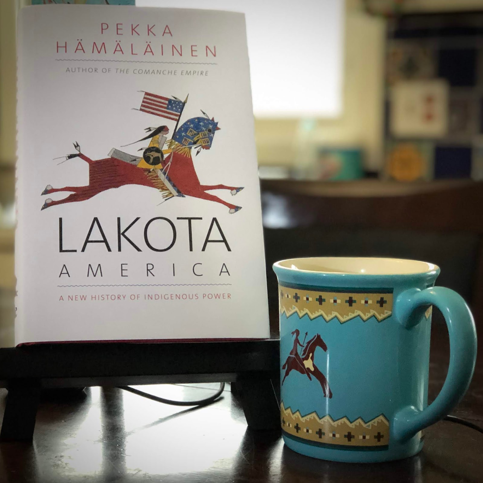
Hämäläinen, Pekka. Lakota America: A New History of Indigenous Power. New Haven, CT: Yale University Press. 2019. $35.00 (hardcover). 544 pages + ix. Acknowledgments, a note on terminology, introduction, epilogue, a list of abbreviations, notes, glossary, index, maps, photos, illustrations.

“Yet this book is decidedly a history of the Lakotas, written from sources that seek to convey their perspective, often in their own words. An extraordinary archive makes this possible to an unusual degree. Lakota communities traced the passage of time by drawing on a buffalo hide a pictograph of one memorable event for each year. Lakotas call these calendars waníyetu iyáwapi. They draw attention to the mundane and reveal the sublime. Perhaps most important, as a body of historical record, winter counts capture what fascinated Lakotas and what mattered to them most. Lakota America makes the fullest use yet of this Indigenous archive in writing Lakota history.” (Hämäläinen, 2019; 8)

Thus begins Hämäläinen’s Lakota America, a post-colonial contact history of a people referencing their own historical records, and in this process, treating these pictographic records with a serious care and careful regard that these primary resource documents deserve. Most histories regarding the Očhéthi Šakówiŋ, Seven Council Fires (or “The Great Sioux Nation), are constructed primarily from colonial records (i.e. explorer journals, trader records, and missionary accounts). Hämäläinen embraces the indigenous record as a concurrent history, complemented by the colonial record.

I felt a deep sense of gratification reading this beautiful work.

Hämäläinen paints a picture of a people occupying a known and busy landscape inhabited and shaped by other indigenous peoples from trade, war, disease, and expanding colonial empires, to displacement, removal, imprisonment, and survival in a post-reservation world.

The story begins not with conflict, but with the arrival of Thiyóškate (Plays In The Lodge) on a diplomatic mission to Montreal to secure peace in the interior of North America. Conflict spread west threatening to invade Očhéthi Šakówiŋ homelands for beaver pelts in a trading system that left indigenous peoples dependent on iron wrought trade items.

There are many books about the Očhéthi Šakówiŋ, among them other notables including Royal Hassrick’s “The Sioux: Life and Customs of a Warrior Society,” Thomas Mails’ “Mystic Warriors of the Plains.” Nearly all western history books agree that the horse arrived in the mid-1700s. Hämäläinen breaks from academic consensus by informing readers that the horse arrived on the northern plains following the Pueblo Revolt of 1682. (Hämäläinen, 2019; 55)

The chapter, The Lakota Meridian, explores the Očhéthi Šakówiŋ in the context of world history. Hämäläinen reconstructs the setting of the interior of North America following the arrival of the horse, the gun, and smallpox epidemics which obliterated or weakened so many other first nations. The Lakȟóta secured and manipulated trade to their benefit. The Arikara War of 1823, the first American military campaign against Plains Indians sees the Očhéthi Šakówiŋ side with the United States, years after refusing “to be discovered” and acknowledging the United States as sovereign. (Hämäläinen, 2019; 140)

Lakota America is not a conflict history of the American West. It is closer to a biography in tone, but not on any one individual or few of Očhéthi Šakówiŋ leadership. It is not so much a cultural examination either; there are other resources for that. This work is like a study of the character of a people throughout several generations. Hämäläinen briefly articulates the cultural story of the White Buffalo Calf Woman and the Gift of the Sacred Pipe but reimagines this ancient narrative as a story of new urgency as the Lakȟóta ventured west from the Mnišóše, the Water-Astir (or Missouri River). (Hämäläinen, 2019; 164-165). He does reiterate throughout his work that Očhéthi Šakówiŋ identity is evidenced by virtue of practice and language. 

The image above was drawn by Sitting Bull's own hand. In his later years, Sitting Bull and his own people, the Húŋkpapȟa, identified him as a medicine man or spiritual leader. 

Očhéthi Šakówiŋ homeland is determined by occupation of waterways, in particular, the Mnišóše and all his tributaries. Boundaries are determined by the waters, and those boundaries were recognized in both the Fort Laramie Treaties. Hämäläinen carefully determines and explains how those boundaries were set through conflict and diplomacy. Their villages moved from valley to valley across the plains. The traditional Očhéthi Šakówiŋ recalls that the people moved from stream source to stream source across the plains.

Hämäläinen explores Lakȟóta political philosophy in their own terms as well as they dealt with the decline of the great bison ganges and the arrival of more fixed signs of American occupation. Iwáštegla, meaning “moderate,” “gentle,” and “easy,” but for also for the greatest maximum benefit, that which is “wašté,” or “good,” for the people. “Lakotas still expected wašíčus [sic] to compromise more than they did: after all, most of their interactions took place in Lakota territory. In this charged moment one can glimpse something essential about Lakotas’ ability to accept new realities, adjust to changing governing conditions, and yet remain indigenous.” (Hämäläinen, 2019; 300)

Lakota America has many strengths. Meticulous research is one, but what makes Hämäläinen’s work stand out is that he acknowledges, employs, and attributes the history (oral and pictographic) of the people he writes about, putting it on the same page as colonial records equating its importance.

Lakota America touches on the greatest conflict to shape the American West, Pȟežíšla Wakpá Okíčhize, or the Battle of the Little Bighorn. Every year there’s a book written about Lt. Col. Custer and the fate of the 7th Cavalry. Every book published about the Očhéthi Šakówiŋ includes this fight. It is refreshing that Hämäläinen does not dedicate an entire chapter retreading the last great Indian fight.

Hämäläinen does not stop his narrative of Lakȟóta history with Čhaŋkpé Ópi Owíčhakte, the Wounded Knee Massacre. No, he brings the story of adaptation, survival, and self-determination up to recent events at Íŋyaŋ Iyá Wakpá, the Talking Stone River (or the Cannonball River). A people and their history did not end at the turn of 1900. It lives and is a constant story of change. Hämäläinen gets it.

Lakota America is an engaging read. I found myself stopping several times throughout, lost in thought, and provoked to remember that indigenous occupation includes several other first nations who contested the landscape and gratified to discover how much Hämäläinen relied on Lakȟóta history to create this immensely reflective work.

My only concern, and it is a very minor thing, is that not all Dakhóta-Lakȟóta use the same term for the “winter count:” Northern Lakȟóta (i.e. Húŋkpapȟa) and Iháŋkthuŋwaŋna (i.e. Wičhíyena, or “Upper Yanktonai”) refer to the pictographic records as Waníyetu Wówapi, which means, “Keeping an Account of the Winter.” The Dakhóta and Lakȟóta who were placed at Fort Peck refer to winter counts as Hékta Yawápi, or “Counting Back.”

Lakota America has earned its place on my bookshelf. Get your copy as soon as you can to add it to yours. 


Saturday, December 21, 2019

Winter Solstice Is Sacred Time

The Long Night Moon at White Earth Butte. The crescent represents the moon or month. Above the moon, appearing upside down at the top is the landscape profile of White Earth Butte as seen from the south looking north. 
Winter Solstice Is Sacred Time
A Time To Carry One Another

By Dakota Wind
The longest season of the year was winter on the Great Plains. On the traditional Očhéthi Šakówiŋ lunar calendar, the year consisted of two spring, four summer, two autumn, and five moons or months. The word for "year," in fact, is “Waníyetu,” meaning “Winter.”

The first snow was celebrated. Men put on their snowshoes and danced in the fresh powder. The snow made for ease of hunting. The Lakȟóta explained the changing of the seasons as an epic battle between two brothers: Wazíya (The North) and Okáǧa (The South). As one retreated, the other gained ground. When Wazíya won, his breath blew across the landscape, and for as deadly and sharp his cold breath might be, he brought a blanket of snow under which Uŋčí Makȟá (Grandmother Earth) slept.

The cultural genesis of the seasons aside, they remembered and shared real events from winters past. The High Dog Winter Count recalls the year 1800 as one of the most challenging years to survive. The summer heat was unbearably hot. The great gangs of bison went away, and hunting was poor. Flowers disappeared from the landscape, and the wind drank up the water. The birds refused to sing too.

A punishing winter followed, as remembered in the White Bull Winter Count.

Winter came, snow and ice were everywhere. A group of Lakȟóta decided to move winter camp from the bottomlands of one river to that of another. As they moved over the high plains, a blizzard caught them. Gradually some of them began to succumb to the cold and fell. As one person fell, another lifted and carried him or her for the rest of their journey. Kičhíč’iŋpi keúŋkiyapi, “They say that they carried each other.”

The Lakȟóta used the long winter night to share stories like that of Wičháȟpi Hiŋȟphaya (The Fallen Star; also called “Star Boy”). The story of his mother, Tȟapȟúŋ Šá Wíŋ (Red Cheek Woman), and father, Wičháȟpi Owáŋžila (The Star that Does Not Move; “The North Star”) is fairly well known and told in books and various online media.

The Lakȟóta share Ohúŋkakaŋ (stories from the distant past) and Wičhówoyake (stories, legends, myth) during the five lunar months of Waníyetu (the winter season), and during this moon especially, they share stories like the Fallen Star narrative. 


Sometime during the Long Night, the Fallen Star rises from the highest point of White Earth Butte. As the heavens turn, or as the earth rotates, the constellation gradually moves counter-clockwise until most of it gradually disappears past the northern horizon. Fallen Star, or Capella, dips down past the horizon, then majestically rises, bringing hope to the people. 

According to Ronald Goodman’s work in his Lakota Star Knowledge, Fallen Star was renowned among the Lakȟóta as “the Protector, the bringer of light and higher consciousness.” After becoming a father, Fallen Star ascended “a hill at night with a friend,” and told him that he was going to return home. Fallen Star laid down upon the hilltop and died. His spirit was seen as a light that rose into the star world. “At some time in the past, all Lakȟóta acquired the gift of light he brought them.” (Goodman, 2017; 32)

Goodman discusses an ancient central symbol strongly associated with the heavens and the world. This symbol is referred to as Kapémni (“the action is swinging around and around,” as with a warclub or bull roar), and resembles an hourglass. One half represents all that is heavenly, the other half represents all that is worldly. What is in the heavens is also present in the world. In the pages of Lakota Star Knowledge, this “mirroring” is demonstrated in a map of the Lakȟóta constellation Čhaŋgléška Wakȟáŋ (The Sacred Hoop) which demarcates the locations of landmarks in and around the Black Hills.

In 1967, Helen Blish published her thesis A Pictographic History of the Oglala Sioux, featuring the works of Amos Bad Heart Bull (~1868-1913), a noted Lakȟóta artist, amongst of what was a map of the Black Hills and other features including Pahá Ská (White Butte). White Butte is noted as being north of the Black Hills.

It is a general map; not everything matches up perfectly, in fact, maps of the landscape were concerned with lineal cohesion rather than over-exactness. Matȟó Thípila (Bear Lodge), or Devils Tower, is not actually within Khiíŋyaŋka Očháŋku (The Race Track), the edge of the Black Hills. The Race Track is the “mirror” of the Sacred Hoop, just as Makȟáska (White Earth Butte), or White Butte, is not a part of the Black Hills, it is north of the ‘Hills. It is a real butte. It is also the hill upon which Fallen Star made his journey back to the sky. 

Like Devils Tower, White Butte appears to be in the narrative of the Sacred Hoop in Bad Heart Bull’s map narrative, though it is not so in actuality. Yet according to the map of the Sacred Hoop constellation in Lakota Star Knowledge, a star commonly known as Capella, the brightest star in the constellation Auriga appears as part of the Sacred Hoop.

Referencing Bad Heart Bull’s map and tracking the sky from the Sacred Hoop to the North Star one “sees” the stars associated with the constellation Auriga “pointing” or “reaching” towards the North Star. The constellation Auriga appears to be Kapémni, or "mirror" of White Butte and the immediate landscape surrounding that beautiful plateau. 

Fallen Star returns to the sky to be with his father. He sends rays of light and hope to the Očhéthi Šakówiŋ people. 

As Capella is the Fallen Star I’d like to suggest that Auriga is his constellation. At about 6:00 PM on the longest night of the year, this constellation appears upside down. Twelve hours later, at about 6:00 AM, which is at the tail end of the longest night, the heavens have rotated 180° counterclockwise, and have become right side up. The Fallen Star “rises” from the horizon, it rises from the top of White Earth Butte.

Long ago, before the reservation era anyway, the month which some might call December today, was known by some Lakȟóta as Waníčhokaŋ Wí (The Midwinter Moon). They might not have known the exact time (it’s 10:19 PM CST) but could reckon the subtle shift in daylight when there was a little more of it and could track the general date with counting sticks; they knew it happened in the Midwinter Moon.

According to Vi Waln, “I believe the real day of prayer was observed on the winter solstice by the people with ceremony, food, and family.” Further, “Nature and the stars were monitored carefully to help with preparation for whatever time of year was upon the people.” And lastly, “Many Lakota people will offer prayer in much the same our ancestors did so on the Winter Solstice.” (Valn, Winter Solstice Is Sacred, 2011)

There are five winter moons in the traditional Lakȟóta calendar. After the Winter Solstice, it was time to gather red willow (eastern dogwood) to make čhaŋšáŋšaŋ, traditional tobacco made from the inner bark of the red willow, and used for ceremony.

In the heart of winter, in daylight, there sometimes appears the sundog. The Lakȟóta call it Wíačhéič'thi, which means "The Sun Makes A Campfire [For Himself]," and the story associated with this event holds the promise of light, that it returns. Sometimes, during the winter nights, they see a ring around the moon, also called Wíačhéič'thi, only this is interpreted as "The Moon Makes a Campfire [For Herself]." The Moon has vigorously stirred her pot and light has spilled about her lodge.

The New Lakota Dictionary lists the Winter Solstice as Waní-Wí-Ipȟá (Crest of the Winter Sun). The Húŋkpapȟa might call the same Haŋyétu Háŋska (The Long Night) as they called this traditional month Haŋyétu Háŋska Wí (The Long Night Moon).

However it is called this day, or this month, these things are certain: gather close together with family in observation or prayer, eat together, share stories, and carry each other.


Wednesday, November 13, 2019

Historical Record On Beaver Creek

WA NA TA, THE CHARGER, Grand Chief of the Sioux, by Charles King Bird.
Missing Narrative In North Dakota
Historical Record On Beaver Creek

By Dakota Wind
Linton, N.D. (The First Scout) – There is a great long gradual rise on the vast open prairie between the Mnišóše (The Water-Astir, or “Missouri River”) and Čhaŋsáŋsaŋ Wakpá (White Birch River, or “James River”). The Iháŋkthuŋwaŋna (Little End Village, or “Yanktonai”) who occupied this region for hundreds of years call this rise Ȟé Mníšoše, the Water-Astir Ridge. The French called it the Coteau du Missouri.

The Očhéthi Šakówiŋ often know places by two or more names. An everyday name for everyday things like hunting or gathering. A site may have a special or spiritual significance. The Middle Dakhóta called the Water-Astir Ridge, just that, when they hunted and gathered. When they prayed there, when they put their relatives to rest on the coteau, they called it Wanáǧi Tȟamákhočhe, or Country of the Spirits.

For the Dakhóta, the Water-Astir Ridge begins in the north by Šuŋk’óthi Pahá, or Wolf Den Butte, which is today called Dogden Butte. The coteau reaches southwest to a point near the North Dakota-South Dakota border by Forbes, ND. A creek across the border meanders across the plain and serves as a natural boundary of the coteau. This creek has two names in Dakhóta, and if that weren’t enough, it has two designations in English. 


The Battle of Whitestone Hill, as it appeared in Harpers Weekly, October 31, 2863.

A gulch six miles west-southwest of Forbes, ND is known to the Iháŋkthuŋwaŋna as Šúŋka Wakȟáŋ Wičháktepi, or Where Their Horses Were Killed, in reference to the horses that were wounded in the 1863 Whitestone Hill Conflict carried survivors to this point and laid down to rest.

This creek is known by the Middle Dakhóta as Wíŋkta Wakpána (Hermaphrodite Creek) or Dakhóta Núm Wakpá (Two Dakota Creek). The Corps of Discovery called it Stone Idol Creek. The modern population in the vicinity of Pollock call it Spring Creek. This stream originates about nine miles south-southeast of Ashley, ND.

Another stream that bears re-examination is Čhápa Wakpána, or Beaver Creek. It rises at Bdé Čhápa, or Beaver Lake, and flows out of the coteau about 108 miles west to join the Mnišóše by the Beaver Creek Recreation Area by HWY 1804.

In the fall of 1839, Waná’ata, the Charger, led his band of Dakhóta to make their winter camp. It was his last winter. The camp spread out for miles along the creek. The Charger was a veteran of the War of 1812. He was commissioned a captain by British Indian Agent Col. Robert Dickson. The Charger led several hundred Dakhóta people at the battles of Fort Miegs and Fort Stephen in Ohio. He was so influential on the field, his bravery so renowned, that President Martin Van Buren met with the Charger and commissioned his likeness in a portrait. The Charger also met with King George III. Was the Charger an important and influential figure in the history of the American West? A president and a king seemed to think so.

In 1818, at Fort Snelling, the Charger became a devoted proponent of the United States.

The Charger led a command of hundreds of Dakhóta and Lakȟóta warriors in the first ever punitive campaign against a Plains Indian people, the Arikara, in the Arikara War of 1823. 


U.S. General Land Office Map, No. 12, 1878, details Grant's executive order extending the boundaries of Standing Rock Agency into present-day Emmons County.

President Grant extended the boundary of the Standing Rock Agency in his Executive Order, dated March 16, 1875, from west of the Missouri River, east of the agency along Beaver Creek to about where 19th Ave SE, Linton, ND is located, and south into North Campbell, SD. This boundary set aside land for the Iháŋkthuŋwaŋna Dakhóta people. The people who fought on the side of the United States were recognized for their service and dedication by the federal government and the president set aside land for them in perpetuity.

There’s plenty of cultural and occupational history in Emmons County. If only there were some kind of in-depth historical Class III survey that could document these significant events.

Friday, March 15, 2019

A Resolution To Study A Dichotomy Of Archaeology & Indigenous History

Aerial view of North Dakota State Capitol, Bismarck, N.D. Digital Horizons. 2004-P-19-0014.
A Resolution To Study A Dichotomy
Archaeology & Indigenous History
By Dakota Wind
I attended a committee hearing this morning for Senate Concurrent Resolution 4017 at the North Dakota State Legislature. The summary of the bill is:

“A concurrent resolution directing the Legislative Management to consider studying the dichotomy between the archaeological discipline on cultural resources and the knowledge and expertise of tribal elders and tribal historic preservation officers to educate local, state, and federal agencies and the public; and the facilitation of effective consultation and cooperation for historic and prehistoric site identification and registration and the betterment of North Dakota and its citizens.”

I understand the language of this bill to mean that this is a study only, to begin a dialog between State Historic Preservation Office of North Dakota, the Tribal Historic Preservation Offices and tribal expertise to articulate the importance of known, recorded, sacred, and unrecorded historic sites to the people of North Dakota.

The sponsors of this bill are Sen. Joan Heckaman, Sen. Jordan Kannianen, Sen. Richard Marcellais, Sen. Dave Oehike, Rep. Ruth Buffalo, and Rep. Gretchen Dobervitch.

Sen. Marcellais and Rep. Buffalo introduced the resolution and public testimony followed almost unanimously in favor of this bill.

North Dakota Indian Affairs Commissioner Scott Davis spoke about his boots on the ground approach to meeting with energy interests about the importance of indigenous heritage sites in North Dakota. “It is what it is,” said Commissioner Davis regarding the development of energy resources, even as he spoke of the necessity of dialog between tribes, the state, and energy interests.

Dr. Erich Longie, Tribal Historic Preservation Officer of Spirit Lake began by greeting everyone, “Hiháŋna wašté!” he said. Dr. Longie spoke of the challenges and milestones all of the North Dakota’s citizens have made together in the name of progress while sharing the challenges he faced growing up in North Dakota. He urged the committee to support the concurrent resolution.

Mr. Calvin Grinnell spoke eloquently in support of this resolution. Former Sen. Tracy Potter took the mic and encouraged a change in wording from “dichotomy” in this study to something else, that the most important tool he learned in his political career was to listen, then he promptly left. Two more spoke in support of the resolution, then Fern Swenson took the stand.

I offered testimony in support of the resolution. I shared that there is more to the discussion than the physical record – archaeology – and we need to include the historical record. I then cited a dozen primary historic examples for the failure of the Dakota Access Pipeline’s Class III Survey, information that is completely missing from the report; and cited primary historical documents relating to the prison camp history of the Nez Perce at Fort Abraham Lincoln.

Swenson, the Deputy State Historic Preservation Officer at the State Historic Preservation Office, gave a most tepid oration that, as it turns out, was neither in support or against the resolution. She just wanted the committee to know how many thousands of sites the SHPO manages, how they work with the tribes of North Dakota, and how they assist the tribes “if they ask for it.”

When the committee asked if there were any who opposed the resolution, no one came forward.


Saturday, December 8, 2018

Winter Solstice and the Midwinter Moon

"The Long Night Moon," or Winter Solstice, pictured above, a pictographic representation for the lunar month of the Lakota people. This month will last from Dec. 7, 2018, through Jan. 4, 2019. The crescent represents the moon, or month, the star represents the night, and the arc represents the length of the night. 
Winter Solstice and the Midwinter Moon
They Were Carried When They Fell
By Dakota Wind
The long star-filled nights were a time to remember the myth-history of the people. I imagine a family similar to mine, gathered around a glowing fire, watching the flame, feeling the heat, and listening to the voice of ancient authority in a line of grandmothers and grandfathers going back to their elders and those before them.

The first snow was celebrated. Men put on their snowshoes and danced in the fresh powder. The snow made for ease of hunting. The Lakȟóta explained the changing of the seasons as an epic battle between two brothers: Wazíya (The North) and Okáǧa (The South). As one retreated, the other gained ground. When Wazíya won, his breath blew across the landscape, and for as deadly and sharp his cold breath might be, he brought a blanket of snow under which Uŋčí Makȟá (Grandmother Earth) slept.

The High Dog Winter Count recalls the year 1800 as one of the most challenging years to survive. The summer heat was unbearably hot. The great gangs of bison went away, and hunting was poor. Flowers disappeared from the landscape, and the wind drank up the water. The birds refused to sing too.

The punishing summer was followed by a harsh winter.

Winter came, snow and ice were everywhere. According to the White Bull Winter Count, a group of Lakȟóta decided to move winter camp from the bottomlands of one river to that of another. As they moved over the high plains, a blizzard caught them. Gradually some of them began to succumb to the cold and fell. As one person fell, another lifted and carried him or her the rest of their journey. Kičhíč’iŋpi keúŋkiyapi, “They say that they carried each other.” 


This constellation is commonly known as "Auriga" is as it would be seen in the middle of the night during the Winter Solstice. The biggest star closest to the middle of the crescent is commonly known as Capella. 

By firelight and starlight, the Lakȟóta used the time of the long winter night to share stories like that of Wičháȟpi Hiŋȟphaya (The Fallen Star; also called “Star Boy”). The story of his mother, Tȟapȟúŋ Šá Wíŋ (Red Cheek Woman), and father, Wičháȟpi Owáŋžila (The Star that Does Not Move; “The North Star”) is fairly well known.

According to Ronald Goodman’s work in his Lakota Star Knowledge, Fallen Star was renowned among the Lakȟóta as “the Protector, the bringer of light and higher consciousness.” After becoming a father, Fallen Star ascended “a hill at night with a friend,” and told him that he was going to return home. Fallen Star laid down upon the hilltop and died. His spirit was seen a light that rose into the star world. “At some time in the past, all Lakȟóta acquired the gift of light he brought them.” (Goodman, 2017; 32) Goodman’s work says that human beings are composed of matter and light.

In 1967, Helen Blish published her thesis A Pictographic History of the Oglala Sioux, featuring the works of Amos Bad Heart Bull (~1868-1913), a noted Lakȟóta artist, amongst of what was a map of the Black Hills and other features including Pahá Ská (White Butte). White Butte is noted as being north of the Black Hills. 


Kapemni, an hourglass shape symbolizing what is in the heavens is also on earth. 

Goodman discusses an ancient central symbol strongly associated with the heavens and the world. This symbol is referred to as Kapémni (“the action is swinging around and around,” as with a warclub or bullroar), and resembles an hourglass. One half represents all that is heavenly, the other half represents all that is worldly. What is in the heavens is also present in the world. In the pages of Lakota Star Knowledge, this “mirroring” is demonstrated in a map of the Lakȟóta constellation Čhaŋgléška Wakȟáŋ (The Sacred Hoop) which demarcates the locations of landmarks in and around the Black Hills.

It is a general map; not everything matches up perfectly. Matȟó Thípila (Bear Lodge), or Devils Tower, is not actually within Khiíŋyaŋka Očháŋku (The Race Track), the edge of the Black Hills. The Race Track is the “mirror” of the Sacred Hoop. White Butte is not a part of the Black Hills, but it is north. It is a real butte. It is also the hill upon which Fallen Star made his journey back to the sky. 


White Butte, located in southwest North Dakota near the town of Amidon. 

Like Devils Tower, White Butte appears to be in the narrative of the Sacred Hoop, though it is not so on earth. Yet according to the map of the Sacred Hoop constellation in Lakota Star Knowledge, a star commonly known as Capella, the brightest star in the constellation Auriga appears as part of the Sacred Hoop.

Referencing Bad Heart Bull’s map, and tracking the sky from the Sacred Hoop to the North Star one “sees” the stars associated with the constellation Auriga “pointing” or “reaching” towards the North Star. The constellation Auriga appears to be Kapémni, or "mirror" of White Butte and the immediate landscape surrounding that beautiful plateau. 


The constellation is commonly known as Auriga. The brightest star in this constellation is Capella. If this were the Lakota constellation for Fallen Star it would seem that his arm is raised, perhaps reaching for his father, North Star. 

I suggest that Capella is the Fallen Star, and Auriga is his constellation.

The Lakȟóta share Ohúŋkakaŋ (stories from the distant past) and Wičhówoyake (stories, legends, myth) during the five lunar months of Waníyetu (the winter season), and during this moon especially, they share stories like the Fallen Star narrative. 


Fallen Star, wears a robe symbolizing the day and night, a bow under the edge of his robe. 

Long ago, before the reservation era anyway, the month which some might call December today, was known by some Lakȟóta as Waníčhokaŋ Wí (The Midwinter Moon). They might not have known the exact day, but could reckon the subtle shift in daylight when there was a little more of it and could track the general date with counting sticks; they knew it happened in the Midwinter Moon.

According to Vi Waln, “I believe the real day of prayer was observed on the winter solstice by the people with ceremony, food, and family.” Further, “Nature and the stars were monitored carefully to help with preparation for whatever time of year was upon the people.” And lastly, “Many Lakota people will offer prayer in much the same our ancestors did so on the Winter Solstice.” (Valn, Winter Solstice Is Sacred, 2011)


There are five winter moons in the traditional Lakȟóta calendar. After the Winter Solstice, it was time to gather red willow (eastern dogwood) to make čhaŋšáŋšaŋ, a traditional tobacco made from the inner bark of the red willow, and used for ceremony. 

In the heart of winter, in daylight, there sometimes appears the sundog. The Lakȟóta call it Wíačhéič'thi, which means "The Sun Makes A Campfire [For Himself]." Sometimes, during the winter nights, they see a ring around the moon, also called Wíačhéič'thi, only this is interpreted as "The Moon Makes a Campfire [For Herself]."

The New Lakota Dictionary lists the Winter Solstice as Waní-Wí-Ipȟá (Crest of the Winter Sun). The Húŋkpapȟa might call the same Haŋyétu Háŋska (The Long Night) as they called this traditional month Haŋyétu Háŋska Wí (The Long Night Moon).

However it is called this day, or this month, these things are certain: gather close together with family in observation or prayer, eat together, share stories, and carry each other.


Sunday, July 29, 2018

Woman Walks Ahead, A Film Review

"This does not look like Standing Rock," he said. "...Standing Rock is supposed to look like New Mexico...," she replied.
Woman Walks Ahead, A Film Review
Can One Scene Redeem A Movie?
By Dakota Wind
Woman Walks Ahead. Directed by Susanna White. Produced by Edward Zwick, Marshall Herskovitz, Erika Olde, Rick Solomon, and Andrea Calderwood. Written by Steven Knight. Music by George Fenton. Starring Jessica Chastain, Michael Greyeyes, Chaske Spencer, Sam Rockwell, and others. U.S.A. & U.K.: Black Bicycle Entertainment, Bedford Falls Productions, and Potboiler Productions. June 29, 2018. Film. 101 Minutes.

Some films are beautifully crafted narratives based on real-life people or circumstances. Others struggle in their telling to make a story bigger than it was. Still more only have one redeeming quality to them. Woman Walks Ahead has one powerful message in a beautifully constructed scene that contains a minimal presence of the film’s female protagonist.

Before the film began, I was milling around in the atrium of the Grand Theater, a locally owned theater in Bismarck, ND, with an old friend talking about life and church. We got there about half an hour early to get good seats. About fifteen minutes into our wait, a young native man comes up to me and shakes my hand. I introduce myself in Lakȟóta and ask him his name. Lo, he offers a confident reply and we exchange pleasantries. A quiet opened around us as we engaged in our language. I told him that I’m not a fluent speaker and that he spoke very well. He nodded his head before rejoining his mother. They went on to see “Deadpool 2.”

Sam Rockwell, pictured above, as Col. Groves on a mission to justify killing Indians and redeem himself, but can't escape white male paternalism, plays a perfect guilty asshole who hasn't slept since the Killdeer fight of 1863. His Lakhota is alright too. 

I knew I wasn’t going to see a historically accurate film. There are plenty of articles drifting in the internet atmosphere challenging the artistry of Susanna White and a rambling self-serving narrative by Steven Knight that pretty much cover my concerns, but I have one overwhelming question.

Why film the movie in New Mexico? There are a few shots where the landscape might pass for Standing Rock, but anyone who has made the pilgrimage to Sitting Bull’s camp knows the rolling hills and sinuous banks of the Grand River are shaded overwhelmingly by cottonwood. The story is as removed from historical fact as it is in location.

New Mexico and its mountains are beautiful, but a beautiful mountain sunset in the southwest is not the same on the vast open prairie steppe. The prairie features unique flat-topped plateaus, an open sky with bright sunlight unhindered only by passing clouds, and a constant wind that has been here since creation. Thítȟuŋwaŋ, or Teton, means “They Who Dwell On The Plains.” White removed the people from the land that made them.

Susanna White (above) goes for emotional truth, not historical truth. The emotional truth that existed between Sitting Bull and Weldon simply did not exist.

Agent McLaughlin (pronounced mick-LOFF-lin by the community and by the Major’s descendants) would have been better served by perpetual cowboy Sam Elliot, at least he’s got the mustache for it. Knight didn’t know whether to write the Major as an apologist or paternalist, and it shows. McLaughlin learned Dakhota from his wife; Hinds’s Major is as confused about hearing Lakhota as Knight’s apparent research about the time and setting of the actual story, and neither should be.

Sam Rockwell’s Colonel Silas Groves is the perfect asshole whose arc represents something of a mix between white guilt and white redemption. Groves tells Chastain’s Weldon of the Indian depredation as justification for the country’s punitive campaign against the red man, and just barely touches on the exchange of escalating violence on the frontier (the 1863 Killdeer Mountain conflict is mentioned in which Sitting Bull mentions seeing Groves there, who was on campaign against the Lakhota who had nothing to do with the events in Minnesota, but for Groves, an Indian is an Indian).

Where's the snow that Knight's script mentioned in Sitting Bull's recollecton? It was not snowing, as it was the middle of summer. 

The 1863 Killdeer Mountain conflict took place in late July, the Moon of Ripe Chokecherries, making it nigh improbable that there was snowfall, and though it could snow in July, there is none mentioned at all in the oral tradition. Maybe in England it snows in July, but not on the Great Plains, but snowfall, even in retrospect in a rambling narrative makes for good telling.

There is a lot to deconstruct and inquire about this film, but it has one powerful redeeming scene. Agent McLaughlin sat with his wife/translator and General George Crook to hear testimony about whether the tribe should sign the Dawes Treaty, which in fact was not a treaty but a congressional act, to break up the Great Sioux Nation into small reservations. These smaller reservations were originally part of official US Indian policy called “concentration,” and were prison camps, the legacy of which enrolled members of federally recognized tribes are assigned enrollment numbers (prison numbers in the concentration policy days).

Sitting Bull, played by Michael Greyeyes (Plains Cree), delivers a powerful oratory about Makȟóčhe (Grandmother Earth) and how the Lakȟóta cannot sell it, “not even this much,” he said as he reached down for a handful of earth and held it before the agent. Some films redeem themselves with the perfect music, others with cinematography. This moment is this film's redemption. 

Stone Man's pictographic testimony of the conflict at Sitting Bull's camp the morning he was killed on the Grand River. Soldiers' guns and cannon fired onto Spotted Elk's (Big Foot's) band of Mnikowozu as they fled. 

The film concludes with the arrest and death of Sitting Bull. Artistic licensing aside, there was just too much missing for me to appreciate this scene as the director intended (a dramatic close up of Welden in the snow in distress over the loss of Sitting Bull). There was a conflict there between the police and the people camped there at Sitting Bull’s home. Soldiers stood atop the bluff of the south bank of the Grand River and fired gun and shell at the camp. Sitting Bull’s death was not by a sniper, but by BIA police officer Bull Head after he was shot; Bull Head shot Sitting Bull twice, once in the side, then in the head.

Sitting Bull was shot and killed by the BIA Indian Police up close, not by sniper. 

Welden’s painting is on display at the ND State Heritage Center and Museum, torn by one of the BIA police officers, but it is not the same as the painting as depicted in Woman Walks Ahead. Sitting Bull was painted “old” because he was old.

Weldon's painting of Sitting Bull on display at the ND Heritage Center and State Museum. The tear in the painting came from one of the BIA police officers. 

There was no romantic love between Sitting Bull and Weldon, but she did things for him that were expected of wives while she lived there: cooked and fed him, chopped wood, and tended his fire. I remember hearing that Sitting Bull asked her just to be his wife since she was doing the things wives do, but there was no romantic attachment. The on-screen chemistry between Weldon and Sitting Bull is chaste and distant, but the introduction of that chemistry is introduced by White and Knight.

See the movie, then visit the North Dakota Heritage Center and Museum to see the real Weldon painting. Adjacent to Weldon’s painting is Stone Man’s pictographic testimony of the conflict that ensued as Sitting Bull was arrested. Both images are worth taking in. 


Wednesday, December 6, 2017

History Of North Dakota, A Book Review

History of North Dakota, A Book Review
Environment Determines Character
By Dakota Wind

Robinson, Elwyn Burns. History of North Dakota. Lincoln, NB: University of Nebraska Press, 1966. Out of print. (Fargo, ND; ND Institute for Regional Studies, 1995. $40.00.) 610 pages + viii. Preface, table of contents, maps, illustrations.

Robinson’s History of North Dakota is a dense read. Twenty-three chapters take readers on a journey of remoteness from the formation of the prairie, a modest “Indian” occupation, through exploration, settlement, booms, WWI & WWII, to the culture and character of North Dakotans.

Robinson’s History’ features indigenous history, but the human occupation history only begins with Pierre La Vérendry’s 1838 fall encounter with the Mandan on the Missouri River. Robinson disguises ecological history as pre-contact history, describing the conditions in which the Indians lived and hunted.

The Opening of the West unapologetically includes frontier military history. Lt. Col. Armstrong gets a two-page mention here regarding his role in the Black Hills Expedition of 1874, and his last failed command which concluded at the Little Bighorn Fight of 1876. The military was placed in an odd position, to the natives, the forts represented a permanent advancing presence, and to the pioneer, the military represented the furthest most edge of western civilization. Robinson describes the military as practically impotent, a token might that couldn’t hold back its own citizens from entering and occupying the Black Hills, but a might that was exercised only after American citizens died in escalating conflict with the natives.

The environment, the dry, semi-arid plains, industrial technology, and a desperate need to help and be helped or utterly fail developed the cooperative character of the North Dakota farmer. If environment determined the pioneer spirit, it would seem that one could make the argument that the vast open plains did the very same to the indigenous for millennia. One simply couldn’t survive or progress without the help of another soul. For farmers, this real need to cooperate extended beyond the social confines of church and field, and developed into cooperations.

The completion of settlement teeters on a few things, not just immigration. War in the Philippines and Cuba, industrial and technological advances in agriculture, contributed to the development and settlement of the plains.

The Character of a People offers an answer to the spirit of North Dakota citizens: common experience and conditions of existence (the environment). It’s the environment that Robinson determines is the factor in character development and cites the work of psychologist and part-time ethnohistorian Dr. James H. Howard, that even the natives were affected by the environment because plains Indians differ in personality and disposition than their woodland kin.

Robinson touches on the “country mouse” mentality of North Dakota citizens, and feelings of inferiority and non-adjustment of rural citizens among city-folk, even among the city or townfolk in the state. Politicians reacted to their rural constituents by dressing down. The two characteristics that both the indigenous and colonist must posses are courage and faith in the future.

Robinson wrote his History’ for the citizens of North Dakota, perhaps to instill a sense of pride that the people of the state could live and thrive to a time then a history of book could reward their patience and faith. Though Robinson recognizes the struggle settlement, and acknowledges the displacement and confinement of the indigenous, his work is too optimistic. Fifty-seven years after the first printing of History and North Dakota is still dealing with the consequences of native dispossession and treaty issues decades before the territory entered the union as a state. Perhaps Robinson would attribute his optimism to the North Dakota experience.

Robinson’s book is dense, and it’s certainly not a recreational read. It’s dated material, but that’s probably why one should read it, for its insight to North Dakota as someone who’s experienced North Dakota; a retrospect from the middle of the twentieth century.


Dakota Wind is an enrolled member of the Standing Rock Sioux Tribe. He is currently a university student working on a degree in History with a focus on American Indian and Western History. He maintains the history website The First Scout.


Saturday, October 7, 2017

The History of Wells County, A Book Review

The History of Wells County, A Book Review
Book Offers Insight To Place Names, Stuff
By Dakota Wind
Spokesfield, Walter. The History of Wells County, North Dakota and Its Pioneers, with a sketch of North Dakota History and the Origin of Place Names. Jamestown, ND: North Dakota, 1929. 804 pages. Index, illustrations, maps, and photos.

The History of Wells County is heavy reading. There are some images scattered throughout, but it’s the kind of book that expects its reader to read, but it’s also the kind of book that is easy to get through once you become familiar with its layout. It also helps to know that the index is at the end of the book.

Google is an impressive search engine, and its book search shares excerpts of many books and features many books online, but this isn’t one of them. There’s something satisfying about going to the North Dakota State Library and finding something that isn’t online yet, and it’s there where I found this dusty tome. It was equal parts dusty, dry, and delicate, and frankly, I was surprised that I was allowed to take it home. I swear the book was almost grateful that I checked it out.

The subject of site names, and origin of place names is what piqued my interest, and this book has it. Spokesfield put more into this book regarding this subject than one could think possible. It is certainly more edifying than Mary Anne Barnes Williams’ 1966 effort: Origins of North Dakota Place Names.

Spokesfield research on North Dakota’s place names doesn’t have the finesse of works like contemporary place name historians like Mr. Louie Garcia, but then Mr. Garcia has the advantage of insight by marrying into the Dakhóta people. Spokesfield has something, however, neither Williams nor Garcia has, and that’s the sheer size of his work. Spokesfield has not just place names, but alternatives in names and narrative.

An example of rediscovering a place for me is “Hawksnest,” found in section 26 of the Hawksnest township, located about a mile south of Sykstown, ND. Spokesfield writes of this location as Huyawayapaahdi, written in what’s called “Mission Dakota,” which is how priests and missionaries wrote the Dakhóta language. Spokesfield’s “Huyawayapaahdi” means nothing to me, until I read his narrative: the Dakhóta saw an eagle (or hawk) carrying a bit of meat in its beak as it took to the sky. Suddenly, I can deconstruct Spokesfield’s word and pronounce it. Using the new Lakota Language Consortium’s standard of writing the language, I would write Spokesfield’s word as: Ȟuyá Wayápȟa Akdí (Eagle [archaic] To-Hold-Things-In-The-Mouth To-Return-Bringing-Something).

Hawknest was an overnight campsite when Dakhóta went west to the Missouri River, and for when the Lakȟóta went east to Spirit Lake.

History is also a collection, a who’s who of pioneers, but he also acknowledges explorers and the indigenous. Many of the narratives of people and places, at least in the first half of the book, are written in the first person. One narrative is outstanding for its concise information regarding horse thieves in 1896 operating between Spirit Lake and the Missouri River. The Wells County sheriff and deputy captured four horse thieves, but failed to secure one of them properly which resulted in the escape of one. The others were later released for lack of evidence. Eventually, the sheriff married one of the supposed horse thieves’ sister.

Another eye-catching narrative is about the “Teton Okandandas.” When I see a word that looks “native” I try to pronounce it several ways, with different accent placement, and with glottal pronunciations until the word comes to me. This is another “Mission Dakota” word. In this case, this is an archaic word in Dakhóta for “They Scatter Their Own.”

Spokesfield probably never intended his written word to be powerful or emotive, but his work is certainly inspiring. Near the end of his work, I found myself unexpectedly moved: The Indians were grossly misunderstood and long cheated and abused. They objected to the intrusion of the white men because it interfered with their roamings and their hunting grounds and fought only for their lands and their homes, which were often wrested from them through force and intrigue.

Spokesfield gives all the people of North Dakota their due. Names of First Nations leaders appear along with prominent pioneers and settlers. Histories of early explorers get mentioned. The Corps is included, and Spokesfield coverage of them is not overdone. General Custer, the 7th Cavalry, and the Little Bighorn Campaign are included, neatly and concisely in Spokesfield’s writing, not aggrandized, but certainly more is written of than contemporary North Dakota Studies.

This book deserves to be in all North Dakota city, county, college, and university libraries. It probably is. Go check it out. 

Dakota Wind is an enrolled member of the Standing Rock Sioux Tribe. He is currently a university student working on a degree in History with a focus on American Indian and Western History. He maintains the history website The First Scout.


Friday, August 4, 2017

Crying Hill, An Endangered Historic Site

"Crying Hill," or "Mandan Hill" can be seen in the middle of this photo, the Missouri River down below, city development behind in the distance. 
Crying Hill Endangered
Site Overlooks River, City, Interstate
By Dakota Wind
Mandan, N.D. (TFS) – A hill rolls above the floodplain where the Heart River converges with the Missouri River. It divides the city of Mandan from traffic of I-94. It loudly proclaims “MaNDan” on its east face in bright white concrete lettering; the south face of this same plateau says the same but with trees spelling the city's name.

It’s the home of the Mandan Braves, named after the indigenous people who lived there on the banks of the Heart River as traders, fishers, and farmers. The Nu’Eta, as they call themselves, could defend themselves when called for as well. They lived in fortified villages in the Heart River area from about 1450 to about 1781.

Each village had a civil chief and a war chief to advice and look after their interests. The Nu’Eta were productive and hard-working. They must have been doing something right; their villages possessed no jails.

Welch's notations on a 1911 US Geological survey map. Bismarck and Mandan have grown considerably in the hundred+ years since. 

The village along the banks of the Heart River in present-day Mandan, ND was large, with a population of perhaps as many as 3000. Its identified mainly as a Nu’Eta site, but the Hidatsa claim the populace as their own. The Hidatsa became neighbors of the Nu’Eta sometime around 1600 C.E., and inter-married with them over the centuries that today one isn’t Nu’Eta without having Hidatsa relatives.

This large village was known by many names. The Nu’Eta called it Large and Scattered Village. The Hidatsa called it the Two Faced Stone Village for the sacred stone feature atop the plateau overlooking their village. Crows Heart, a principle leader of the Nu’Eta, informed Colonel Alfred Welch that that they called the village there in present-day Mandan, “The Crying Hill Village.” Crows Heart also essayed to Welch that they called it so because their women went to the top of the hill to mourn for lost relatives.

Another village there, south of the Crying Hill Village, called Motsif today, was known by the Nu’Eta as Youngman’s Village. According to Welch’s informants, the Nu’Eta of both these two villages would gather together and inhabit a winter camp in the timber on the floodplain of the Missouri River[1].

According to the late Mr. Joe Packineau, the Crow separated from the Hidatsa at the Crying Hill Village, adding that the village was also called the Tattoo Face Village, and further, that it was Hidatsa, not Nu’Eta. In the time of Good Fur Robe, he had a brother whom they called Tattoo Face. A hunt concluded with a dead bison recovered from the middle of the river. Good Fur Robe divided the kill and took the paunch, which infuriated Tattoo Face and his people, who picked up and moved west. According to Packineau, the Hidatsa called them not Crow, but “The Paunch Jealousy People.” Where the Crow broke away from their Hidatsa relatives was at the Crying Hill Village[2].

Welch drew this diagram mapping the features of Crying Hill. Visit the Welch Dakota Papers site.

At the top of Crying Hill were stone features (including a stone turtle effigy measuring twelve feet across), sacred to the Nu’Eta, upon which were images or pictographs, which changed, and were said to be able to tell the future. One oracle stone in particular, was said known as the “Two Face Stone.” When diviners gathered ‘round to interpret the stone’s musing for the future, they would lift the stone, which seemed to them to be very light. Upon putting it down, they would lift again, and the stone mysteriously weighed more than one could lift. They called this stone Two Face because of its dual nature, and according to Welch’s informant, the village below was called “Two Face Village.” Enemy Heart, an Arikara man, estimated the side of the Two Face Stone to be a diameter of about 18 inches[3], it’s location, at least in 1912, was lay just east of the Morton County Courthouse in Mandan, ND[4]. Enemy Heart insisted that the Crying Hill Village’s proper name was Two Face Village.

In the 1870’s, as the city of Mandan developed on the remains of the Large and Scattered Village, or Crying Hill Village, or Tattoo Face Village, Two Face Village, homes and streets encroached on Crying Hill itself. One day, a prospective home owner, took dynamite to the sacred stone on the hillside of Crying Hill and blew it up[5]. Welch contends that the greater oracle stone was drilled and split by white settlers for building stone. One resident, Mr. G.W. Rendon built the basement of his house from fragments of this holy stone[6].

There used to be a burial ground at Crying Hill. In 1933, laborers of the city of Mandan were expanding development of the city for two new houses, and disturbed the graves of eleven Nu’Eta men and women, including a baby. Col. Alfred Welch was called on to offer his assessment of the findings, and he estimated that the size of the Crying Hill Village at about 3000 souls, and was occupied for about 300 years[7], from ~1500 C.E. to about ~1800 C.E. The bodies were hastily buried, possibly due to the haste in which the survivors departed the Heart River villages in 1781 following the smallpox epidemic which struck them.

This reconstruction of the 1863 Apple Creek Fight is overlaid on 1850's Warren survey map. 

Crying Hill overlooks one of the largest conflicts in Dakota Territory history. In 1863, General Sibley led ~2200 soldiers into Dakota Territory on a punitive campaign from Camp Pope in Minnesota. The campaign concluded at the mouth of Apple Creek, on Aug. 1, 1863, when Sibley withdrew from the field of conflict, unable to pursue the Lakȟóta across the Missouri River. The Húŋkpapȟa, led by Black Eyes, crossed the Missouri River where the Northern Pacific Railroad Bridge spans the river, and thence up the Heart River to escape pursuit.

A week after the Apple Creek conflict, Black Eyes brought the Húŋkpapȟa back across the Missouri River and re-crossed the Missouri at the northern most mouth of the Heart River (which had three mouths at that time), and camped above the floodplain opposite Crying Hill. During the night, miners from Fort Benton, MT came down and camped on a sandbar. The next morning the miners tried forced themselves on a Lakȟóta woman who had gone down to the river to refresh herself. She died at the miners’ hands; Black Eyes retaliated and the Húŋkpapȟa warriors awoke and hurried to the river’s edge and exchanged gunfire with the hostiles. During the fight, the boat’s swivel gun misfired into the boat itself causing a fire to break out. The miners were killed to the last man, and there precious gold was scattered about the sandbar[8].

The Mandan Historical Society features this photo of the "Mandan Hill" in the summer of 1959. Visit the Mandan Historical Society today.

In 1934, a local Boy Scouts troop arranged forty-seven truckloads of local stone into giant letters which spelled out “MaNDan,” on what became renamed “Mandan Hill.” It was maintained by the Boy Scouts, Girl Scouts, and the Mandan Jaycees over the years, then in 1968, after Interstate 94 (I-94) was complete, the “MaNDan” sign was reconstructed in concrete. In the late 1990’s, pine trees were planted on the south face of Crying Hill arranged to spell “MANDAN[9].”

Sometime in 2003, Mr. Patrick Atkinson, acquired 4.7 acres of what remained of Crying Hill, to save it from development. Atkinson heard that the property was going to be put on the market, and he dashed up to Crying Hill after hearing a little about the lore, and provoked by his own winter memories of sledding down the face of Crying Hill. He took his son to the site to talk about what it meant to them. They concluded to save what they could. Atkinson maintains that the Crying Hill preservation effort is ecumenical and non-political, preserving the site for the sake of the sacredness and inspiration found there by native and non-native alike[10]. Visit Atkinson's site about Crying Hill.

In 2008, Preservation North Dakota declared that Crying Hill was endangered. To be declared endangered, a site must be of historical, cultural, or architectural significance and in danger of demolition, deterioration, or substantial alteration due to neglect or vandalism. Preservation North Dakota acknowledged the preservation efforts of Atkinson and the Crying Hill preservation coalition for saving Crying Hill for the edification and gratification of future citizens.

Dakota Wind is an enrolled member of the Standing Rock Sioux Tribe. He is currently a university student working on a degree in History with a focus on American Indian and Western History. He maintains the history website The First Scout.


[1] Welch, Alfred, Col. "Good Fur Blanket Was Mayor Of Mandan In 1738 - Proof Is Found Of Ancient City On Present Site." Mandan Daily Pioneer (Mandan), April 14, 1924.
[2] Welch, Alfred, Col. "Joe Packineau's Verson of The Split and Formation of Crows." Welch Dakota Papers. November 15, 2011. Accessed August 2, 2017. http://www.welchdakotapapers.com.
[3] Welch, Alfred, Col. "Arikara Hide Their Sacred Stone From The Sioux." Welch Dakota Papers. November 15, 2011. Accessed August 2, 2017. http://www.welchdakotapapers.com.
[4] Welch, Alfred, Col. "More About The Two Face Stone." Welch Dakota Papers. November 15, 2011. Accessed August 2, 2017. http://www.welchdakotapapers.com.
[5] Welch, Alfred, Col. "The Minnitari Stone." Welch Dakota Papers. November 15, 2011. Accessed August 2, 2017. http://www.welchdakotapapers.com.
[6] Welch, Alfred, Col. "Stone Idol Creek Journey." Welch Dakota Papers. November 15, 2011. Accessed August 2, 2017. http://www.welchdakotapapers.com.
[7] "Spades Of Workers Rudely Disturb Last Resting Place Of Ancient Gros Ventres Warriors." Mandan Daily Pioneer (Mandan), May 11, 1933.
[8] Dakota Wind. “The Apple Creek Fight.” The First Scout. Nov. 17, 2014. Accessed Aug. 4, 2017. http://thefirstscout.blogspot.com.
[9] "Mandan Hill 501 N Mandan Ave." Mandan Historical Society. 2006. Accessed August 2, 2017. http://mandanhistory.org.
[10] Crying Hill Heritage Site. 2003. Accessed August 3, 2017. http://www.cryinghill.com