Showing posts with label Mandan Indians. Show all posts

Friday, December 9, 2016

Forgotten History At State Park

A Corps of Discovery Bicentennial medallion is on display near the visitor center at Fort Abraham Lincoln State Park. 
Forgotten History At State Park
Omission Of Prison Camp Narrative
By Dakota Wind
Mandan, ND – On the night of October 21-22, 1804, the Corps of Discovery established camp above the abandoned Mandan Indian Village known today as On-A-Slant, located at present-day Fort Abraham Lincoln State Park. Their mission, one of exploration and science, but also one of peace and friendship.

Seventy-three years later, on October 5, 1877, the Nimiipuu (Nez Perce) concluded a running battle from their homelands in Idaho to Bear Paw Mountain, MT, heart-breakingly short a few miles to US-Canadian border. Their destination: Fort Walsh, to live amongst Sitting Bull and the Hunkpapa Lakota, whom the Nez Perce thought would assist them. Nearly 800 Nez Perce were captured by Col. Miles. 300 of the Nez Perce were imprisoned at Fort Abraham Lincoln in October, 1877, as they were prepared to be shipped to Indian Territory (OK). Some of them died, as prisoners of war, at Fort Abraham Lincoln.

Among the 300 Nez Perce prisoners of war was Tzi-Kal-Tza, or Daytime Smoke, an elder at seventy-one/two years, who survived the military’s single-minded pursuit of his people, had actually fought to defend his people in the Nez Perce War, and was part of their subsequent capture at the Bear Paw conflict, and their relocation to Indian Territory (OK). Information at the Nez Perce County Historical Museum in Lewiston, ID, says that Daytime Smoke was the son of Captain William Clark.

The son of Captain William Clark, Daytime Smoke, who was imprisoned at Fort Abraham Lincoln in October, 1877, where his father once stepped. 

The imprisonment of the Nez Perce survives in living memory today, which isn’t so long ago as one would imagine. “My great-grandmother’s sisters, two of them, died there,” shared Mr. Woodrow Star, an enrolled member of the Nez Perce tribe. “I paid a visit to Fort Lincoln to visit my grandmothers’ graves. None of the park rangers, not even the park manager, had ever heard of this.”

After the fort was decommissioned in 1890, all veterans and citizens at rest there – including the POWs, were exhumed and reinterred at St. Mary’s Cemetery. The Nez Perce were buried in a line, their names unrecorded. Their graves in Bismarck lie there still, in unmarked graves. The Nez Perce today, want to change this.

Fort Abraham Lincoln has seen a lot of reconstruction over the years. Blockhouses and the museum/visitor center have been in place in the 1930’s. Earthlodges were originally reconstructed by the CCC in the 1930’s too, then reconstructed as needed. In the late 1980’s the commanding officer’s quarters were reconstructed, built as General Custer would have known it in 1875. Four other buildings followed. The museum/visitor center was renovated to feature the Mandan Indian and military occupations.

The visitor center features an area dedicated to representing the overnight stay of the Corps of Discovery within present-day Fort Abraham Lincoln State Park.

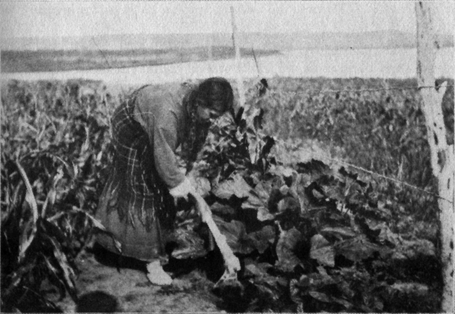
The museum/visitor center displays feature archaeological findings both from the Mandan and military, Sheheke, (White Wolf; White Coyote) a Mandan who was born there, an artistic diorama of the historic Mandan village there, Fort Abraham Lincoln, General Custer, and the Civilian Conservation Corps. The Little Bighorn campaign and battle are also featured, as is the Corps of Discovery.

Guided tours of the commanding officer’s quarters (“The Custer House”) are offered throughout the tourist season. The guides are dressed in period attire and speak in the present tense as though it’s 1875 rather than the modern day. The Custer House features various novelties that once belonged to Lt. Col. G.A. Custer and his wife. These are pointed out to the visitor by way of a prompt, “Take special notice of…”

The fort’s history is summarized in a prologue and conclusion of every tour: it was built in 1873, a cavalry post to protect the Northern Pacific Railway survey crews, the Black Hills Expedition of 1874 (to confirm the discovery of gold) receives a mention, the Little Bighorn Campaign (Centennial Campaign), the plight of Elizabeth “Libby” Custer following the failure of her husband’s command, the decommission of the fort, citizens dismantling the fort for construction materials in their homes, the CCC placing building markers, and the reconstruction of the fort.

Fort Abraham Lincoln State Park's interpretive programming focuses heavily on the military occupation of the site from 1872 to 1890. 

What is entirely missing from the narrative in the interpretive programming and the museum information about the military occupation is the prison camp history. There is no mention either of the 1875 Treaty of Fort Abraham Lincoln, which was a big activity there at the fort. Lt. Col. Custer called on members of the Arikara, Hidatsa, Hunkpapa Lakota, Mandan, and Yanktonai Dakota to end their generations-long intertribal warring.

The interpretive training that seasonal staff at Fort Abraham Lincoln State Park receive is based on the practices of Freeman Tilden. There are six principles in this methodology. Tilden’s principles are the basics of all interpretive programming found in the National Parks, state parks, museums, and other institutions across the country. Tilden’s principles are:

Tilden's work began with a focus on state parks before his work on interpretive programming was picked up by the National Park Service. 

1. Any interpretation that does not somehow relate what is being displayed or described to something within the personality or experience of the visitor will be sterile.

2. Information, as such, is not interpretation. Interpretation is revelation based upon information. But they are entirely different things. However, all interpretation includes information.

3. Interpretation is an art, which combines many arts, whether the materials presented are scientific, historical or architectural. Any art is in some degree teachable.

4. The chief aim of Interpretation is not instruction, but provocation.

5. Interpretation should aim to present a whole rather than a part, and must address itself to the whole man rather than any phase.

6. Interpretation addressed to children (say, up to the age of twelve) should not be a dilution of the presentation to adults, but should follow a fundamentally different approach. To be at its best, it will require a separate program.

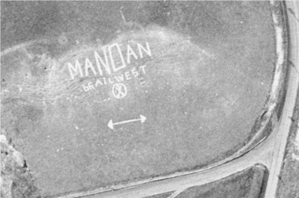
Artistic licence was used to create this reconstruction of the On-A-Slant Mandan Indian village. The layout is slightly different, and according to the archaeological report, there was no ceremonial lodge. 

The whole history of the park is not addressed, so the whole experience of the visitor is not “wholesome.” This omission has shaped the experience of millions of visitors over the years the park has been active. It isn’t just the interpretation or presentation of this tragic history that this is missing; the prison camp history of Fort Abraham Lincoln State Park receives a half paragraph mention in the ND Parks and Recreation Department’s publication by Arnold O. Goplin, “The Historical Significance of Ft. Lincoln State Park” and then only that the 7th Cavalry escorted the Nez Perce to Bismarck, not Fort Abraham Lincoln. In another publication of the ND Parks and Recreation Department, “100 Years – Fort Abraham Lincoln State Park,” the Nez Perce are missing entirely.

An informal visit to the North Dakota Parks and Recreation Department on Thursday, August, 25, 2016, and message for the director went unanswered. An email to the Fort Abraham Lincoln State Park received a reply on Oct. 15, 2016, but only to say that the park manager would respond “next week.” There has been no further follow-up from the North Dakota Parks and Recreation Department. 

The original post cemetery was located at the top of the bluff near old Fort McKeen. 

Mr. Woodrow Star humbly requested any and all information that the North Dakota Parks and Recreation could share with him about his relatives imprisonment. The staff could not respond to Mr. Woodrow, because their information is woefully incomplete. Fort Abraham Lincoln State Park does not employ an actual historian to research and construct their interpretive program. In October of 2015, the park manager referred Mr. Star to me.

Here’s follows a bibliography of non-native primary resources which specifically mention the Nez Perce in Bismarck and at Fort Abraham Lincoln in October of 1877.

Primary Resources:
Fred G., Bond. “Floatboating On The Yellowstone.” 1st Ed. New York, New York: New York Public Library, 1925. 1-22.

Miles, Gen. Nelson Appleton. "The Nez Perce Campaign & The Siege And The Surrender." In Personal Recollections And Observations Of General Nelson A. Miles, 250-280. 1st Printing. New York, New York: Werner Company, 1896.

Zimmer, William F. "Part Two: August 1, 1877 to December 31, 1877." In Frontier Soldier: An Enlisted Man's Journal, Sioux And Nez Perce Campaigns, 1877, edited by Jerome Greene, 89-160. 1st ed. Helena, Montana: Montana Historical Society Press, 1998.

Journals:
Romeyn, Capt. Henry. "The Capture Of Chief Joseph And The Nez Perce Indians." Contributions To The Montana Historical Society, Vol. 2 (1896): 283-91.

Haines, Francis. "Nez Perce Indians." Army And Navy Journal, 1877, 290-91.

Magazines:
Henry Remsen, Remsen (Tilton). "After The Nez Perces." Field And Stream And Rod And Gun, December 1, 1877, 403-04.

"The Surrender Of Joseph." Harper's Weekly, November 17, 1877, 905-906.

Newspapers:
Bismarck Tri-Weekly Tribune, November, 21 & 23, 1877.

Cheyenne Daily Leader, November 25, 1877.

Inter-Ocean, November 23, 1877.

The Nez Perce themselves know their own history. They survived displacement from their homelands, imprisonment, and placement in Indian Territory (Oklahoma).

Goplen, Former Senior Foreman Historian for the National Park Service minimized this tragedy to half a paragraph and displaced the locality to Bismarck, ND. Fort Abraham Lincoln State Park staff have repeatedly ignored calls to address the omission of this history in an effort to preserve the lionized integrity of an egotistical and incompetent military commander. The Fort Abraham Lincoln State Park website focuses only on the Mandan Indian and military occupations and provides a link to Little Bighorn History. There is a pattern of omission of historical fact that is taking place at Fort Abraham Lincoln State Park. One can only hope that this changes. 

Visit this park. It's still the greatest park in North Dakota. Ask the park manager to develop the interpretive narrative. It doesn't need to be apologetic. It needs to be informed. 

Wednesday, January 28, 2015

Warfare On The Northern Plains: Interpreting The Pictographic Bison Robe

The Pictographic Bison Robe, Peabody Museum.
Warfare On The Northern Plains
Painted Robe Reveals Battle
By Dakota Wind
BISMARCK, N.D. – The Peabody Museum of Archaeology and Ethnology at Harvard University in Massachusetts has a spectacular collection of Lewis and Clark related artifacts in all the country. The artifacts have been determined to have been collected by the Corps of Discovery who gathered dresses, shirts, and various painted robes in 1804-1806, or by Lt. George Hutter in 1825-1826. In particular, both parties acquired a painted robe depicting conflict either with or against such tribes as the Sioux, Arikara, Hidatsa, and the Mandan.

Castle McLaughlin, Associate Curator of North American Ethnography, Peabody Museum at Harvard, carefully researched the “Pictographic Bison Robe” and has concluded that the robe is likely to have been collected by Hutter, not the Corps of Discovery. McLaughlin noted that another robe was collected by a Charles Wilson Peale in 1826, and that this robe was said to depict the Arikara War of 1823, the first American military campaign against Plains Indians. However, McLaughlin notes, “this is unlikely to be the Peabody robe, which does not depict Anglo-Americans.”[1]

In a telephone interview, McLaughlin offered an updated reflection about the painted bison robe, “The robe is likely to be Siouan in origin, and it was collected after the Corps of Discovery Expedition of 1804-06, maybe not by Hutter.” The Lewis and Clark Collection came to the Peabody Museum from more than one source and at different times.

There are about three major conflicts the Očhéti Šakówiŋ (Seven Council Fires, aka “The Great Sioux Nation”) participated in that fall within a thirty year window: a fight against enemy tribes in the 1790s, a conflict along the Grand River involving the Arikara and Ensign Pryor’s command in 1809, and the Arikara War of 1823.

Warfare At The Turn Of The Century
In the winter of 1794-95, the Dakota camped with the Mandan[2] perhaps to trade but the peace was short lived when a Mandan killed a Dakota with long hair and took his scalp,[3] however other winter counts recall that the Mandan killed a Crow instead, and that may be the case as White Bull recalled this particular conflict at Rawhide Butte.[4] The following year, the Mandan Chief Man-With-A-Hat became noted as a warrior[5], the Mandan knew this great leader by a different name in their own language, Shekek Shote (White Wolf).[6]

In summary, the Očhéti Šakówiŋ waged near continual warfare against such tribes as the Crow, Ponka, Assiniboine, Arikara, and Omaha. In particular, the Očhéti Šakówiŋ continued war against the Omaha until an epidemic of either smallpox or chickenpox struck the Lakȟóta in 1802.[7] The Omaha retaliated in a series of relentless attacks, but when the Lakȟóta recovered sufficiently, a warparty leader raised a pipe with a horsetail affixed to it and waved it over the people, a call to arms.[8] The Lakȟóta rallied together and launched an offensive that left seventy-five Omaha dead and fifty as prisoners.[9]

In 1803, there was one major battle of note, the Battle of Heart River. The northern Očhéti Šakówiŋ known then as Saúŋni, or simply as Saúŋ (White-Rubbed Shirts/Robes), who were made up of Huŋkphápȟa, Oóhenuŋpa, Sihásapa Lakȟóta in alliance with the Iháŋkthuŋwaŋna Dakȟóta[10] fought against the Assiniboine who were possibly allied with the Arikara who were then living at the mouth of Beaver Creek (south of present-day Bismarck, ND). [11]

Conflict At Grand River
A second possible interpretation of the Painted Bison Robe is of the 1808 conflict between Ensign Nathaniel Pryor’s command, the Saúŋ Lakȟóta, and the Arikara. This conflict has its roots in the Corps of Discovery’s visit a few years previous.

In 1804, the Arikara selected a leader, Arketarnarwhar, to descend the Missouri River with an escort provided by coterie from the Corps of Discovery who would escort and interpret his eventual meeting with President Thomas Jefferson back east. The Arikara leader never returned. Manuel Lisa, of the American Fur Company, was charged with delivering the missive of Arketarnarwhar’s death[12], which was found to be of natural causes.[13] The news was carried upriver in 1806 by two French trappers who in turn were detained by the Corps of Discovery on their return journey. The trappers having delivered the Corps news of civilization were dismissed.

When the corps passed by the Arikara villages going downstream they deliberately withheld news of their leader’s death, in fact, the Arikara didn’t hear word of Arketarnarwhar’s death until 1807.[14] The Arikara developed a hostility towards the United States thereafter, and harassed trappers and traders alike coming upriver, and actually halted Ensign Nathaniel Pryor’s expedition to return the Mandan Chief Shehek Shote to his people at Knife River in August 1808 with a war party of about 650 Arikara warriors.[15] Location: where the Grand River converges with the Missouri River near present-day Mobridge, SD.

The Saúŋ Lakȟóta, who had their own mixed history with the Corps of Discovery, were also present when the Arikara stopped the Pryor expedition. The Wapȟóštaŋ Ğí (Brown Hat) Winter Count records the event that a Huŋkphápȟa man named Red Shirt was killed.[16] No Ears recorded the year with the following text, “Ogle Luta on wan itkop ahi ktepi,” which translates a few ways, but essentially means that Red Shirt died in conflict.[17] Lone Dog’s pictograph indicates that Red Shirt died by two arrows[18].

It is possible that Oglé Lutá (Red Shirt), in the Lakȟóta tradition of great leaders, had a different name, Tȟatȟáŋka Sapá (Black Bull). It should be noted that in the Corps of Discovery’s encounter with the Thithúŋwan (Teton) along Bad River in 1804 ended when the Corps gifted a Lakȟóta leader, then Black Bufallo, a hat, a medal, and a red military coat.[19] Black Buffalo intervened on behalf of the Corps of Discovery when the Corps refused to pay a toll. Black Buffalo ordered the warriors to lower their bows. The Corps passed after throwing a twist of tobacco at the feet of the Lakȟóta.

The Arikara War of 1823
The third possibility is the Arikara War of 1823.

The Arikara War saw Colonel Henry Leavenworth ascend the Missouri River to defend the interests of the American Fur Company from the hostile aggression of the Arikara. Leavenworth led a command of six companies of the US Infantry, and an aggrieved William Ashley plus sixty men of the American Fur Company who were accompanied by about 750 Očhéti Šakówiŋ warriors.[20]

The Očhéti Šakówiŋ led the assault on the Arikara village at dawn on Aug. 9, 1823. The fighting consisted of an exchange of gunfire and hand-to-hand fighting until the Arikara retreated behind their stockade. The following morning Leavenworth ordered artillery to commence firing on the Arikara. The Arikara pressed for a cease-fire soon after and Leavenworth heard them out. Thirty Arikara were killed by the artillery in addition to the fifteen from the previous day’s fighting.[21]

Leavenworth negotiated peace with the Arikara. Unbeknownst to Leavenworth, the Arikara were preparing to abandon their village that very night. The peace talks were likely a diversion while the village made ready. The Arikara left that night under Leavenworth’s sleepy watch. The Očhéti Šakówiŋ warriors were anticipating a fight in which they’d get many war honors, but were ultimately disgusted with Leavenworth’s decision to treat with the Arikara. The Očhéti Šakówiŋ raided the Arikara cornfields. Ashley was also disgusted with Leavenworth in that the entire Arikara village wasn’t destroyed.

The Lakȟóta remember the Arikara War of 1823 as “The year of much dried corn.[22]” Many winter counts depict stalks of corn to remember 1823 and frequently reference conflict with the Arikara. It is interesting to note that while Leavenworth organized this punitive campaign against a Plains Indian tribe, and referred to his command, including the Očhéti Šakówiŋ, as the Missouri Legion, that three winter count pictographs actually mentions Leavenworth, his soldiers, or the trappers in his command.

The Swan winter count recalls 1823 as “US troops fought Ree Indians.[23]” The 1823 entry on The Flame winter count is “White and Dakotas fought Rees.” Cloud Shield reveals a little more, “They joined the whites on an expedition up the Missouri River against the Rees.” Lone Dog’s entry says, “White soldiers made their first appearance in the region.” Lone Dog does not mention the Corps of Discovery as his people, the Iháŋktȟuŋwaŋna Dakȟóta were stealing horses from the Crow in 1804. Had this band of Iháŋktȟuŋwaŋna been at Bad River in 1804, they certainly would have recorded white soldiers ascending the river as Blue Thunder,[24] also an Iháŋktȟuŋwaŋna, did.

The battle depicted on the Pictographic Bison Robe could represent the Arikara War of 1823. Because it does not include the representation of white soldiers or trappers does not mean without certainty that it isn’t. Why would it? The Očhéti Šakówiŋ did the actual fighting. The robe depicts warriors fighting warriors. Leavenworth refrained from ordering his infantry to engage in the fighting, but was still involved in the fight through use of his artillery.

Ken Woody (St. Regis Mohawk), Chief of Interpretation, Little Bighorn Battlefield National Monument, reproduced the Pictographic Bison Robe for the National Forest Service’s Lewis and Clark Interpretive Center, Great Falls, MT. According to Woody, who examined the original, the green quills on the ends of the quilled strip are in fact bird quills. The Mandan and Hidatsa were well known for their quillwork involving the use of bird quills. The feathers would have been collected from sea gulls which came north in the summer to North Dakota. The feathers were stripped and treated for use in quillwork.[25] “The only thing on the robe which would hint of a Mandan or Hidatsa origin is the bird quills for the quilled strip, although if I remember right, most were porcupine quills and only the green quills at the beginning and end were bird quills,” remarked Woody.

It is entirely possible that the Pictographic Bison Robe represents other conflicts not recorded in winter counts or remembered in surviving oral tradition. There seems to be only one certain thing, that the robe was painted before George Catlin and Karl Bodmer for their visits among the first nations of the Upper Great Plains in the 1830s left such an impression with their art, that simple form pictography was transformed with elaborate flourish and became the high plains pictographic art of the middle nineteenth century.

Endnotes:[1] McLaughlin, Castle, Arts Of Diplomacy: Lewis & Clark’s Indian Collection, University of Washington Press, Seattle WA, 2003.
[2] The Rosebud Winter Count.
[3] White Cow Killer Winter Count.
[4] White Bull, Chief Joseph (translated and edited by James H. Howard), The Warrior Who Killed Custer: The Personal Narrative of Chief Joseph White Bull, University of Nebraska Press, London, 1968.
[5] The Flame Winter Count.
[6] The Big Missouri Winter Count. It becomes clear who The-Man-With-The-Hat is when Big Missouri mention that a Mandan chief descended the Missouri River in 1806 with some white men to go meet the Great White Father.
[7] Pp. 130-146, Howard, James H., Fourth Annual Report Of The Bureau Of American Ethnology, Washington DC, Smithsonian, 1886.
[8] The Blue Thunder Winter Count, State Historical Society of North Dakota, Bismarck, ND.
[9] Clark, Capt. William, journal, Sept. 25, 1804.
[10] The John K. Bear Winter Count, 1803.
[11] Pp. 20-58, Howard, James H., Yanktonai Ethnohistory And The John K. Bear Winter Count, Plains Anthropologist: Journal Of The Plains Conference, Memoir 11, 1976.
[12] Page 306, Jackson, Donald C., Journey To The Mandans, 1809: The Lost Narrative Of Dr. Thomas,” Missouri Historical Society Bulletin, Vol. 20, No. 3, April, 1964.
[13] Pp. 5-7, Innis, Ben, Bloody Knife: Custer’s Favorite Scout, Smoky Water Press, Bismarck, ND. 1994.
[14] Ibid.
[15] Page 144, Potter, Tracy, Sheheke: Mandan Indian Diplomat, Farcountry Press, Fort Mandan Press, Washburn, ND, 2003.
[16] The Brown Hat (Baptiste Good) Winter Count.
[17] No Ears Winter Count.
[18] Lone Dog Winter Count.
[19] Page 169, Ambrose, Stephen, Undaunted Courage, Simon & Schuster, 1996.
[20] Ibid.
[21] Ibid.
[22] Long Soldier Winter Count, Sitting Bull College, Fort Yates, ND.
[23] The Swan Winter Count, National Museum of the American Indian, Washington, DC. The Swan Winter Count, http://wintercount.si.edu.
[24] Blue Thunder Winter Count, State Historical Society of North Dakota, Bismarck, ND.
[25] Woody, Ken, discussion with author, Nov. 26, 2014.

Monday, October 28, 2013

Crying Hill: A Sacred Natural Landmark

A view of Crying Hill from above in the 1930s.
Crying Hill: A Sacred Natural Landmark
Where The Hidatsa Became Two Tribes
Edited by Dakota Wind
Mandan, N.D. - In 1919, Colonel Alfred Burton Welch, a World War I veteran came to call the city of Mandan, N.D. home. There in Mandan, Welch began a new life as a store keeper, he also served as the post master, and founded the El Zagel Shrine. He spent the remainder of his life in the rolling hills of Heart River country along the Missouri River valley, and became fast friends with many of the Indian tribes there.

Captain AB Welch, seen here in his uniform from the 1898 Spanish-American War.

Welch became good friends with Chief John Grass. Grass was a distinguished Sihásapa Lakȟóta leader and veteran of the Sioux campaigns of the 1870s such as the Little Bighorn. Grass was known to the Lakota as Matȟó WatȟákpA, or Charging Bear. He had attended the Carlisle Indian School and became fluent in English to help his people fight the government in the new battlefields, the courtrooms. In March 1913, Grass adopted Welch as his son and bestowed on him Grass’ own name of Charging Bear.

While Welch lived in Mandan he took in all the lore about the site and more, and recorded as much as he could. One of those site stories he recorded was about the village and people who lived in the Mandan village along the Heart River near to Crying Hill.

Andrew Knudson painted this scene of the Corps of Discovery entering Black Cat's village near Knife River. A similar village would have graced the banks of Heart River below Crying Hill. That village was known to the Mandan as Large And Scattered Village.

The Mandan Indians have lived along the Upper Missouri River for about a thousand years and longer if you take into account their emergence story south of Mandan.

According to Welch, or the stories he attributed to the Hidatsa, Crying Hill is where the Hidatsa split into two distinct tribes. Welch uses the term Gros Ventres to name the Hidatsa. Here’s the story, Feb. 24, 1925:

The Gros Ventre were divided into two bands, and each of these bands followed their own chiefs. One starving winter-time they were reduced, by the absence of game and the failure, or destruction, of their crops, to eating the red seed pods of the wild rose bushes.

But, at last, through the prayers of a holy man among them, one lone, rogue buffalo bull, lean and staggering, wandered close to the village. He was chased and fell in the exact middle of the Heart River. Upon being dragged to the shore, it was decided that the meat should be divided in two equal portions, each band obtain the same amount of meat, bone and hide. When the division was made, one band was aggrieved and claimed that the other party had obtained the fatty portion of the stomach, while they had only the lean part.

The aggrieved band then decided that they would leave the other and go into a country which they would discover, and where they would be their own hunters and use their kill as they saw fit to do. Consequently this band did leave, traveled southwest into the country west of the Black Hills and east of the Big Horn Range, which territory they secured and where they have maintained themselves ever since that day.

These are the people known today as the Crows. They frequently come to visit the Gros Ventre; speak the same language and accept each other as cousins or relatives, but the real Gros Ventre call the crows the “Jealousy People,” on account of the separation, long ago.

Crow Indians Firing Into The Agency by Frederic Remington.

A variation of the story about the separation of the Hidatsa into two tribes came a few years earlier by way of Joe Packineau, Dec. 3, 1923:

“Crow Indians are Gros Ventre. I will tell you how it came about that they do not live together now. “That Indian village site in Mandan, we call it “Tattoo Face.” It is not Mandan village, but Gros Ventre or Hidatsa.

“There were two brothers born in that place a long time ago. One had a tattoo mark on his face like a quarter moon. It started on the cheek and ran down across the chin and up on the cheek on the other side of his face. So the people called him Tattoo Face. He became a very famous man among the Gros Ventre.  His brother was all right, and he was named Good Fur Robe. He also became a very great man and a wise man.

“Good Fur Robe was the one who had the corn seeds first. He gave one grain to each person and told them how to plant and look after the plant. Tattoo Face had tobacco before anyone else.

“Now the best part of a buffalo is his paunch. It is nice to eat. One time there was one buffalo which they killed right in the river there. He dropped dead in the middle of the Heart River when he was killed. The people drew him out for they were hungry. Good Fur Robe was the biggest chief, so he took the paunch when they divided the buffalo up between the two bands.

“That made [the] Tattoo Face people mad so that band decided that they would go away. They did go, and made their home in the country west of the Black Hills after that time.

“People call that people Crows now. But the Hidatsa do not. We call them “The Paunch Jealousy People.”

So the place where these people separated from the Hidatsa, is the Heart River at the Crying Hill (or Tattoo Face Village) which was Gros Ventre. The Mandan lived there too after that, I think.”

Crying Hill is located within the city of Mandan, ND. In 2003, Patrick Atkinson purchased Crying Hill in efforts to save the heritage site from further development. Read about Atkinson’s efforts to preserve Crying Hill

Thursday, July 25, 2013

The Origin Of Apple Creek

A view of Apple Creek, south and east of Bismarck, N.D.
The Origin of Apple Creek
Tȟaspáŋ Wakpála Ohútkȟaŋ
By Dakota Wind
BISMARCK, N.D. - I’ve often wondered about the origin of the name of Apple Creek here in North Dakota.

Apple Creek is a tributary of the Mní Šhošhé (The Water A-Stir; Missouri River), converging with it at the base of Pictured Bluff, just south of the University of Mary, off of HWY 1804.

It begins somewhere in field near Wing, ND, and winds a quiet meandering path south and west towards the Missouri. Nearly four miles east of Bismarck, about on HWY 10, is the Apple Creek Country Club. I’ve not personally been to the country club, mainly because the only golf I’ve ever played was mini, but the 18-hole golf course incorporates the natural environment, which includes the Round Leaf Hawthorn tree.

Another creek with a differing name is the Little Heart Creek, shown here with the name "Bad Water Creek," which is how the Nu'Eta (Mandan) knew it.

Apple Creek is, or was, known among the Nu’Eta (Mandan) Indians as Black Bear Creek, at least according to the Sitting Rabbit map of the Missouri River.

The Mandan used to live in the vicinity of Heart River for hundreds of years. In 1781, they were struck by a epidemic of smallpox. The survivors abandoned their villages and moved north to Knife River, where the Corps of Discovery encountered them in 1804.

Near where the Apple Creek converges with the Missouri River is where General Sibley’s command of about 4,000 soldiers relentlessly chased a group of Dakota and Lakota in a running battle that began west of present-day Jamestown, ND in mid-July, 1863 and ended at about present-day General Sibley Park in Bismarck, ND, on Aug. 2 two weeks later.

The Lakota who’ve lived on the Great Plains and who traded with the Mandan Indians knew of this meager tributary of the Mní Šhošhé. The Lakota have names for landmarks, wildlife, seasons, and rivers. And they personified all, believing – and some still do – that all these things aren’t just animated, but live and have lives of their own, that all have spirits or souls of their own too.

A thornapple tree, or Hawthorn, in bloom at Cashman's Nursery, Bismarck, ND.

In English, the Round Leaf Hawthorn is named for the shape of its leaf. In Latin the tree is called Crataegus cyclophylla, and I don’t know what the hell that means, but I’m sure that it means something really important to science.

In Lakota, the same tree is called Tȟaspáŋčhaŋ, which meant “Of-Red-Tree,” in reference to the dark red or swarthy color of the fruit which resemble little apples and are edible. The creek was called Tȟaspáŋ Wakpála, or as a free translation may have it, “Apple Creek.”

Mary Ann Barnes Williams’ book, “Origins Of North Dakota Place Names,” has it as the unusual name “Qui-Apelle” was given the creek by the early French-Canadians for the many Red Haw or Thorn Apple thickets bordering its banks. Another version is that the name Apple Creek is an inaccurate translation of the Dakota Indian name for it, which it [sic] Taspan Wakpala; Taspan (thorn apple), Wakpula [sic] (creek).

Tuesday, March 26, 2013

Interpreting A Pictograph Calendar

An excerpt of a pictograph by Sitting Rabbit. The scene is of the Hidatsa village along Knife River, the village that Sacagawea lived in when she encountered the Corps of Discovery.
Interpreting A Pictograph Calendar
An Examination Of A Mandan Lunar Chart
By Dakota Wind
BISMARCK, N.D. - Sometime back in the fall of 2003, enrolled member of the Cherokee in Oklahoma and Distinguished Professor of Anthropology, Dr. Russell Thornton and Dr. Candace Green published a short paper about the Little Owl calendar, a lunar chart, of the Mandan Indians.

The calendar, or lunar chart, is a fascinating example of Plains Indian pictography. It is similar and yet different to another Plains Indian pictographic tradition, the Winter Count.

The lunar chart is the personal property of the late Mr. Ronald “Sammy” Little Owl, of the Arikara Hidatsa and Mandan Nation on the Fort Berthold Indian Reservation in North Dakota, who found it amongst his late mother’s belongings. Mr. Little Owl brought the lunar chart to Dr. Thornton’s and Dr. Green’s attention in 1998. Little Owl also supposed that the lunar chart was associated with the Bad News Clan, to which his father and paternal grandfather belonged.

Dr. Green suggests that the Little Owl lunar chart may indicate “a possible record of planting by the agricultural Mandan…apparent cycles and obvious plant symbols, one might conclude that the calendar was used to keep a record of planting and harvesting.”[1]


Dr. Edwin Benson, the last man to speak Nu'Eta as a first language. Watch and listen to him.

In the fall of 2003 I contacted Dr. Edwin Benson, of the Arikara Hidatsa and Mandan Nation, who was teaching the Nu’Eta (Mandan) language at the Twin Buttes Day School on the Fort Berthold Indian Reservation at the time for his knowledge of the Mandan calendar. Dr. Benson graciously responded with the following:

January            Kupa-hanas                              Seven Nights
February          Ma-istami-ba-da                      Sore Eyes
March              Wa-he-knew                           Spring
April                Ma-nabe-ki-bu-ke                   Game
May                 Muut-ogeheneh                        Planting/Sowing
June                 Ma-na-bu Shu-kena-de-ke      June Berries
July                  Ka-dek-na-de-ke                    Chokecherries
August             Wak-da-na-de-ke                   Wild Plums
September       Koxate-du-kie                         Ripe Corn
October           Ma-nah-pe-o-dee-geh             Frost-On-The-Ground
November       Ikatehne-o-nu Des-o                Freezing Rivers
December        Hump-ni-nahge-ge-gipdahg     Short Day/s

Dr. Benson also sent me a few alternate names, but these only in English:

January                                                            Seven Cold Days
April                                                                Breaking-Up-Of-The-Ice
October                                                           Falling-Of-The-Leaves
December                                                        Little Cold

Here follows a basic understanding of the Mandan and Hidatsa gardening practices throughout the summer. This may assist with interpreting the Little Owl Lunar Calendar (chart).

"Singing The Corn" by Jack Stewart.

“In the old garden, the work usually started when the first geese appeared on their way north, or when the Missouri River broke up, events which usually occurred almost together. At this time the old weeds and stalks and vines were collected and burned.”[2]

The women would arise when the light began to appear on the horizon or at daybreak, sometimes as early as three o’clock in the morning.[3] The women would work the fields from sunup to when the heat of the day could be felt, at which point they returned to their lodges and did other work. If any time was left over in the day, toward the close of the afternoon, they would go back to their fields.

Often times the women would sing while working or watching the crops for intruders, or to make fun of the men and boys.[4]

After the fields were cleared of debris, the planting hills were dug up, loosened, and broken back down again into loose soil. The hills measured about twelve to eighteen inches in diameter and were approximately twelve to eighteen inches apart from one another. Sunflowers were the first crop to be planted around the edge of the garden before clearing and digging were finished.[5] They were planted three to a hill of their own about eight or nine paces apart.[6]


Corn followed soon after the sunflower was planted, sometime in the first half of May. Sixty to one hundred corn seeds were planted which was believed sufficient in the sheltered bottomlands to insure that only slight, if any, crossbreeding of the corn.[7] Corn was planted in every other hill, usually seven or eight kernels of corn to a hill, with beans being planted in those early hills skipped by the corn.[8] Planting usually lasted from early May “until the roses bloom in June,”[9] but in the big gardens the beans were planted immediately following the corn, and in the same amounts as the corn. Squash was planted after the beans, after the blooming of the roses.[10]


Toward the latter part of summer, the gardens were rarely unoccupied during the day. This was because of the flocks of crows and other birds that would try to come after the soft corn. To help the watchers, a brush shade was constructed, or a scaffold with a shade of some type would be employed while the women and girls worked on sewing, quillwork or other craft. Girls always went with their mothers to do this work and it was permissible for a man to go to work with his wife if they didn’t have children.

The first harvest of the Mandan, known as the green corn harvest, started as early as August as the young squashes were gathered, sliced and dried. This event is generally determined by the older women who examined the ears and silk of the corn, which, if it was brown or withered and the husk was dark brown, the corn was harvested until frost. The green corn harvest was a time of feasting and rejoicing, but also a time of drying food for storage. Preparing corn to eat might consist of either boiling or roasting.[11] The green corn harvest seldom lasted more than ten days. The second harvest, the ripe corn harvest, followed two to four weeks later and usually lasted about ten days or until early October. Sunflowers were the last to be harvested.

A corn threshing booth. Corn was dried on the stage above ground, then the kernels were threshed or beaten from the cob in the booth. Choice corn, or corn which was traded, was braided together, about a hundred ears of corn to a braid and was considered the equal of a tanned bison robe.

Depending on the variety of corn, Mandan corn generally matured in about ninety to 105 days. Squash was picked immediately after the first frost. Beans, which were planted after immediately after the squash, were picked in the fall after they had ripened and the pods were dead and dried.

Tobacco was planted at the same time as sunflowers, but only by the men; the first harvest of tobacco took place in about midsummer, or June. The men would go out amongst the tobacco and pluck some of the flowers, which were dried, crushed and later enjoyed in their pipes. The rest of the tobacco would be harvested sometime before the frost came.

Corn, squash and beans were stored in a bell-shaped cache pit. As deep as six feet and as wide as three to five feet. 

The new year begins, or at least a new growing season, after the ice has broken up, when the geese have returned, after the spring rains, when the bison calves are born, and when the leaves began to bud on the trees.

Figure 1 of the Little Owl Lunar Chart.

In figure 1, the crests, or lunar crescents mark only a very small part of the entire page. Only one of the crescents appears to bear additional markings of a tree on its convex and rain in the concave. If this series of lunar crescents indicate the new year or growing season, this lunar cycle might concur with the roman calendar of April. The crescent with tree and rain could read as “The rains fell; the trees returned to life.”

Figure 2 of the Little Owl Lunar Chart.

In figure 2, the series of pictographs appear to begin on the bottom left and seem to read up the page. The second row then appears to read top to bottom, and seems to be aligned with the lunar crescents, and there is no line separating the row of pictographs and the row of crescents, which also seem to be combined with glyphs in concordance with the row of pictographs.

It should be noted that when a death is mentioned, it may indicate that someone actually died or that someone, likely a woman or child, was abducted by an enemy. Women were eventually married into and accepted by a tribe; children were treated and raised as members of a tribe, this was particularly true of the Teton Lakota and Yanktonai Dakota whom the Mandan were sometimes at war.

Figure 2 interpretation:

  1. Unknown.
  2. Fish/Fishing.[12]
  3. A gathering or council.
  4. A man.
  5. Five days.
  6. Corn.
  7. Corn medicine.
  8. Man with a staff, perhaps a man called a war party.
  9. A horse, perhaps a successful horse raid.
  10. A bison jump or bison hunt.
  11. A lasso, perhaps indicating a successful horse raid.
  12. Unknown, indiscernible.
  13. An event regarding the Assiniboine Sioux.[13]
  14. Three lassos, perhaps indicating either three successful horse raids or that horses were stolen back and forth between an enemy tribe.
  15. They heard a spirit.[14]
  16. Someone killed, perhaps an enemy.
  17. Bison Bull killed.[15]
  18. Unknown. Squash? Beans?
  19. A tornado struck.
  20. Squash and beans.
  21. This appears to be an extension of the squash and beans pictograph.
  22. Singing to the crops?[16]
  23. Lassos arranged in a column, perhaps representing a series of successful horse raids.
  24. Unknown.
  25. Unknown.
  26. A talon?
  27. Someone died.
  28. Elk, perhaps someone made love medicine. Elk, or love medicine, has the antithesis meaning of death.
  29. Staff, perhaps a society’s call to action, or a war party.
  30. Someone had vision.[17]
  31. Someone died, maybe an enemy.
  32. A field, planting.
  33. Unknown.
  34. A knife. A standing knife.
  35. A man with a staff. Perhaps a call to action, a call to gather a society or call a society to action, a call to war.
  1. A time for planting?
  2. Time for planting a particular crop?
  3. Corn has reached a particular stage?
  4. Someone died.
  5. Trees have a full display of leaves?
  6. Rain.
  7. Squash, perhaps an indicator that it was time to plant squash, or that squash was finished being planted.
  8. Man in a garden, perhaps indicating that it was now time to establish sentry duty in the gardens.
  9. Indiscernible pictograph next to a pictograph of corn perhaps indicating that a certain rite relating to corn happened at that time.
  10. Horse tracks under the lunar crescent, perhaps a successful horse raid.
  1. The image appears to be a bird.
  2. Garden,[18] perhaps a time for hoeing.
  3. Beans?
  4. Corn, the pictograph for corn appears to be sideways, perhaps a storm or wind knocked down their crops or perhaps it indicates a time for a rite related to the corn.
  5. Thunderbird.
  6. Horse
  7. Lodge, perhaps a medicine lodge.
  8. Travois, perhaps a hunting party or the trade party of another tribe.
  9. A division of the garden?
  10. Travois.
  11. Lassos.
  12. Unknown.
  13. Travois.
  14. Lassos.
  15. Unknown.
  16. A fallen travois.
  17. Three fallen people, perhaps marking the passing of three people.
  1. Rain
  2. A spirit appeared.
  3. Tree or bush. Perhaps this pictograph indicates that it was time to pick Juneberries. There are four marks beside this lunar crescent, perhaps the entire pictographic entry indicates that it was time for the Mandan Okipa.
  4. Two people beside an unknown pictograph.
  5. A person.
  6. Rain. To the very right of this lunar crescent and descending down are twenty-two marks which appear to be connected to the lunar crescents on the immediate left. These were the days when the Mandan prayed for rain.[19]
  7. Unknown.
  8. A person.
  9. A small garden, perhaps representing the tobacco garden which measured about twenty feet by twenty feet, maybe indicating a time when the flowers were plucked.
  10. Tree.
  11. Two people.
  12. A fence or palisade, perhaps noting the repair of either. Two pictographs appear to be associated because of their proximity to the lunar crescent, unknown.
  13. Unknown. A pictograph appears one end of this lunar crescent, perhaps indicating a death.
  14. Rain. Twenty-three marks appear here much the same as the marks mentioned in “P” above.
  15. Rain?
  16. Dog? Coyote? Fox? There are two pictographs near this lunar crescent, a travois and another which seems to represent a garden.
AA. Butterfly.
BB. Tree, and what appears to be effigies which stand outside the medicine lodge as when the Okipa ceremony takes place.
CC. Unknown, and two “effigies.”
DD. Tree or bush.
EE. Tree or bush, perhaps the two pictographs of trees or bushes indicate that it was time to harvest buffalo berries.

Figure 2.2 (right half of image turned 90 degrees clockwise) of the Little Owl Lunar Chart.
The other half of figure 2 consists of what seems to be almost writing, similar to the Sioux alphabet which was developed by the Lakota man named Curly.[20] A Bison dancer sits astride a gracefully rendered horse. The dancer holds a lance with two tassels attached. The lance resembles the ceremonial lances that the bison dancers carried in their dance. This dancer brought the horse into the dance to ensure a good hunt and to secure the safety of the hunters.

The Lakota alphabet as developed by Curly, from the Cheyenne River Sioux Indian Agency in 1982. Copied from the Lakota alphabet on display at the Crazy Horse Museum at the Crazy Horse Mountain near Custer, SD.

In figure 3 there appears to be no separation between the pictographs to the immediate left of the lunar crescents; they appear to be connected to the lunar crescents and relate directly to them.

Figure 3 of the Little Owl Lunar Chart.

Figure 3 interpretation:

  1. Someone died?
  2. Travois.
  3. Corn.
  4. Hoeing corn?
  5. Two fallen people, perhaps noting their deaths.
  6. Two fallen people and a travois, perhaps noting these deaths on a hunting party.
  7. A person – an inverted pictograph – and a garden, perhaps someone died in a garden.
  8. Five people, perhaps noting their passing.
  9. Rain, a thunderbird and travois appear together.
  10. A person and what appears to be a bush, perhaps harvesting chokecherries.
  11. The pictograph appears to be a hoe, and corn.
  12. Nine marks appear here. Possibly horse whips indicating a successful horse raid, possibly marks to indicate fallen corn stalks.
  13. Garden. Two lunar crescents below, twenty-three marks follow, perhaps an indication for a period of prayer for rain and good weather for crops.
  14. Thunderbird, a few other marks.
  15. Heavy rain; travois.
  16. Garden and a tree.
  17. Garden.
  18. Unknown.
  19. Travois; another pictograph aside may indicate a skirmish.
  20. Two people died?
  21. A person with corn? Twenty-Two marks appear to the very right of this lunar crescent, perhaps in indication for prayer for rain.
  22. Unknown.
  23. A spirit.
  24. Travois; spirit.
  25. Garden.
  26. Spirit.
  27. Travois; rain.
  28. Travois; unknown pictographs.
  29. Corn, and what appears to be a burden basket, perhaps an indication for a harvest.
  30. Thunderbird.
  31. Travois.
  32. Garden; three figures, perhaps three deaths.
  33. Rain.
  34. Corn, and what appears to be a burden basket.
  35. An inverted pictograph for a person, perhaps a death.
  36. Unknown.
  37. Corn.
  38. Travois.
  39. Garden, and what appears to be a spirit.
  40. Unknown.
  41. Lassos.
  42. Travois; thunderbird.
  43. Fallen people and rain.
  44. Corn; indiscernible pictograph. Seventeen marks appear to the immediate left of the lunar crescents. This may indicate a time for prayers or ceremony.
  45. Unknown.
  46. Travois.
  47. Unknown.
  48. Rain; indiscernible pictograph.
  49. Rain and thunderbird.
  50. Corn, and what appears to be a burden basket.
  51. Rain.
  52. Rain and thunderbird.
  53. Pictograph seems to articulate that it is a person of some note appears alongside corn. What appears to be feathers or a hairstyle or a headdress is present.
The right half of figure 3 appears to be read bottom to top. The line of pictographs seem to demarcate the Mandan Okipa ceremony. An interpretation of the pictographs bottom to top follows:

Singing/Beginning
Pipe
Singing
Sweat Lodge
Singing
Medicine Lodge
Singing
Similar/Alike?
Singing Between?
Unknown
Singing
Singing Man
Night
Singing
Similar/Alike
Singing
Day
Singing
Night
Singing
Day
Singing
Night
Singing
Day
Singing
Night/End

Figure 4 of the Little Owl Lunar Chart.

Figure 4 interpretation:

  1. No moon.
  2. Someone in a garden, perhaps working.
  3. Someone with a garden hoe.
  4. Unknown.
  5. Staff with something attached to the top, it looks like a tassel or an ear of corn. Perhaps a successful year.
  6. A person.
  7. A person with something held, possibly a child.[21]
  8. Corn, and what looks like fallen corn under the standing corn.
  9. A standing knife.
  10. Someone holding a staff aloft.
  11. Unknown.
  12. Unknown.
  13. Garden.
  14. Person standing.
  15. Five circles, possibly representing five days.
  16. Corn in a medicine wheel, perhaps an offering or prayers or ceremony.
  17. Corn in a garden, perhaps a selection of the best seed for next year’s garden.
  18. Person with a staff.
  19. They shot a bison; a lasso below.
  20. They shot another bison; another lasso appears.
  21. Lasso.
  22. A wolf.[22]
  23. An eagle.
  24. Unknown.
  25. A spirit.
  26. A person, or man, with the text “Foolish Woman” beside it, perhaps to indicate the birth of the Mandan Foolish Woman who became a winter count keeper.
  27. Bison. The lines below indicate a great hunt and/or feast followed.
  28. Someone in a field, perhaps working the field, or collected the last of a harvest.
  29. A burden basket.
  30. A little hill which seems to have crops yet in it, perhaps left as an offering.
  31. Unknown.
Mistakes and assumptions about the interpretation of the Little Owl lunar calendar are this author’s.
__________
END NOTES:


[1] Thornton, Ph.D., Russell, A Report of a New Mandan Calendric Chart, Ethnohistory, Vol. 50, No. 4, Fall 2003.
[2] Will, George F. (with George E. Hyde), Corn Among The Indians of The Upper Missouri, page 76, University of Nebraska Press, 1917.
[3] Will, George F. (with George E. Hyde), Corn Among The Indians of The Upper Missouri, page 92, University of Nebraska Press, 1917.
[4] Conversation with Lydia Sage Chase, July 2006.
[5] Will, George F. (with George E. Hyde), Corn Among The Indians of The Upper Missouri, page 79, University of Nebraska Press, 1917.
[6] Wilson, Gilbert L. (as told to), Buffalo Bird Woman’s Garden, page 16, Minnesota Historical Society Press, 1917.
[7] Will, George F. (with George E. Hyde), Corn Among The Indians of The Upper Missouri, page 291, University of Nebraska Press, 1917.
[8] Will, George F. (with George E. Hyde), Corn Among The Indians of The Upper Missouri, page 83, University of Nebraska Press, 1917.
[9] Will, George F. (with George E. Hyde), Corn Among The Indians of The Upper Missouri, page 88, University of Nebraska Press, 1917.
[10] Conversation with Amy Mossett, June 2001.
[11] The Mandan boiled their corn in kettles or by roasting it. When they roasted the corn, they gathered bunches of brush into as flat a pile as could make it, then covered the pile with corn, while the corn was still in the husk, then burned away the brush. Report of the Indian Agent at Fort Berthold, 1878.
[12] The Mandan fished using a few techniques, a switch with line, hook and sinker; a bell-shaped fish trap; a weir made from willow and baited with rancid meat.
[13] A very similar glyph was employed by Baptiste Good in his Brown Hat winter count to represent the Assiniboine.
[14] Below the pictograph for spirit is a pictograph for an ear. The Bad News Clan was said to be able to converse with the deceased and owls, the messengers of the deceased.
[15] The bison in this pictograph is on a line that might be used to indicate death, Bison Bull, or Buffalo Bull might be the name of the individual.
[16] The pictograph that could represent “singing” bears a strong resemblance to Baptiste Good’s pictograph which he employs to represent the Assiniboine.
[17] The lines protruding from the vision seeker’s head seem to indicate a “crazy.”
[18] The Sitting Rabbit Mandan Indian winter count utilized the square to represent the garden.
[19] Conversation with Kandi Mossett, Winter 2002.
[20] Conversation with Jan Ullrich, January 2013. Ullrich said that the Lakota alphabet was developed by Curly from the Cheyenne River Sioux Indian Reservation, then the Cheyenne River Sioux Agency, in the mid to late 1800s.
[21] Little girls would often walk around holding a squash as though it were a baby.
[22] It doesn’t appear to be a deer or an elk or other four legged prey, the raised ears seem to indicate a wolf.