

The cover to "Prologue To Lewis & Clark" features a 1795 map by Antoine Soulard. "There is probably no scholar more qualified to write on this subject than Wood," said James P. Ronda in his review.
Prologue To Lewis And Clark
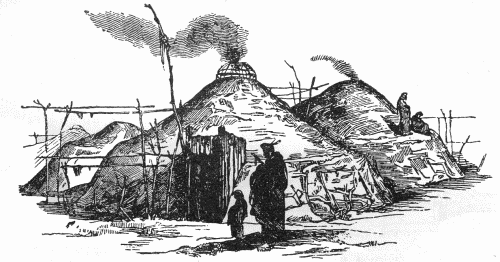
Remarkable Places Around Cannonball
A Book Review by Dakota Wind
Bismarck, ND – Wood’s book, “Prologue To
Lewis And Clark: The Mackay And Evans Expedition,” is a wonderful combination
of research and composition relating to the expedition almost ten years before
the Corps of Discovery arrived on scene. The work isn’t loaded with
archaeological narrative nor bogged down in the weight of its own revelation,
but is carefully and deliberately written with the common reader in mind.
At five chapters and only 255 pages, Prologue is amazingly concise, and
features maps by John Evans and Antoine Soulard, and maps of the explorations reconstructed by Wood’s own meticulous research.
Wood is Professor Emeritus of
Anthropology at the University of Missouri, Columbia. He is an acknowledged
expert of archaeology on the Missouri River by the State Historical Society of
North Dakota and many other fine institutions, state, federal, and tribal,
across the country. Wood has over fifty years of experience from before the
federal dam projects of the 1950s to general field work at the Mandan Indian
village Double Ditch in recent years.
Here’s a three paragraph (pp. 109-110)
excerpt from Wood’s “Prologue To Lewis And Clark: The Mackay And Evans
Expedition.”

Page 147 features sheet 5 of the Beinecke Library Map.
Chapter
Four
The Missouri River Basin Explored
“Those Remarkable Things Mentioned By
Evans”
Between Beaver Creek and the Cannonball
River, there is a sequence of small named and unnamed islands and tributary
streams. [Wood is/was unaware of these streams having names in any of the
native languages.] Evans called the Cannonball River the “Bomb River,” a name
we also may presume to derive from his hypothesized companion. (In this
instance, we may speculate on a French origin, for an Indian identification of
the individual is improbable.) “Bomb” is an appropriate name, for the banks and
valley of this stream once were home to uncounted spherical sandstone concretions
that ranged from a few inches to several feet in diameter. Some of them indeed
were the size of cannonballs. Today they have been carried away by curio
hunters in such numbers that they are very rare.
The mouth of the Cannonball, which Evans
said was 150 yards wide, marks the south end of a high, steep bluff that
extends for four miles upriver along the west bank of the Missouri. It was here
that William Clark “walked on Shore, in the evining with a view to See Some of
those remarkable places mentioned by evens, none of which I could find.”
Unfortunately, we cannot determine what those “remarkable places” might have
been by looking at Evans’s narrative; if it was consulted by Clark, it is no
longer available to us today. Nor are there clues to their identity in Clark’s
subsequent notes, perhaps because he did not begin his search until he had
passed the mouth of modern Badger Creek, thus being upstream from three
locations on Evans’s map that modern viewers find so intriguing. But the map
that Evans made of his voyage contains several clues to those “remarkable
places.” The four-mile-long bluff above the Cannonball is called the “Hummit”
(or “Hermitt”) on his chart – a term that so far defies explanation. Two
features that he names on the rim of Humitt Bluff demonstrate that here he was
following the river uplands on foot, for the features he notes would have been
invisible from the river channel two hundred feet below its rim.

Page 111 from Wood's book features an aerial view of the mouth of the Cannonball River. Eagle eyed readers should be able to make out the curved fortification ditch in this image. Google Earth users can zoom in and view the area for themselves.
One notation reads “Jupiter’s Fort,”
which a hand-and-finger pointing to the north side of the Cannonball River atop
the south end of Humitt Bluff. There is no doubt that this refers to a
prehistoric Mandan village at that location overlooking the mouth of the Cannonball.
Today, archaeologists call this village the North Cannonball site. Not only was
it a defensive setting, but the village also was fortified by a curving ditch
that isolated a lever upland spur from the adjoining upland. The village today
is badly disturbed by plowing, but from the air one can clearly see the
fortification ditch and the numerous bastions protruding from it. Little wonder
that Evans referred to it as a fort, though his reference to Jupiter is not
explainable.
In light of the current energy interests
on the north side of the mouth of the Cannonball River, one might be inclined
to review the historical properties that are about to be disturbed. Get your
copy of W. Raymond Wood’s “Prologue To Lewis And Clark: The Mackay And EvansExpedition” today. Contact the North Dakota Heritage Center and Museum's Store at (701) 328-2822 for available copies.


