Showing posts with label Gall. Show all posts

Friday, July 25, 2014

Impact Of Killdeer Mountain Battle Felt 150 Years Later

Killdeer Mountain at sunset. Photo by Dakota Wind.
'Overlooked' History: Killdeer Mountain 
Battle Felt 150 years Later
By Nadya Faulx, for The Dickinson Press
KILLDEER, N.D. - Monday marks 150 years since the battle at Killdeer Mountain, an event that shaped North Dakota in ways felt more than a century later.

As one of the western-most Civil War-era battles, the Killdeer Mountain Battle was “a turning point in Dakota history,” said writer Jennifer Strange, co-coordinator of a commemoration event beginning at 9 a.m. Saturday at the Dunn County Historical Society and Museum, where she also sits on the board.

But for many outside of the state — even inside the state — the conflict between the U.S. military and a gathering of Teton, Yanktonai and Dakota Indians doesn’t carry the same weight as other Civil War-era battles like Gettysburg or Antietam.

“It’s not much taught about, or, for that matter, discussed,” said Tom Isern, a North Dakota State University professor of history. “Here within North Dakota, there’s just a little postage stamp of a historic site. Hardly anybody goes there.

“It’s a very much neglected and overlooked chapter in history,” he said.

Some state historians say they hope that by commemorating the events of 1864, it will bring renewed attention to their impact on the state, particularly on Native American communities.

“It’s a good time to reflect on this,” said Diane Rogness, historic sites manager with the State Historical Society of North Dakota.

The impact of the two-day battle in 1864 cannot be understated, she added.

“It’s very significant,” she said. “It changed the way of life for the Sioux and for the settlement of Dakota territory. It changed the world. It changed history.”


The Killdeer Mountain conflict as portrayed by C.L. Boeckmann.
Remembering The Battle
She and several others — including United Tribes Technical College instructor of Native Studies Dakota Good House and Standing Rock Sioux tribal historian Ladonna Brave Bull Allard — will speak at the Dunn County museum Saturday on a panel discussing the significance of the battle, which saw General Alfred Sully and 2,200 troops launch an attack on an estimated 1,600 Indians who had gathered at the sacred site of Killdeer Mountain.

Anywhere from 31 to 100 Indians were killed in the conflict, depending on whose historical account you read, as well as two U.S. soldiers. Troops targeted women, children and other non-combatants, even returning to burn down lodges and buffalo meat, and shoot abandoned dogs and horses, according to historians.

The bloody assault was and is regarded as a punitive campaign for the Dakota War of 1862, in which Sully and General Henry Sibley sent forces in to quell an uprising of Dakota Indians in Minnesota angered over late payments from the U.S. for their land. Sully and his men either didn’t know or didn’t care that most of the Indian tribes at Killdeer Mountain two years later had no involvement with the Dakota War, historians said.

Though Killdeer Mountain was theoretically punishment for the hostilities in Minnesota, it was beyond any provocation that took place in Minnesota, Isern said.

“This was about the fate of North Dakota territory,” he said.

Somewhat indirectly, the Battle of Killdeer Mountain opened the door for western railroad expansion, pushed many Native Americans onto reservations, and effectively shaped North Dakota 25 years before the territory was even a state.


Killdeer Mountain from the south side looking north. Photo by Dakota Wind.
A New Focus For An Old Battlefield
Historians and educators have put a renewed focus on Killdeer Mountain in recent years, both because of the lead up to the 150th anniversary of the battle, and because of the encroachment of the energy industry on the now-private land on which the battle took place.

New information is being discovered all the time, mostly in the form of U.S. military correspondence and documents, said Isern, but the American Indian perspective is often left out of the story.

More than a century later, the Native narrative that has been passed down orally for two generations or more is starting to help shape modern understanding of the conflict.

Good House said he has been meeting with tribal elders — many whose grandparents witnessed the conflict — who have continued to share the story of Killdeer Mountain with their own children and grandchildren.

“The most important thing is that we’re talking about it and we remember it so another generation or two don’t go by and we forget about it,” he said.

The State Historical Society of North Dakota could, in the future, update their North Dakota studies curriculum to included the American Indian perspective of not only Killdeer Mountain, but of other conflicts across the prairie between the U.S. military and Native Americans, he said.

Though the Civil War-era battles “did nothing but shape anti-American sentiment” among Native American tribes, by continuing to share the story in oral tradition, “I feel like there’s a burden that’s lifted,” Good House said.

“When we talk about history or significant sites or conflicts where terrible things happened, we need to remember those things happened,” he said. “But those things didn’t happen to us today or yesterday or just last year.”

Strange said the goal of Saturday’s event — featuring storytelling, a bison roast and a writing workshop — is to be “inclusive, educational and respectful of all cultures.”

The spiritual significance of Killdeer Mountain, where for years separate bands of Sioux Indians would gather, often for coming-of-age vision quests for young males, lends an added element to the battle that took place there.

A narrative is still taking shape of what happened at Killdeer Mountain 150 years ago, and what it means for North Dakota today.

“In some ways it’s not as climactic, I don’t think, as some have made it out to be,” Isern said, “but in other ways, it’s more so.

“I think it still remains to be placed in full context,” he said.

Thursday, July 10, 2014

The Killdeer Mountain Conflict

A painting of the Killdeer Mountain Conflict of 1864 by Carl Boeckman. 
General Sully’s 1864 Punitive Campaign
Conflicts In Dakota Territory
By Dakota Wind
KILLDEER, N.D. – “Four Horns was shot in the Killdeer Battle between Sioux and General Sully’s troops…some time after the fight, his daughter cut out the lead bullet,” One Bull said to Colonel Alfred Welch on hot July day in 1934 at Little Eagle, S.D. “The report [that] the soldiers killed hundreds of Indian dogs is untrue,” said One Bull, “because Indian dogs, half wild creatures, would follow the Indians or run away long before soldiers would come up within range.[i]

The Killdeer Mountain conflict occurred on July 28, 1864. Sully was under orders to punish the Sioux in another campaign following the September, 1863 massacre of Dakȟóta and Lakȟóta peoples at Pa ÍpuzA Napé Wakpána (Dry Bone Hill Creek), Whitestone Hill.[ii]

The Lakȟóta and Dakȟóta knew Killdeer Mountain as Taȟčá Wakútepi (Where They Hunt/Kill Deer), Killdeer. The hunting there was good and dependable, and the people came there regularly, not just to hunt but to pray as well. The plateau rises above the prairie steppe allowing for a fantastic view of the landscape, and open sky for those who came to pray.

A hand-tinted photo of Matȟó Watȟákpe by Frank Fiske.

Matȟó Watȟákpe (Charging Bear; John Grass), led the Sihásapa (Black Sole Moccasin; Blackfeet Lakȟóta) on the defensive at Killdeer. The Sihásapa had nothing to do with the 1862 Minnesota Dakota Conflict. “In this surprise attack the Indians lost everything… soldiers destroyed tons of food, etc.,” Matȟó Watȟákpe told Welch, and added that great suffering followed the fight and hatred against the whites grew.[iii] 

The Lakȟóta and Dakȟóta saw General Sully’s approach from miles away, his march put a great cloud of dust into the sky. Sully formed his command in to a large one mile square, and under his command was a detachment of Winnebago U.S. Indian Scouts, traditional enemies of the Očhéthi Šakówiŋ (Seven Council Fires; Great Sioux Nation). A war party of thirty warriors had tussled with the Winnebago two days before Sully’s arrival.

In Robert Larson's take on the Killdeer Mountain conflict, the Teton are overconfident and Inkpaduta was the chief who organized the defense against Sully. 

Historian Robert Larson describes July 28, 1864, nearly perfectly, “…Sully’s five mile march to reach the large Sioux village was a tense and uncomfortable one. Even though it was morning, the day would be hot and dry; the tense summer heat had already thinned the grass and muddied the water holes. On every hill along the valley at the south end of the village were clusters of mounted warriors.”[iv]

The Dakȟóta under ĺŋkpaduta (Scarlet Point) had been engaged with soldiers since the Minnesota Dakota Conflict of 1862. They had fled west towards Spirit Lake when General Sully and his command caught up to them at Big Mound. The Huŋkphápȟa Lakȟóta under Phizí (Gall) had crossed the Mníšoše (Missouri River) in search of game; the heat and drought had driven game from the traditional their hunting grounds. Sibley’s arrival and pursuit of the Dakȟóta and Lakȟóta towards the Mníšoše marked the first U.S. martial contact against the Huŋkphápȟa.

Tačháŋȟpi Lúta pictured here in his B.I.A. police uniform. "Sitting Bull was my friend," he said, "I was under orders...I killed him..." 

Tačháŋȟpi Lúta (Red Tomahawk), infamously known for his part in Sitting Bull’s death years later, recalled the Sibley Campaign, “There was a shallow lake south of the hills and about where Dawson now stands. That was fine buffalo country. The buffalo would get into this lake and mire down so they could not get out. We went there that time to drive them into the lake and get meat and hides. While we were there the Santees came along.”

Tačháŋȟpi Lúta then referred to the ĺsaŋyathi (Santee) as “hostile,” but that the Huŋkphápȟa camped with them and joined together in the hunt. He doesn’t detail how the fight began at Big Mound, only that Sibley pursued them to the Mníšoše. The warriors held the attention of the soldiers, which allowed the Lakȟóta two days to cross the river. The ĺsaŋyathi under ĺŋkpaduta and Wakhéye Ská (White Lodge) broke off and turned north.

ĺŋkpaduta pictured here. After the Little Bighorn fight he went into exile in Canada and died there in 1881. 

After the escape at Apple Creek, ĺŋkpaduta and Wakhéye Ská moved their camps in an arc, first northerly, then back east and south, and kept a respectable distance between the Isáŋyathi and Sibley’s retreat. Then the Isáŋyathi journeyed to Pa ÍpuzA Napé Wakpána to make camp and hunt with the Iháŋktȟuŋwaŋna the following month. Sully found the camp and slaughtered as many as 200 and took over 150 captives, mostly women and children in both cases.

After the Dakȟóta split from the Lakȟóta, “we went to cross the river. We were not afraid,” explained Tačháŋȟpi Lúta, “We did not lose any of our people when we crossed.”[v] He admitted to being a part of the party who waited the night through and then attacked and killed two soldiers.

Here's a reconstruction of the Apple Creek conflict. The map comes from a survey of the Missouri River in the 1890s. 

The late Delma Helman, a Huŋkphápȟa elder from Standing Rock, recalled the story of the Mníšoše crossing, “The soldiers chased us into the river. We cut reeds to breathe underwater and held onto stones to keep submerged until nightfall.” After the vesper of sunset, they emerged from the river safely onto Burnt Boat Island (later called Sibley Island).[vi]

The Sibley campaign was the Huŋkphápȟa’s first encounter with U.S. soldiers, Sully’s assault at Killdeer was the second. Sitting Bull’s own pictographic record testifies to his own portrayal, not as a warrior but as a medicine man, counting coup and stealing a mule from Sibley’s wagon train in July, 1863.[vii]

Sitting Bull pictographed his part in the Big Mound conflict in which he stole a mule from Sully and counted coup on one of the men. 

Historian Robert Utley estimates that there were perhaps as many as 1400 lodges at Taȟčá Wakútepi. It was a sizable village consisting of Huŋkphápȟa, Sihásapa, Mnikȟówožu, Itázipčho, Iháŋktȟuŋwaŋna, and Isáŋyathi. Utley paints the Lakȟóta and Dakȟóta in overconfident tones: “they did not order the lodges packed,” explains Utley, “nor did they order the village moved, “The women, children, and old men, in fact, gathered on a high hill to watch.”[viii]

But the camp was moved. At least the Lakȟótas’ was, from the west side of Taȟčá Wakútepi to the southeast side, below Medicine Hole the day before Sully’s arrival,[ix] in a movement which placed a fresh water creek between them and the approaching soldiers. The Lakȟóta had learned the previous summer that water slowed or stopped the soldiers’ advance.

"Tȟatȟáŋka ĺyotake," says Ernie LaPointe of Sitting Bull, "that's his name." 

Ernie LaPointe, Tȟatȟáŋka ĺyotake’s (Sitting Bull’s) direct lineal descendant, a great-grandson of the Huŋkphápȟa leader, offers this retrospective, “If it had been possible, Tȟatȟáŋka ĺyotake might have accepted peace terms that simply allowed his people and him to continue to live their traditional lifestyle.” As it was, Sully’s assault left one hundred Lakȟóta dead,[x] though Sully’s reports have the count closer to 150.

A map of the Killdeer conflict as it unfolded, courtesy of the State Historical Society of North Dakota.

The Lakȟóta camp had moved in a position which faced Sully’s left flank; ĺŋkpaduta’s camp faced Sully’s right. A hunting party, possibly a war party though all the men were as much prepared to fight as to hunt, skirmished with Sully’s Winnebago scouts earlier that day. Sully’s command, five miles away, approached Taȟčá Wakútepi for a showdown.

When the soldiers got closer, a lone Lakȟóta warrior, Šúŋka Waŋžíla (Lone Dog), decided to test the fighting resolve of the soldiers and boldly rode his horse within range of fire. The soldiers fired three times at him. Tȟatȟáŋka Ská (White Bull) believed that Šúŋka Waŋžíla lived a wakȟáŋ life, charmed some would say in English. Šúŋka Waŋžíla, explained Tȟatȟáŋka Ská, “…was with a ghost and it was hard to shoot him.”[xi]

A map of the 1864 Sully campaign in Dakota Territory.

Lt. Col. John Pattee, under Sully’s command that day, said of Šúŋka Waŋžíla riding, waving, and whooping at the soldiers, that an aide from Sully approached him, “The General sends his compliments and wishes you to kill that Indian for God’s sake.” Pattee ordered three sharpshooters to bring down Šúŋka Waŋžíla. One shot, according to Pattee, sent Šúŋka Waŋžíla from his horse, though Sully claimed the warrior fell from his horse.[xii]

According to Šúŋka Waŋžíla’s own pictographic record, he was riding, armed with bow and arrows, carrying black shields as much for practical protection as for spiritual protection, and received one wound.[xiii]

The fighting continued north for the five miles it took for Sully’s command to reach the encampments. For those five miles, the Lakȟóta held the soldiers’ attention, at times in brutal hand to hand combat. The Lakȟóta managed to outflank Sully’s men, which threatened the wagons and horses, so Sully ordered artillery to open fire. When the fight approached the encampments, the women hastened to break and flee. Frances “Fanny” Kelly, a captive of the Lakȟóta said that as soon as soldiers were sighted, the women withdrew into the hills, woods, and ravines, around Taȟčá Wakútepi, for protection[xiv].

Taȟčá Wakútepi (Killdeer Mountain), a view from the south looking north.

On the Iháŋktȟuŋwaŋna and Isáŋyathi side of the conflict, the fight for the Dakȟóta became a stubborn retreat back to the encampments at the base of Taȟčá Wakútepi. There the soldiers broke into heavy fire into the Dakȟóta protectors until they finally broke. White Bull told Stanley Vestal (Walter Campbell) that the Iháŋktȟuŋwaŋna and Isáŋyathi were as strangers to the Lakȟóta, and that they lost thirty when their line of defense broke.[xv]

In a dialog with Mr. Timothy Hunts In Winter, there was a woman, an ancestor of his, Ohítika Wiŋ (Brave Woman) who fought at Killdeer. “She was only 14 on the day of the Killdeer fight but she fought along side her até (father). Her até was killed that day in battle,” explained Hunts In Winter, “she was named Ohítika Wiŋ because she was a woman warrior.”[xvi]

The Lakȟóta and Dakȟóta encampment lay on the other side of this coulee (the treeline in the middle ground). The Lakȟóta camp moved here from the southwest side of the plateau.

From the Lakȟóta camp there came a singer escorting a man known as The-Man-Who-Never-Walked, a cripple since birth. His limbs were twisted and shrunken and in all his forty winters, he had never once hunted nor fought. When the soldiers came to the camp, The-Man-Who-Never-Walked knew that this was his one chance to fight. He was loaded onto a travois and a creamy white horse pulled the drag. The singer led him to where Tȟatȟáŋka ĺyotake was watching the fight.

When the singer finished his song, he called out, “This man has been a cripple all his life. He has never gone to war. Now he asks to be put into this fight.” Tȟatȟáŋka ĺyotake replied, “That is perfectly all right. Let him die in battle if he wants to.” White Bull later said of Tȟatȟáŋka ĺyotake, “Sitting Bull’s heart was full that day. He was proud of his nation. Even the helpless were eager to do battle in defense of their people.”[xvii] The horse was whipped and drove The-Man-Who-Never-Walked straight into a line of soldiers, who shot the horse then him. They called him Čhaŋte Matȟó (Bear’s Heart) after that because of his great courage.

A closer look at the south-facing slope of Taȟčá Wakútepi, below Medicine Hole. They would have ascended the plateau going around the landmark and over. 

Íŋkpaduta engaged in a counter-attack on Sully’s right flank to stall his approach and lost twenty-seven warriors in hand to hand fighting. The Isáŋyathi broke just as Sully’s artillery began to fire upon the encampment.

Women and children who hadn’t retreated into the hills and ravines west of Taȟčá Wakútepi were suddenly in the fight. The women gathered what they could before abandoning camp, and young boys shepherded the horses to safety. “Children cried, the dogs were under everybody’s feet, mules balked, and pack horses took fright at the shell-fire or snorted at the drifting smoke behind them,” according to Frances Kelly.[xviii]

The Badlands west of Taȟčá Wakútepi. Thousands of places to hide and rendezvous on top of generations of intimate familiarity with the land helped the Lakȟóta remain elusive.

The Lakȟóta and Dakȟóta turned west into the Badlands, and there evaded capture.

The smoke cleared and over a hundred Lakȟóta and Dakȟóta lay dead. Sully ordered troops to destroy everything left behind. Lodges, blankets, and food were burned. Dogs were shot. Children inadvertently left behind in the confusion were chased down by the Winnebago scouts and killed.
________________________
GLOSSARY:
Čhaŋte Matȟó: Bear’s Heart (The-Man-Who-Never-Walked), a forty-year-old disabled Lakȟóta man who fought his first and last fight at Taȟčá Wakútepi

Huŋkphápȟa: also known as “Hunkpapa,” one of the seven Thítȟuŋwaŋ tribes

Iháŋktȟuŋwaŋna: Little End Village (Yanktonai), one of the seven tribes that make up the Očhéthi Šakówiŋ

ĺŋkpaduta: Scarlet Point, war chief of the Waȟpékhute band of the Isáŋyathi

Isáŋyathi: the general name of the four eastern tribes (Sisíthuŋwaŋ, Waȟpéthuŋwaŋ, Waȟpékhute, and Bdewákhaŋthuŋwaŋ), their language is Dakȟóta

Matȟó Watȟákpe: Charging Bear (John Grass), a war chief of the Sihásapa, one of the seven Thítȟuŋwaŋ tribes

Mníšoše: Water-Astir (Missouri River)

Očhéthi Šakówiŋ: Seven Council Fires (The Great Sioux Nation), the confederation is made up of the Thítȟuŋwaŋ, Iháŋktȟuŋwaŋna, Iháŋktȟuŋwaŋ, Sisíthuŋwaŋ, Waȟpéthuŋwaŋ, Waȟpékhute, and Bdewákhaŋthuŋwaŋ

Ohítika Wiŋ: Brave Woman, she fought at Killdeer Mountain alongside her father when she was fourteen years old

Pa ÍpuzA Napé Wakpána: Dry Bone Hill Creek (Whitestone Hill Creek)

Phizí: Gall, a war chief of the Huŋkphápȟa (Hunkpapa), one of the seven Thítȟuŋwaŋ tribes

Sihásapa: Black Sole Moccasins (Blackfeet) one of the seven Thítȟuŋwaŋ tribes

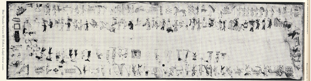
Šúŋka Waŋžíla: Dog Only-One (Lone Dog), a Huŋkphápȟa warrior and a Waníyetu Wowápi (Winter Count) keeper

Tačháŋȟpi Lúta: Red Tomahawk , a Huŋkphápȟa warrior known more for being a Bureau of Indian Affairs police officer and his role in the death of Sitting Bull.

Taȟčá Wakútepi: Where They Kill Deer (Killdeer Mountain)

Tȟatȟáŋka ĺyotake: Sitting Bull, a great leader of the Huŋkphápȟa

Tȟatȟáŋka Ská: White Bull, nephew of Sitting Bull, and a famous warrior

Thítȟuŋwaŋ: Dwellers On The Plains (Teton), the Thítȟuŋwaŋ is made up of the Huŋkphápȟa, Sihásapa, Mnikȟówožu, Itázipčho, Oglála, Oóhenuŋpa, and Sičháŋǧu, their language is Lakȟóta

Wakȟáŋ: With-Energy, often translated as “Holy” or “Sacred”

Wakhéye Ská: White Lodge, a chief of the Sisíthuŋwaŋ
________________________
ENDNOTES: 

[i] In an interview conducted by Colonel Alfred Welch with One Bull, July 14, 1934.
[ii] From Mr. Corbin Shoots The Enemy, September 2013.
[iii] Welch, A. B., Welch Dakota Papers (welchdakotapapers.com).
[iv] Larson, R., Gall: Lakota War Chief (University of Oklahoma Press, 2007), 45.
[v] Welch, A. B., Welch Dakota Papers (welchdakotapapers.com).
[vi] Interview with Delma Helman, July 2013.
[vii] Vestal, S. (Campbell, W.), Sitting Bull: Champion Of The Sioux (University of Oklahoma Press, 1957).
[viii] Utley, R., The Lance And The Shield: The Life And Times Of Sitting Bull (Henry Holt And Company, 1993), 55.
[ix] White Bull, box 105, notebook 24, pp. 1-6, Walter S. Campbell Collection, University of Oklahoma Library, Norman, OK.
[x] LaPointe, E., Sitting Bull: His Life And Legacy (Gibbs Smith, 2009), p. 49.
[xi] White Bull, box 105, notebook 24, pp. 1-6, Walter S. Campbell Collection, University of Oklahoma Library, Norman, OK.
[xii] Pattee, J., Dakota Campaigns (South Dakota Historical Collections 5, 1910), 308.
[xiii] Hé Núŋpa WaníčA (No Two Horns), thípi with pictographic records, July 7, 1915.
[xiv] Kelly, F., Narrative Of My Captivity Among The Sioux (Mutual Publishing Company, 1871), pp. 274-278.
[xv] White Bull, box 105, notebook 24, pp. 1-6, Walter S. Campbell Collection, University of Oklahoma Library, Norman, OK.
[xvi] From Mr. Tim Hunts In The Winter, March, 2014.
[xvii] Vestal, S., Sitting Bull: Champion Of The Sioux (University of Oklahoma Press, 1932), p53-54; White Bull, box 105, notebook 24, pp. 1-6, Walter S. Campbell Collection, University of Oklahoma Library, Norman, OK.
[xviii] Vestal, S., New Sources Of Indian History (Gayley Press, 2008), p. 56.

Friday, August 9, 2013

The 1863 Apple Creek Conflict 150 Years Later

A composite panorama of Apple Creek from the northeast point of Pictured Bluff. The image is southwest (l) to north (r). 
The Dakota Conflict In Dakota Territory
The Apple Creek Conflict 150 Years Later
By Dakota Wind
BISMARCK, N.D. – The Mníšoše, Missouri River, moves determinedly along the ancient valley it has carved over thousands of years. The river flows in the very heart of the Great Plains, in fact, aside from the wind, it’s a defining feature of the prairie steppe. Its Lakȟóta name means “The Water A-stir” in reference to its muddy stirred up appearance in historic times. Commercial traffic on the river in the nineteenth century came to call it “The Big Muddy.”

Tȟaspáŋla Wakpála, Apple Creek, meanders along its own course from a field north and east of present-day Bismarck, N.D. The Menoken Indian Village rests along the quiet creek, a silent witness to trade in what archaeologists call the Late Woodlands period. The creek’s name refers to the tree that bears the tiny edible thorn apple.

Where the Tȟaspáŋla Wakpála converges with Mníšoše is Mayá Itówapi, Pictured Bluff. There, along the bluff are caves where the sediment is layered in colors. A testament to the changing climate throughout the ages of the world to the geologist, but to the Lakȟóta, it was a place to gather natural yellow and red pigments to create paint.

There was a conflict between the Pȟadáni (Arikara) and the Iháŋktȟuŋwaŋna (Yanktonai) in the 1830’s. According to the John K. Bear winter count the year is recorded as Čhaŋnóna na Pȟadáni ob thi apá kičhízapi, The Wood-Hitters (a band of the Iháŋktȟuŋwaŋna) fought with the Arikara. 


The Blue Thunder Winter Count, variant III.

The Waŋkíya Ťho, Blue Thunder, winter count correlates this event at a Dakota winter camp located below Čhaŋté Wakpá, Heart River. According to Blue Thunder, the assailants are variously identified as Arikara, Mandan, or Assiniboine. The Mandan Indians have the Foolish Woman winter count, and they record that they destroyed fifty lodges. The Tȟatȟaŋka Ska, White Bull, winter count has that winter as Wičhíyela waníyetu wičhákasotapi, the Yanktonai were almost wiped out that winter.

The John K. Bear winter count also mentions the Dakota Conflict in its 1863 entry: Isáŋyatí wašíčuŋ ob okȟíčize, the Santee warred with the whites. The Minnesota Dakota conflict is also reflected in the Red Horse Owner, Roan Bear, and Wind winter counts.

Clell Gannon, a depression era artist, painted this scene of General Sibley's command in pursuit of the Sioux. The painting can be found in the south vestibule of the Burleigh County Courthouse, Bismarck, ND.

The fight between the two tribes paled in comparison when in 1863, General Sibley and his command of about four thousand soldiers engaged the Dakȟóta and Lakȟóta people in a running battle lasting two weeks, from Big Mound (near present-day Tappen, N.D.) to Pictured Bluff.

Sitting Bull counts coup on one of Sibley's men and steals a mule at the Big Mound Conflict. The image was Sitting Bull's own account, from "Sitting Bull's Heiroglyphic Autobiography" which appears in Stanley Vestal's "Sitting Bull: Champion Of The Sioux."

In Tȟatȟáŋka Íyotake’s, Sitting Bull’s, own pictographic account, he placed himself at Big Mound where he rode into Sibley’s camp, stole a mule, and counted coup. It is almost entirely certain that if this great leader was at the beginning of the running battle, he was there to the end at Pictured Bluff.


The running battle began as a masterful retreat on July 24, 1863, across hilly terrain in a sinuous line back and forth across streams. This constant crossing, in effect, caused Sibley to lag behind enough for the Dakȟóta and Lakȟóta to gain enough lead time that the women, children, and elders could navigate their crossing waŋna hiyóȟpayA Tȟaspáŋla Wakpála hená Mníšoše, where the Apple Creek converges with the Missouri River.

That critical crossing came on July 29, 1863. The oyáte, people, abandoned their thiíkčeka, lodges, on the broad flood plain of the Mníšoše. A thousand lodges encircled two little lakes, sloughs in later years. They crossed the Mníšoše in as many as five places below Pictured Bluff. The warriors rallied together, perhaps under the leadership of Tȟatȟáŋka Íyotake or Phizí (Gall), and took the high ground a-top Pictured Bluff.

The women, children, and elders who made a successful crossing signaled the warriors with flashes of sunlight using trade mirrors. The warriors in turn, signaled back to their loved ones then they turned their attention to Sibley’s command. There is no exact number of warriors, but if there were a thousand lodges, then there was at least one able-bodied man or warrior per lodge. Using this projection, the warriors were outnumbered four-to-one.


Sibley and his men arrived on the scene, July 29, 1863, to witness flashes of light in communiqué to those in safety across the river. The general struck camp and named it “Camp Slaughter” after a doctor in his command. Over the course of the next few days, Sibley could not take the hill and some of his men were ambushed in the middle of the night. The morale of his soldiers suffered and on July 31, withdrew his men from the field when the enemy seemingly disappeared.

The Apple Creek Conflict is the only fight in the Punitive Campaigns of 1863 & 1864 in which the Dakȟóta and Lakȟóta chose the battlefield, met their aggressor, and held them off until they withdrew. This clear victory became entirely overshadowed by the tragedies of Iŋyáŋsaŋ (Whitestone Hill) and Tȟáȟča Wakútepi (Killdeer), and the victory of Pȟežísluta, the Battle of the Little Bighorn in 1876.


An unknown, or perhaps forgotten, artist pictographed this scene which was originally identified by Mike Cowdrey as "The Battle Of Whitestone Hill," but is quite possibly a Yanktonai account of the Apple Creek Conflict.

Susan Kelly Power, an esteemed uŋčí (grandmother) of the Iháŋktȟuŋwaŋna Dakȟóta and enrolled member of the Standing Rock Sioux Tribe and great-granddaughter of Chief Two Bear, has the oral tradition that places three warriors there at the Apple Creek Conflict: Callous Leg, Little Soldier, and Has Tricks. There must certainly be more warriors and oral traditions amongst the Iŋyáŋ Wosláta Oyáŋke, the community of Standing Rock, and others.

Today, a park named for General Sibley rests virtually where his Camp Slaughter once stood, where some of the Dakȟóta and Lakȟóta made their crossing. Bismarck has turned a battlefield into a place of recreation. There is no signage explaining the name of the park, nor of the conflict.

The landscape has been appropriated and development has erased the battlefield; Dakȟóta and Lakȟóta oral tradition recalls that the soldiers chased the people into the river. 

On July 29, 2013, 150 years after Sibley’s command withdrew entirely from the Apple Creek Conflict, the anniversary passed in silence. 

Friday, February 8, 2013

Preserving The Story Of Killdeer Mountain

An image of a soldier engaged in hand-to-hand combat with a warrior. The image is engraved upon the elevator doors on the ground floor and main floor. 
Preserving The Story Of Killdeer Mountain
Public Hearing: Energy Development At Site
By Dakota Wind
BISMARCK, N.D. – The polished hall outside the Missouri Room of the Bismarck State Capital building gradually filled with archaeologists, historians, tribal representatives and land owners from around Killdeer Mountain, all from different disciplines and walks of life, all concerned citizens of a proud state.

The study area of the Killdeer Mountain Conflict within the purple boundary.

The citizenry gathered in little groups here and there to introduce themselves and exchange greetings. It seemed like a fellowship of near universal concerns that brought everyone together, and life is like that. Sometimes it takes one thing to bring people together who might not have met in another situation.

An alarming amount of existing wells and proposed wells within the Killdeer Mountain Conflict area.

The hearing was scheduled at 2:00 PM CST and the fellowship exchanged the hall of polished stone and brass for the quiet cell of the Missouri River Room. A coterie of archaeologists clustered together in one corner, the tribal representatives quietly moved themselves to a corner close to the front, and historians scattered amongst the throng. Chit chat grew to a loud buzz, and though the Government and Veteran Affairs Committee was delayed an hour the motley collection of citizens didn't seem to grow impatient.

This is North Dakota, and sometimes things happen when they’re scheduled to, and other times things happen when they should. Farmers might call it natural time, Indians would agree.

Senator Triplett explains that next year marks the 150th anniversary of the Killdeer Mountain Conflict. "Its an opportunity for the state to reflect on the tragedy that shaped our statehood and include the story that has been under represented these long years," said Triplett, or something like that - my pen could not move fast enough.

The good people who made up the committee apologized for their unexpected delay and things quickly got started when Chairman Dever (Dist. 32, Bismarck) brought the gavel down with great ceremony and authority.  The hearing was to hear Senate Bill 2341, a proposal by senators on either end of the political spectrum, introduced by Sen. Wardner (Dist. 37, Dickinson) but the voice of the bill was provided by Senator Triplett (Dist. 18, Grand Forks).

Senate Bill 2341 proposed to appropriate $250,000 to do an archaeological and historical survey of the Killdeer Mountain conflict study area. A packed room of about forty-five people, including the good senators, heard testimony from several individuals representing various entities, and a few who spoke as private citizens.

Paaverud maintained an impeccable composure of respect for the committee as he endorsed the Heritage Center's support of the bill.

Mr. Merlan Paaverud and Ms. Fern Swenson represented the interests of the State Historical Society of North Dakota and voiced the SHSND’s endorsement of this bill. Ms. Swenson offered that the Killdeer Mountain study area consists of 17,433 acres or about 23 square miles, a core area of about 5,421 acres and only about 569 acres has been surveyed. Swenson also shared that the site has had a continual cultural occupation for the past 3,000 years.

Dr. Isern addresses the committee. He said his piece in about five minutes or less and gave some handouts with points explaining the nature of heritage preservation. 

Dr. Tom Isern, Director of the Institute for RegionalStudies, rendered a concise and wonderful explanation of the intrinsic value of Killdeer Mountain as a heritage site and acknowledged the attraction of the site to hikers and lovers of history and nature who would be drawn to this site, as many like-minded visitors have in the past. Dr. Isern expressed his institute’s support of the bill.

An immaculately groomed Aaron Barth (looking at the camera) visited with Mr. Jepson of Killdeer.

A few concerned citizens took to offering their support of this bill. Mr. Aaron Barth, founding writer of The Edge Of The Village, shared the need to survey and catalogue the Killdeer Mountain as a start to preserve the story of the site, if the natural integrity of the site is to be developed. “There’s a story to tell, and we must do all we can to share it,” as he compared the need to tell the stories of all combatants, like the American Civil War.

Without waver or hesitation, Young shared a resolution regarding sacred places from the National Congress of American Indians.

Ms. Waště'Wiŋ Young, Standing Rock Tribal Historic Preservation Officer, took the stand and pointedly stated that “the Indian voice has yet to be heard.” Young boldly shared with the committee a resolution adopted by the National Congress of American Indians in October of 2012 regarding the protection and preservation of sacred places. She read the whole thing, expressed her office’s support of Senate Bill 2341, and quietly departed.

Bravebull-Allard representing Standing Rock Tourism supports this bill.

Ms. LaDonna Bravebull-Allard, Director of Standing RockTourism, shared her lineage going back to survivors who were at Killdeer Mountain when General Sully forced his command on the Yanktonai Dakota, Hunkpapa Lakota and Santee Dakota. Bravebull-Allard spoke about how Killdeer Mountain was a sacred site, not just to the Dakota and Lakota people, but the Mandan, Hidatsa, Chippewa and Assiniboine. With practiced confidence of a story-teller she shared that the site was where Sun Dreamer ascended Killdeer Mountain in 1625. Bravebull-Allard’s office supports this bill.

St. John spoke with dignified authority, less than two minutes, and left many of the committee nodding their heads in approval of her gracious support.

Ms. Tamara St. John, Sisseton-Wahpeton Tribal Historic Preservation Officer, eloquently and briefly echoed Young’s and Bravebull-Allard’s sentiments of protecting a special site like Killdeer Mountain and her office’s support of the bill.

Sand called for the state to move carefully and deliberately to preserve North Dakota's heritage sites.

Mr. Rob Sand, a representative of the Killdeer MountainAlliance, a tall gentleman with the gait of a lifelong rancher took to the podium briefly and passionately encouraged oil development to wait. Sand offered the support of the Killdeer Mountain Alliance in favor of the bill.

Rothaus, self-described hard-boiled skeptic, put the bill on a scale but explained the overwhelming need to preserve as much of the story of Killdeer as possible and endorsed the bill.

Dr. Richard Rothaus, founder and director of TrefoilCultural and Natural, drove like a mad man from his office in Sauk Rapids, MN to render cold and succinct explanation of the Killdeer Mountain conflict’s standing in US military history as one of the largest, if not the single largest, Indian-White conflict in the west and why North Dakota needs to preserve as much of the conflict site and stories as possible. A former university professor, Rothaus came across brutally blunt but also exceptionally honest. He also endorsed his support of the bill.

Dvirnak proudly wore a Fighting Sioux windbreaker to the hearing. 

Lastly, Mr. Bryan Dvirnak, a lifelong rancher on family-owned and managed land at Killdeer Mountain, shared his family’s generations-long commitment to the preserving the cultural and historic integrity of the conflict site. “No one has done more to preserve and protect the site. We’re all for preserving the property,” said Dvirnak in a moving testimony to the committee. Dvirnak expressed that his brother could best articulate how their family has forged relationships with various Indian communities in state and  into Canada. The Dvirnaks have graciously allowed traditional ceremonies and prayers to be conducted on their land throughout the years.

Dvirnak, regardless of his family’s openness to the American Indian presence on his family’s land, managed to convey his open skepticism of the bill. “What will the [archaeological] study do?” he wondered aloud. Dvirnak conveyed his disillusionment with the bill, the sharpest point of his argument manifested itself in his question about what the bill would mandate him to do on his own land.

The bill doesn’t mandate anyone to do anything on their own private land. In fact, the bill mandates that the archaeologists who conduct the investigation must acquire the permissions of all landowners in the study and core areas of the Killdeer Mountain conflict. Senator Dever, the chairman of the Government and Veterans Committee, understood Mr. Dvirnak’s position and told Sen. Triplett to include language in Senate Bill 2341 that expressly and clearly articulates a mandate for archaeologists to acquire permission of landowners to survey on their land.

Mr. Dvirnak and his family have the best intentions, a family mission taken to heart, passed down from father to sons, to preserve the heritage of Killdeer Mountain. They opened their lands in the past to the Indian communities. They also donated a tidy collection of artifacts from the KilldeerMountain conflict to Dickinson State University.

They did this because there’s a story that needs to be preserved and shared, and that’s something that everyone who testified can agree.