Showing posts with label Dakota Territory. Show all posts

Tuesday, September 24, 2019

Lakota Territory Poster

Očhéthi Šakówiŋ (Seven Council Fires) Territory Poster, above, shows several maps, all of which show an occupation in the heart of North America.
Očhéthi Šakówiŋ Territory Poster
Traditional Homeland Of Great Sioux Nation
By Dakota Wind
Bismarck, N.D. (The First Scout) - Over 1800 places across the Great Plains have been pinned on a Google Map, drawn from oral tradition, books, journals, historic maps, to create a resource that reflects a historical and cultural occupational history of the Očhéthi Šakówiŋ (Seven Council Fires, or "Great Sioux Nation") over the past three hundred years. 

The Google Map, called Makȟóčhe Wašté (The Good Country, or The Beautiful Country), has over 1800 places in the language of the Očhéthi Šakówiŋ people. Over 24,000 geo-referenced pins on over two hundred historical maps using Google Earth and the David Rumsey Map Collection at the Stanford University Library were employed to create a map history detailing the historic and cultural occupation of the Očhéthi Šakówiŋ in the heart of North America. 

The Makȟóčhe Wašté Map demands a lot of computer memory and bandwidth that it is best accessed online via desktop computer. This poster was created to provide viewers and educators a general view of the Great Plains as the Očhéthi Šakówiŋ saw it, with a south-orientation. A screen capture image of various points shows not just occupation but far reaches of inter-tribal trade. The map is updated as placenames are shared or revealed. 

Three historic maps drawn by Iháŋkthuŋwaŋna Dakhóta (the Whitestone Hill Massacre Map by Richard Cottonwood guided by Takes His Shield) and Húŋkpapȟa Lakȟóta (the two maps of the 1876 Little Bighorn Fight) are included. All three are south-oriented. A Google Map overlaps the various historic occupations (blue is Dakhóta; purple is the Middle Dakhóta; red is Lakȟóta). 

Also included are two historic trader maps, one by John Pope when he was a trader before the 1862 Minnesota Dakota Conflict, and the other by Joseph Nicollet. Both of these maps demarcate the landscape with hundreds of placenames in Dakhóta. 

An explanation of the south-orientation worldview perspective can be found here.

Lastly, several Lakȟóta names appear in large, bold, red text which recalls how they referred to the Great Plains, and by extension North America. This poster measures 36"x48". Download your free Lakota Territory Poster and share it. 

Wednesday, December 6, 2017

History Of North Dakota, A Book Review

History of North Dakota, A Book Review
Environment Determines Character
By Dakota Wind

Robinson, Elwyn Burns. History of North Dakota. Lincoln, NB: University of Nebraska Press, 1966. Out of print. (Fargo, ND; ND Institute for Regional Studies, 1995. $40.00.) 610 pages + viii. Preface, table of contents, maps, illustrations.

Robinson’s History of North Dakota is a dense read. Twenty-three chapters take readers on a journey of remoteness from the formation of the prairie, a modest “Indian” occupation, through exploration, settlement, booms, WWI & WWII, to the culture and character of North Dakotans.

Robinson’s History’ features indigenous history, but the human occupation history only begins with Pierre La Vérendry’s 1838 fall encounter with the Mandan on the Missouri River. Robinson disguises ecological history as pre-contact history, describing the conditions in which the Indians lived and hunted.

The Opening of the West unapologetically includes frontier military history. Lt. Col. Armstrong gets a two-page mention here regarding his role in the Black Hills Expedition of 1874, and his last failed command which concluded at the Little Bighorn Fight of 1876. The military was placed in an odd position, to the natives, the forts represented a permanent advancing presence, and to the pioneer, the military represented the furthest most edge of western civilization. Robinson describes the military as practically impotent, a token might that couldn’t hold back its own citizens from entering and occupying the Black Hills, but a might that was exercised only after American citizens died in escalating conflict with the natives.

The environment, the dry, semi-arid plains, industrial technology, and a desperate need to help and be helped or utterly fail developed the cooperative character of the North Dakota farmer. If environment determined the pioneer spirit, it would seem that one could make the argument that the vast open plains did the very same to the indigenous for millennia. One simply couldn’t survive or progress without the help of another soul. For farmers, this real need to cooperate extended beyond the social confines of church and field, and developed into cooperations.

The completion of settlement teeters on a few things, not just immigration. War in the Philippines and Cuba, industrial and technological advances in agriculture, contributed to the development and settlement of the plains.

The Character of a People offers an answer to the spirit of North Dakota citizens: common experience and conditions of existence (the environment). It’s the environment that Robinson determines is the factor in character development and cites the work of psychologist and part-time ethnohistorian Dr. James H. Howard, that even the natives were affected by the environment because plains Indians differ in personality and disposition than their woodland kin.

Robinson touches on the “country mouse” mentality of North Dakota citizens, and feelings of inferiority and non-adjustment of rural citizens among city-folk, even among the city or townfolk in the state. Politicians reacted to their rural constituents by dressing down. The two characteristics that both the indigenous and colonist must posses are courage and faith in the future.

Robinson wrote his History’ for the citizens of North Dakota, perhaps to instill a sense of pride that the people of the state could live and thrive to a time then a history of book could reward their patience and faith. Though Robinson recognizes the struggle settlement, and acknowledges the displacement and confinement of the indigenous, his work is too optimistic. Fifty-seven years after the first printing of History and North Dakota is still dealing with the consequences of native dispossession and treaty issues decades before the territory entered the union as a state. Perhaps Robinson would attribute his optimism to the North Dakota experience.

Robinson’s book is dense, and it’s certainly not a recreational read. It’s dated material, but that’s probably why one should read it, for its insight to North Dakota as someone who’s experienced North Dakota; a retrospect from the middle of the twentieth century.


Dakota Wind is an enrolled member of the Standing Rock Sioux Tribe. He is currently a university student working on a degree in History with a focus on American Indian and Western History. He maintains the history website The First Scout.


Saturday, October 21, 2017

Terrible Justice, A Book Review

Whitestone Hill, this image appeared in Harper's Weekly, based on a pencil drawing by Gen. Alfred Sully. 
Terrible Justice, A Book Review
No Detail Too Grim Left Out
By Dakota Wind
Chaky, Doreen. Terrible Justice: Sioux Chiefs and U.S. Soldiers on the Upper Missouri, 1854-1868. Norman, OK: University of Oklahoma Press. 2012. $39.95 (hardcover). 408 pages. Illustrations, maps, photographs, bibliography, and index.

Chaky’s Terrible Justice begins with the Ash Hollow conflict of 1854, as settlers migrated across the Great Plains to better lives on the west coast or in the Rocky Mountains. Her research was sparked after participating in an archaeological survey at Fort Rice, and she soon realized that as much as the story of adventure belonged to the soldiers, it was a story that ultimately belongs to the Sioux. She was not satisfied that so little was published about the military’s role in Manifest Destiny there at Fort Rice and across the plains.

An example of an outstanding feature in Terrible Justice is Chaky’s use of Little Crow’s actual name, which is Taóyate Dúta (His Red Nation), and her continued use of his real name throughout her book. She doesn’t mince words in her description of the punitive military campaigns – Generals Sibley and Sully were sent to make war, take prisoners, destroy food resources, and secure Dakota Territory for white settlement.

Chaky carefully constructs the 1863 Sibley campaign on the orders of General Pope and his orders to secure Dakota Territory from President Abraham Lincoln. Sibley’s march is an invasion, and the conflict between the Očhéthi Šakówiŋ (the Great Sioux Nation) and Sibley's command began when his campaign left from Camp Pope on the Minnesota River, not when a young man from the band of Íŋkpaduta (Scarlet Point) shot and killed Surgeon Weiser.

Terrible Justice isn’t an apologist’s narrative. Chaky describes in great detail the gory violence and destruction committed by men, native and non-native; scalps taken by soldiers and warriors. But, she draws close when she includes brief remembrances of Pvt. Phebus, Sgt. Martin, and acting Gov. Hutchinson, several years after the Whitestone Hill massacre.

Federal “Indian Policy” has always been one of dispossession and displacement. As settlers advanced west into Indian Country, tensions erupted in an escalating conflict until the military came in to secure the peace by forcing first nations to sign treaties (land cessions and reservations). Treaties were generally signed by a majority of grown men, sometimes not even by that (ex. Treaty of New Echota).

The Sibley-Sully campaigns were pre-emptive. The Yanktonai, who, at that time yet lived in their homeland, were killed, imprisoned, and forced west across the Missouri River without ever signing a treaty to cede their lands. The land between the Missouri River and the James River is still unceded Yanktonai territory.

Chaky signed my copy, “Dakota, I hope I’ve represented the Sioux properly with this book. I enjoyed doing it very much. Doreen Chaky, 7/28/13.” It’s a book that’s not hard to read, but it’s straight content and elaborate description make it hard to read. These are my people. Chaky began her narrative that this was “the story of the Sioux.” A quick review of her bibliography reveals six recognizable works by first nations, and one hopes a second edition of Terrible Justice would draw on more the surviving oral tradition. 

Recognizing that there are many, many books available for purchase on the subject of the Little Bighorn conflict, Chaky brings her work to a tidy close, by barely mentioning that fight (one sentence). Wounded Knee receives no mention. That’s all right, not every history book about the Očhéthi Šakówiŋ needs to include that tragedy. Chaky focuses on the conditions of peoples, native and settler, of the Great Plains. 

It's a good book. Go get yourself a copy. The maps are a great visual aid.

Dakota Wind is an enrolled member of the Standing Rock Sioux Tribe. He is currently a university student working on a degree in History with a focus on American Indian and Western History. He maintains the history website The First Scout.


Saturday, October 14, 2017

The Spirit and The Sky, A Book Review

The Spirit And The Sky, A Book Review
Astronomer's Study Of Lakota Starscape
By Dakota Wind
Hollabaugh, Mark. The Spirit and the Sky: Lakota Visions of the Cosmos. Lincoln, NB: University of Nebraska Press. 2017. 276 + xii pages. $50.00 (hardcover). Illustrations, tables, photos, notes, bibliography, and index.

The title of Hollabaugh’s The Spirit and the Sky calls to mind Norman Greenbaum’s 1969 psychedelic/gospel classic rock anthem Spirit in the Sky. I contacted the author about this, and he personally assured me that the title of his book is inspired by Lakȟóta star knowledge (which is touched on at the end of chapter 9).

Hollabaugh’s bibliography draws heavily from non-native resources who’ve spent considerable time learning Lakȟól Wičhóȟ’aŋ (Lakota language, tradition, lifeways, philosophy) direct from the Lakȟóta themselves. These resources reach back through the years with specific references to winter count (pictographic records) years, and recorded oral tradition.

What makes The Spirit in the Sky special is that Hollabaugh draws on carefully constructed relationships with contemporary Dakhóta and Lakȟóta people since the ‘90s, and fully acknowledges lasting friendships with scholars, native and non-native in his preface.

A chapter on Telling Time gives readers an insight into how the Lakȟóta reckon a year (generally thirteen months), a month (a lunar month; from new moon to new moon), and seasons (winter is the longest, and why a year is called a “winter”). The times of the month are explained (phases of the moon) as well as times of day (position of the sun). Counting sticks are touched on briefly insofar as the Lakȟóta attempts to measure the months and years, which is frustrating to any who try to tack down exact times. The general acceptance of natural time in the Lakȟóta tradition encourages a non-reliance of exactness. What matters is Wókiksuye, or Remembrance.

A chapter on Eclipses and the Aurora Borealis examines Lakȟóta beliefs of the two events. The eclipse is regarded as the sun’s death by many Lakȟóta, and some reacted with fear. Some said/say that a great serpent swallows the sun, but the sun proves victorious and lives again, and some fire their guns or holler into the air in triumph. The Northern Lights have several names, and several narratives – none more important than another. Surprising to this reviewer is the connection of the Northern Lights to Woȟpé (Falling Star Woman) of Lakȟóta myth-history, and to the Huŋkáyapi (the Making-of-Relatives; when one is taken as a relative).

A chapter on Stars and Constellations explores the cultural narratives of the night sky. Many of the same familiar Greek and Arabic constellations have Lakȟóta counterparts with equally interesting stories. The children of the Sun and Moon dance forever around one wakȟáŋ (with-energy; “holy,” or “sacred”) star, Wičháȟpi Owáŋžila (The Star That Does Not Move), and those who do not, fall down as Wičháȟpi Hiŋȟpáya (Falling Stars).

Hollabaugh doesn’t conclude his study with the establishment of the reservation era. His work breaks that tired trope and includes an entire chapter dedicated to the living tradition of Lakȟóta star knowledge. It’s necessary to show the Lakȟóta as they are today, survivors of a system that has tried to extinguish language, culture, and tradition. Some of Hollabaugh’s native resources and informants are still alive and still sharing.

What makes The Spirit in the Sky an essential for studies of the North American Plains is that the Lakȟóta relationship with the land is reflected in the sky. The Lakȟóta star stories are indigenous and to hear them, one must go to an elder to hear them. This book is a good place to become acquainted. 

The only thing that would make reading this resource better would be to read, deconstruct, and interpret each topic as it’s mentioned with a Lakȟóta elder or other knowledgeable person. It would be a wonderful supplement if Hollabaugh or his publisher included a slideshow or an interactive online feature or smartphone application to articulate the heavens as one goes through each chapter. 

The Spirit in the Sky isn’t hearty enough for college instructors to develop an entire course around – Hollabaugh might even agree with this, but it is solid enough to pique anyone’s interest whether he or she have a passive or deep interest in the stars or Lakȟóta views of the heavens and earth. Make certain your local library has a copy, or get yourself one.

Dakota Wind is an enrolled member of the Standing Rock Sioux Tribe. He is currently a university student working on a degree in History with a focus on American Indian and Western History. He maintains the history website The First Scout.


Friday, August 4, 2017

Crying Hill, An Endangered Historic Site

"Crying Hill," or "Mandan Hill" can be seen in the middle of this photo, the Missouri River down below, city development behind in the distance. 
Crying Hill Endangered
Site Overlooks River, City, Interstate
By Dakota Wind
Mandan, N.D. (TFS) – A hill rolls above the floodplain where the Heart River converges with the Missouri River. It divides the city of Mandan from traffic of I-94. It loudly proclaims “MaNDan” on its east face in bright white concrete lettering; the south face of this same plateau says the same but with trees spelling the city's name.

It’s the home of the Mandan Braves, named after the indigenous people who lived there on the banks of the Heart River as traders, fishers, and farmers. The Nu’Eta, as they call themselves, could defend themselves when called for as well. They lived in fortified villages in the Heart River area from about 1450 to about 1781.

Each village had a civil chief and a war chief to advice and look after their interests. The Nu’Eta were productive and hard-working. They must have been doing something right; their villages possessed no jails.

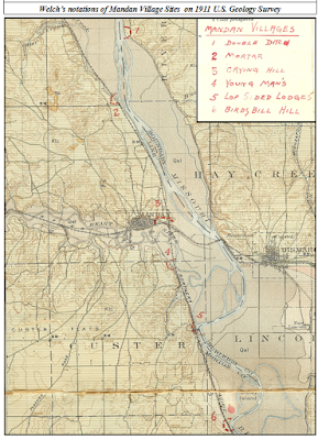
Welch's notations on a 1911 US Geological survey map. Bismarck and Mandan have grown considerably in the hundred+ years since. 

The village along the banks of the Heart River in present-day Mandan, ND was large, with a population of perhaps as many as 3000. Its identified mainly as a Nu’Eta site, but the Hidatsa claim the populace as their own. The Hidatsa became neighbors of the Nu’Eta sometime around 1600 C.E., and inter-married with them over the centuries that today one isn’t Nu’Eta without having Hidatsa relatives.

This large village was known by many names. The Nu’Eta called it Large and Scattered Village. The Hidatsa called it the Two Faced Stone Village for the sacred stone feature atop the plateau overlooking their village. Crows Heart, a principle leader of the Nu’Eta, informed Colonel Alfred Welch that that they called the village there in present-day Mandan, “The Crying Hill Village.” Crows Heart also essayed to Welch that they called it so because their women went to the top of the hill to mourn for lost relatives.

Another village there, south of the Crying Hill Village, called Motsif today, was known by the Nu’Eta as Youngman’s Village. According to Welch’s informants, the Nu’Eta of both these two villages would gather together and inhabit a winter camp in the timber on the floodplain of the Missouri River[1].

According to the late Mr. Joe Packineau, the Crow separated from the Hidatsa at the Crying Hill Village, adding that the village was also called the Tattoo Face Village, and further, that it was Hidatsa, not Nu’Eta. In the time of Good Fur Robe, he had a brother whom they called Tattoo Face. A hunt concluded with a dead bison recovered from the middle of the river. Good Fur Robe divided the kill and took the paunch, which infuriated Tattoo Face and his people, who picked up and moved west. According to Packineau, the Hidatsa called them not Crow, but “The Paunch Jealousy People.” Where the Crow broke away from their Hidatsa relatives was at the Crying Hill Village[2].

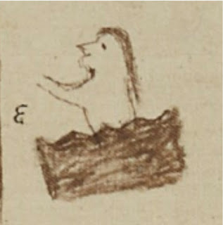
Welch drew this diagram mapping the features of Crying Hill. Visit the Welch Dakota Papers site.

At the top of Crying Hill were stone features (including a stone turtle effigy measuring twelve feet across), sacred to the Nu’Eta, upon which were images or pictographs, which changed, and were said to be able to tell the future. One oracle stone in particular, was said known as the “Two Face Stone.” When diviners gathered ‘round to interpret the stone’s musing for the future, they would lift the stone, which seemed to them to be very light. Upon putting it down, they would lift again, and the stone mysteriously weighed more than one could lift. They called this stone Two Face because of its dual nature, and according to Welch’s informant, the village below was called “Two Face Village.” Enemy Heart, an Arikara man, estimated the side of the Two Face Stone to be a diameter of about 18 inches[3], it’s location, at least in 1912, was lay just east of the Morton County Courthouse in Mandan, ND[4]. Enemy Heart insisted that the Crying Hill Village’s proper name was Two Face Village.

In the 1870’s, as the city of Mandan developed on the remains of the Large and Scattered Village, or Crying Hill Village, or Tattoo Face Village, Two Face Village, homes and streets encroached on Crying Hill itself. One day, a prospective home owner, took dynamite to the sacred stone on the hillside of Crying Hill and blew it up[5]. Welch contends that the greater oracle stone was drilled and split by white settlers for building stone. One resident, Mr. G.W. Rendon built the basement of his house from fragments of this holy stone[6].

There used to be a burial ground at Crying Hill. In 1933, laborers of the city of Mandan were expanding development of the city for two new houses, and disturbed the graves of eleven Nu’Eta men and women, including a baby. Col. Alfred Welch was called on to offer his assessment of the findings, and he estimated that the size of the Crying Hill Village at about 3000 souls, and was occupied for about 300 years[7], from ~1500 C.E. to about ~1800 C.E. The bodies were hastily buried, possibly due to the haste in which the survivors departed the Heart River villages in 1781 following the smallpox epidemic which struck them.

This reconstruction of the 1863 Apple Creek Fight is overlaid on 1850's Warren survey map. 

Crying Hill overlooks one of the largest conflicts in Dakota Territory history. In 1863, General Sibley led ~2200 soldiers into Dakota Territory on a punitive campaign from Camp Pope in Minnesota. The campaign concluded at the mouth of Apple Creek, on Aug. 1, 1863, when Sibley withdrew from the field of conflict, unable to pursue the Lakȟóta across the Missouri River. The Húŋkpapȟa, led by Black Eyes, crossed the Missouri River where the Northern Pacific Railroad Bridge spans the river, and thence up the Heart River to escape pursuit.

A week after the Apple Creek conflict, Black Eyes brought the Húŋkpapȟa back across the Missouri River and re-crossed the Missouri at the northern most mouth of the Heart River (which had three mouths at that time), and camped above the floodplain opposite Crying Hill. During the night, miners from Fort Benton, MT came down and camped on a sandbar. The next morning the miners tried forced themselves on a Lakȟóta woman who had gone down to the river to refresh herself. She died at the miners’ hands; Black Eyes retaliated and the Húŋkpapȟa warriors awoke and hurried to the river’s edge and exchanged gunfire with the hostiles. During the fight, the boat’s swivel gun misfired into the boat itself causing a fire to break out. The miners were killed to the last man, and there precious gold was scattered about the sandbar[8].

The Mandan Historical Society features this photo of the "Mandan Hill" in the summer of 1959. Visit the Mandan Historical Society today.

In 1934, a local Boy Scouts troop arranged forty-seven truckloads of local stone into giant letters which spelled out “MaNDan,” on what became renamed “Mandan Hill.” It was maintained by the Boy Scouts, Girl Scouts, and the Mandan Jaycees over the years, then in 1968, after Interstate 94 (I-94) was complete, the “MaNDan” sign was reconstructed in concrete. In the late 1990’s, pine trees were planted on the south face of Crying Hill arranged to spell “MANDAN[9].”

Sometime in 2003, Mr. Patrick Atkinson, acquired 4.7 acres of what remained of Crying Hill, to save it from development. Atkinson heard that the property was going to be put on the market, and he dashed up to Crying Hill after hearing a little about the lore, and provoked by his own winter memories of sledding down the face of Crying Hill. He took his son to the site to talk about what it meant to them. They concluded to save what they could. Atkinson maintains that the Crying Hill preservation effort is ecumenical and non-political, preserving the site for the sake of the sacredness and inspiration found there by native and non-native alike[10]. Visit Atkinson's site about Crying Hill.

In 2008, Preservation North Dakota declared that Crying Hill was endangered. To be declared endangered, a site must be of historical, cultural, or architectural significance and in danger of demolition, deterioration, or substantial alteration due to neglect or vandalism. Preservation North Dakota acknowledged the preservation efforts of Atkinson and the Crying Hill preservation coalition for saving Crying Hill for the edification and gratification of future citizens.

Dakota Wind is an enrolled member of the Standing Rock Sioux Tribe. He is currently a university student working on a degree in History with a focus on American Indian and Western History. He maintains the history website The First Scout.


[1] Welch, Alfred, Col. "Good Fur Blanket Was Mayor Of Mandan In 1738 - Proof Is Found Of Ancient City On Present Site." Mandan Daily Pioneer (Mandan), April 14, 1924.
[2] Welch, Alfred, Col. "Joe Packineau's Verson of The Split and Formation of Crows." Welch Dakota Papers. November 15, 2011. Accessed August 2, 2017. http://www.welchdakotapapers.com.
[3] Welch, Alfred, Col. "Arikara Hide Their Sacred Stone From The Sioux." Welch Dakota Papers. November 15, 2011. Accessed August 2, 2017. http://www.welchdakotapapers.com.
[4] Welch, Alfred, Col. "More About The Two Face Stone." Welch Dakota Papers. November 15, 2011. Accessed August 2, 2017. http://www.welchdakotapapers.com.
[5] Welch, Alfred, Col. "The Minnitari Stone." Welch Dakota Papers. November 15, 2011. Accessed August 2, 2017. http://www.welchdakotapapers.com.
[6] Welch, Alfred, Col. "Stone Idol Creek Journey." Welch Dakota Papers. November 15, 2011. Accessed August 2, 2017. http://www.welchdakotapapers.com.
[7] "Spades Of Workers Rudely Disturb Last Resting Place Of Ancient Gros Ventres Warriors." Mandan Daily Pioneer (Mandan), May 11, 1933.
[8] Dakota Wind. “The Apple Creek Fight.” The First Scout. Nov. 17, 2014. Accessed Aug. 4, 2017. http://thefirstscout.blogspot.com.
[9] "Mandan Hill 501 N Mandan Ave." Mandan Historical Society. 2006. Accessed August 2, 2017. http://mandanhistory.org.
[10] Crying Hill Heritage Site. 2003. Accessed August 3, 2017. http://www.cryinghill.com


Friday, December 9, 2016

Forgotten History At State Park

A Corps of Discovery Bicentennial medallion is on display near the visitor center at Fort Abraham Lincoln State Park. 
Forgotten History At State Park
Omission Of Prison Camp Narrative
By Dakota Wind
Mandan, ND – On the night of October 21-22, 1804, the Corps of Discovery established camp above the abandoned Mandan Indian Village known today as On-A-Slant, located at present-day Fort Abraham Lincoln State Park. Their mission, one of exploration and science, but also one of peace and friendship.

Seventy-three years later, on October 5, 1877, the Nimiipuu (Nez Perce) concluded a running battle from their homelands in Idaho to Bear Paw Mountain, MT, heart-breakingly short a few miles to US-Canadian border. Their destination: Fort Walsh, to live amongst Sitting Bull and the Hunkpapa Lakota, whom the Nez Perce thought would assist them. Nearly 800 Nez Perce were captured by Col. Miles. 300 of the Nez Perce were imprisoned at Fort Abraham Lincoln in October, 1877, as they were prepared to be shipped to Indian Territory (OK). Some of them died, as prisoners of war, at Fort Abraham Lincoln.

Among the 300 Nez Perce prisoners of war was Tzi-Kal-Tza, or Daytime Smoke, an elder at seventy-one/two years, who survived the military’s single-minded pursuit of his people, had actually fought to defend his people in the Nez Perce War, and was part of their subsequent capture at the Bear Paw conflict, and their relocation to Indian Territory (OK). Information at the Nez Perce County Historical Museum in Lewiston, ID, says that Daytime Smoke was the son of Captain William Clark.

The son of Captain William Clark, Daytime Smoke, who was imprisoned at Fort Abraham Lincoln in October, 1877, where his father once stepped. 

The imprisonment of the Nez Perce survives in living memory today, which isn’t so long ago as one would imagine. “My great-grandmother’s sisters, two of them, died there,” shared Mr. Woodrow Star, an enrolled member of the Nez Perce tribe. “I paid a visit to Fort Lincoln to visit my grandmothers’ graves. None of the park rangers, not even the park manager, had ever heard of this.”

After the fort was decommissioned in 1890, all veterans and citizens at rest there – including the POWs, were exhumed and reinterred at St. Mary’s Cemetery. The Nez Perce were buried in a line, their names unrecorded. Their graves in Bismarck lie there still, in unmarked graves. The Nez Perce today, want to change this.

Fort Abraham Lincoln has seen a lot of reconstruction over the years. Blockhouses and the museum/visitor center have been in place in the 1930’s. Earthlodges were originally reconstructed by the CCC in the 1930’s too, then reconstructed as needed. In the late 1980’s the commanding officer’s quarters were reconstructed, built as General Custer would have known it in 1875. Four other buildings followed. The museum/visitor center was renovated to feature the Mandan Indian and military occupations.

The visitor center features an area dedicated to representing the overnight stay of the Corps of Discovery within present-day Fort Abraham Lincoln State Park.

The museum/visitor center displays feature archaeological findings both from the Mandan and military, Sheheke, (White Wolf; White Coyote) a Mandan who was born there, an artistic diorama of the historic Mandan village there, Fort Abraham Lincoln, General Custer, and the Civilian Conservation Corps. The Little Bighorn campaign and battle are also featured, as is the Corps of Discovery.

Guided tours of the commanding officer’s quarters (“The Custer House”) are offered throughout the tourist season. The guides are dressed in period attire and speak in the present tense as though it’s 1875 rather than the modern day. The Custer House features various novelties that once belonged to Lt. Col. G.A. Custer and his wife. These are pointed out to the visitor by way of a prompt, “Take special notice of…”

The fort’s history is summarized in a prologue and conclusion of every tour: it was built in 1873, a cavalry post to protect the Northern Pacific Railway survey crews, the Black Hills Expedition of 1874 (to confirm the discovery of gold) receives a mention, the Little Bighorn Campaign (Centennial Campaign), the plight of Elizabeth “Libby” Custer following the failure of her husband’s command, the decommission of the fort, citizens dismantling the fort for construction materials in their homes, the CCC placing building markers, and the reconstruction of the fort.

Fort Abraham Lincoln State Park's interpretive programming focuses heavily on the military occupation of the site from 1872 to 1890. 

What is entirely missing from the narrative in the interpretive programming and the museum information about the military occupation is the prison camp history. There is no mention either of the 1875 Treaty of Fort Abraham Lincoln, which was a big activity there at the fort. Lt. Col. Custer called on members of the Arikara, Hidatsa, Hunkpapa Lakota, Mandan, and Yanktonai Dakota to end their generations-long intertribal warring.

The interpretive training that seasonal staff at Fort Abraham Lincoln State Park receive is based on the practices of Freeman Tilden. There are six principles in this methodology. Tilden’s principles are the basics of all interpretive programming found in the National Parks, state parks, museums, and other institutions across the country. Tilden’s principles are:

Tilden's work began with a focus on state parks before his work on interpretive programming was picked up by the National Park Service. 

1. Any interpretation that does not somehow relate what is being displayed or described to something within the personality or experience of the visitor will be sterile.

2. Information, as such, is not interpretation. Interpretation is revelation based upon information. But they are entirely different things. However, all interpretation includes information.

3. Interpretation is an art, which combines many arts, whether the materials presented are scientific, historical or architectural. Any art is in some degree teachable.

4. The chief aim of Interpretation is not instruction, but provocation.

5. Interpretation should aim to present a whole rather than a part, and must address itself to the whole man rather than any phase.

6. Interpretation addressed to children (say, up to the age of twelve) should not be a dilution of the presentation to adults, but should follow a fundamentally different approach. To be at its best, it will require a separate program.

Artistic licence was used to create this reconstruction of the On-A-Slant Mandan Indian village. The layout is slightly different, and according to the archaeological report, there was no ceremonial lodge. 

The whole history of the park is not addressed, so the whole experience of the visitor is not “wholesome.” This omission has shaped the experience of millions of visitors over the years the park has been active. It isn’t just the interpretation or presentation of this tragic history that this is missing; the prison camp history of Fort Abraham Lincoln State Park receives a half paragraph mention in the ND Parks and Recreation Department’s publication by Arnold O. Goplin, “The Historical Significance of Ft. Lincoln State Park” and then only that the 7th Cavalry escorted the Nez Perce to Bismarck, not Fort Abraham Lincoln. In another publication of the ND Parks and Recreation Department, “100 Years – Fort Abraham Lincoln State Park,” the Nez Perce are missing entirely.

An informal visit to the North Dakota Parks and Recreation Department on Thursday, August, 25, 2016, and message for the director went unanswered. An email to the Fort Abraham Lincoln State Park received a reply on Oct. 15, 2016, but only to say that the park manager would respond “next week.” There has been no further follow-up from the North Dakota Parks and Recreation Department. 

The original post cemetery was located at the top of the bluff near old Fort McKeen. 

Mr. Woodrow Star humbly requested any and all information that the North Dakota Parks and Recreation could share with him about his relatives imprisonment. The staff could not respond to Mr. Woodrow, because their information is woefully incomplete. Fort Abraham Lincoln State Park does not employ an actual historian to research and construct their interpretive program. In October of 2015, the park manager referred Mr. Star to me.

Here’s follows a bibliography of non-native primary resources which specifically mention the Nez Perce in Bismarck and at Fort Abraham Lincoln in October of 1877.

Primary Resources:
Fred G., Bond. “Floatboating On The Yellowstone.” 1st Ed. New York, New York: New York Public Library, 1925. 1-22.

Miles, Gen. Nelson Appleton. "The Nez Perce Campaign & The Siege And The Surrender." In Personal Recollections And Observations Of General Nelson A. Miles, 250-280. 1st Printing. New York, New York: Werner Company, 1896.

Zimmer, William F. "Part Two: August 1, 1877 to December 31, 1877." In Frontier Soldier: An Enlisted Man's Journal, Sioux And Nez Perce Campaigns, 1877, edited by Jerome Greene, 89-160. 1st ed. Helena, Montana: Montana Historical Society Press, 1998.

Journals:
Romeyn, Capt. Henry. "The Capture Of Chief Joseph And The Nez Perce Indians." Contributions To The Montana Historical Society, Vol. 2 (1896): 283-91.

Haines, Francis. "Nez Perce Indians." Army And Navy Journal, 1877, 290-91.

Magazines:
Henry Remsen, Remsen (Tilton). "After The Nez Perces." Field And Stream And Rod And Gun, December 1, 1877, 403-04.

"The Surrender Of Joseph." Harper's Weekly, November 17, 1877, 905-906.

Newspapers:
Bismarck Tri-Weekly Tribune, November, 21 & 23, 1877.

Cheyenne Daily Leader, November 25, 1877.

Inter-Ocean, November 23, 1877.

The Nez Perce themselves know their own history. They survived displacement from their homelands, imprisonment, and placement in Indian Territory (Oklahoma).

Goplen, Former Senior Foreman Historian for the National Park Service minimized this tragedy to half a paragraph and displaced the locality to Bismarck, ND. Fort Abraham Lincoln State Park staff have repeatedly ignored calls to address the omission of this history in an effort to preserve the lionized integrity of an egotistical and incompetent military commander. The Fort Abraham Lincoln State Park website focuses only on the Mandan Indian and military occupations and provides a link to Little Bighorn History. There is a pattern of omission of historical fact that is taking place at Fort Abraham Lincoln State Park. One can only hope that this changes. 

Visit this park. It's still the greatest park in North Dakota. Ask the park manager to develop the interpretive narrative. It doesn't need to be apologetic. It needs to be informed. 

Friday, October 7, 2016

Remembering A River

A view of the Cannonball River looking west. 
Remembering A River
Significant Mentions In Historic Resources
By Dakota Wind 
Updated on Nov. 12, 2016
Updated on Dec. 11, 2016
Updated on Feb. 13, 2017
Updated on Feb. 1, 2018
Cannonball, ND – The Lakȟóta people keep their collective memory alive in pictographic records called winter counts. One such winter count, the Brown Hat Winter Count, reaches back to what ethnologists and historians might call “myth-history,” to circa 901. This history reaches back hundreds of years and recalls the arrival of the horse in 1692, the first horse stealing raid in 1706, inter-tribal conflict, contact with traders, smallpox, starfalls, eclipses, comets, sun dances, white bison hunts, conflicts with soldiers, treaties, the arrival of settlers, the boarding school and reservation era, and survival.

If the Cannonball River were excluded from primary resources like journals, maps, and winter counts, our North Dakota history would be poorer for it. There is a continuous cultural occupation of this Missouri River tributary reaching back to circa 1300 through the tribal histories of the Mandan, Arikara, Cheyenne, Yanktonai Dakota, and Hunkpapa Lakota.


Following my viewing of the Class III survey report, I contacted the Chief Archaeologist at the North Dakota State Historic Preservation Society about several things that were missing. Mr. Picha's replied, "Dakota, Thank you. Mentions also appear in J. H. Howard's (1979) British Museum Winter Count. Sincerely, Paul." Mr. Picha acknowledges the missing information by mentioning yet another primary resource document. 

I scheduled a viewing of the Dakota Access Pipeline Class III survey report with the North Dakota State Historic Preservation Office at 4:00 PM on March 1, 2016. The report is in three thick volumes, and there was no possible way that I could view the entire thing in one sitting, however, I narrowed my search to the Cannonball River and Beaver Creek. According to the authors of this report, they admitted to no tribal consultation. They don’t have to, because the pipeline does not physically cross the reservation border. The report doesn’t mention much in the way of history and culture. What is mentioned, can’t be shared, because it may lead to the destruction of the resource.


The Lakota world view perspective places south as the orienting direction. Here is the Missouri River, the Cannonball River on the right (west), and two Missouri tributaries on the left (east) (Beaver Creek, top; Long Lake Creek, bottom).

What it doesn’t say needs to be shared. The report does not mention the flood of 1825 opposite of the mouth of the Cannonball River - thirty lodges, or about 150-180 people drowned. There was no mention of The Charger’s last camp on Beaver Creek either. The Charger was a major historic figure in the War of 1812, he fought in three conflicts in Ohio, met President Van Buren, met King George III, led as many as 700 Dakȟóta-Lakȟóta under Col. Leavenworth’s command of the Missouri Legion in 1823 in the first ever US military campaign on Plains Indians against the Arikara. A major historic figure? A former US president and an English king certainly thought so.


The Charger (inset) and the location of his last winter camp on Beaver Creek where he died the winter of 1839-1840. 

These few things were brought to the attention an individual at the ND SHPO on March 1, 2016, along with where he could find this information. The following day, that individual responded that this info is also be found in the British Museum Winter Count, in London, England.

The north and south banks of the Cannonball River are rife with physical evidence of historic and cultural occupations of people who are still here. This physical evidence of village remains and midden mounds are complemented by surviving oral tradition; there are various mentions in historic journals from English resources (i.e. John Evans) to American resources (i.e. Manuel Lisa, Corps of Discovery, etc.). As to whether or not the historic occupations of the Arikara, Cheyenne, and Mandan Indians ever interred their deceased in the vicinity of the Cannonball River mouth, it is absolutely preposterous to say that there are no burial grounds nearby – to say so would be to suggest that no one ever died in any of the cultural occupations. Alfred Bowers’ Mandan informants told him that their ancestors buried their deceased “in earlier times.”


The Sitting Rabbit Map of the Missouri River. The Cannonball River is listed on this map as "Big River." 

The Sitting Rabbit map of the Missouri River, from the North Dakota-South Dakota border to the North Dakota-Montana border, was commissioned by Orin Libby in 1906. At the time, Libby was the Secretary of the State Historical Society of North Dakota (SHSND). Libby sought out Sitting Rabbit, a Mandan Indian man, to capture the geography of the Missouri River as they knew it. Sitting Rabbit didn’t disappoint in his efforts. In fact, the Mandan Indian villages at the mouth of the Cannonball River, both the north and south bank villages, are called the Big River Villages. The Mandan Indian name of the Cannonball River is the Big River. This precious map is still in the collections of the SHSND. The SHSND has graciously uploaded this map for public viewing on their ND Studies website.


A Cheyenne (left) meets a Lakota (right) on the hunt. The Cheyenne makes the sign for "Finger Cutter" to the Lakota. The graphic is by French artist Jean Marcellin.

According to Col. A.B. Welch's "Seven Fires," Sometime around 1750, the Šahíyela (Red Talkers; Cheyenne) were compelled by the Lakȟóta to cross the Missouri River at the mouth of the Cannonball River. The Šahíyela were hard pressed to make peace with the Lakȟóta or be exterminated, so they embraced their old foe and became allies. A great inter-tribal adoption, cemented by marriages, was arranged. But not all the Lakȟóta were keen to make an ally of a former enemy. 


The origin of the Sičáŋǧu began with a conflict at the Cannonball River.

The Brown Hat Winter Count (aka Baptiste Good Winter Count; Sičáŋǧu, “Brulé”) in the winter count collections at the National Museum of The American Indian in Washington DC, has been made available in its entirety online. This winter count recalls 1762-1763 as the “people were burnt winter.” The entry details a great prairie fire that caught up to their village. Many people and horses were killed in this fire. Survivors themselves were burnt about their legs and made it through this trial by jumping into Long Lake. This band of Lakȟóta had fought the Cheyenne in the Cannonball area. The Cheyenne had retaliated by crossing the Missouri River at the mouth of the Cannonball River and tracking the Lakȟóta along Long Lake Creek, where they set fire to the plains. The late Albert White Hat Sr. (Rosebud; Sičáŋǧu), recalled the oral tradition of the Sičáŋǧu as taking place in the Bismarck region. The conflict which resulted in the formation of the Sičáŋǧu began at the mouth of the Cannonball River. The identity of one of the tribes of the Očhéthi Šakówiŋ (The Seven Council Fires; “The Great Sioux Nation”) tied to this location is significant.


John Evans composed this map of his journey up the Missouri River. Roughly half the Corps of Discovery's expedition was already mapped before they came. 

The Beinecke Library Map, at Yale, CT, the only evidence of John Evans travels (his journals may have been destroyed or lost) provides the only testimony of his journey on the Upper Missouri River. This map was referenced and annotated by the Corps of Discovery. Evans recorded on his map a series of streams, many unknown to him by name; one of the outstanding streams he recorded was the “Bomb River,” or the Cannonball River.

The Corps of Discovery mention the Cannonball River as “La Bullet” on October 18, 1804. Referencing Evans’ map, Captain William Clark walked that evening in search of the remarkable places mentioned by Evans, but couldn’t find them, though by then, the Corps’ campsite was north of the mouth of the Cannonball River. Co-Captain Meriwether Lewis noted on this same date that the cannonball concretions were “of excellent grit for Grindstones,” and had his men select one to “answer for an anker.”


The Pictographic Bison Robe details a huge inter-tribal conflict on the Northern Plains.

The Pictographic Bison Robe, at the Peabody Museum of Archaeology and Ethnology at Harvard University, MA, details the intertribal conflicts amongst the Arikara, Mandan, Hidstsa, Hunkpapa Lakota, and Yanktonai Dakota in the Heart River and Cannonball River area along the Missouri River during the 1790s. This same robe details one of many conflicts between the tribes of the Upper Missouri River which concluded in the 1803 Battle of Heart River, which saw the expansion of the Huŋkphapȟa territory. This conflict is remembered in the Drifting Goose Winter Count (aka John K. Bear Winter Count) as Tȟa Čháŋte Wakpá ed okíčhize, or “There was a battle at Heart River.” The expansion of Huŋkphápȟa territory is significant. This territorial boundary is recognized in the 1868 Fort Laramie Treaty.

Ensign Nathaniel Pryor, a sergeant of the Corps of Discovery during the expedition, recorded on September 9, 1807, that the Arikara and Mandan were at war. The Mandan had killed two Arikara at the mouth of the Cannonball River. Testimony of the conflict at Cannonball River was delivered to Pryor at the Grand River by the Lakȟóta. Pryor’s previous experience with the Arikara and Lakȟóta made him aware that the best policy was to place every confidence in their word; they had no reason to lie.

Manuel Lisa, a fur trader of the American Fur Company, recorded that tensions were high on the Northern Plains among tribes who were pro-English trade, those who were pro-American trade, and American Fur Company trappers in the fall of 1812. The Crow and Lakȟóta had killed American trappers, the Hidatsa had stolen American Fur Company horses, the Arikara had indiscriminately killed trappers be they English or American, and the Cheyenne had robbed and whipped American Fur Company trappers on the Cannonball River.


The native blue flax fascinated Bradbury. 

Botanist John Bradbury made a journey to the Cannonball River in 1811. Bradbury noted late in the day on June 20, the “valley of Cannon-ball River, bounded on each side by a range of small hills, visible as far as the eye can reach; and as they appear to diminish regularly, in the proportion of their distance, they produce a singular and pleasing effect. The Cannon-ball River was muddy at this time; but whether it is constantly so or not, I could not learn. It is here about one hundred and sixty yards wide, but so shallow that we crossed it without swimming. We camped on a very fine prairie, near the river, affording grass in abundance, nearly a yard high. The alluvion of the river is about a mile in breadth from bluff to bluff, and is very beautiful, being prairie, interspersed with groves of trees, and ornamented with beautiful plants, now in flower.” Among Bradbury’s findings was a species of flax he identified as linum perenne. The Lakȟóta know the native blue flax as Čhaŋȟlóğaŋ Nabláǧa (“Hollow-Stem To-Blossom-From-Within”) and employ the seed in their food stock.

Bradbury returned again to the Cannonball River on July 7, 1819, for the express purpose of procuring additional botany specimens.


The location of the 1825 spring flood (Mní wičhát’tÉ) and the name in memorial (Étu Pȟá Šuŋg t’Á) afterward. 


The location and story of the 1825 flood is remembered in the pictographic record. Pictured above is the 1825 entry on the Medicine Bear Winter Count. 


The location and story of same flood is recorded on the Chandler-Pohrt Winter Count for the same year, 1825.

The Blue Thunder Winter Count, the No Two Horns Winter Count, and the High Dog Winter Count, all of which are in the collections at the State Historical Society of North Dakota - the High Dog Winter Count is on display in the Early Peoples Gallery - all recall a devastating flood in the spring of 1825. The High Dog Winter Count remembers the flood as Mní wičhát’tÁ, or “Many died by drowning.” The Blue Thunder Winter Count remembers the flood as Mní wičhát’tÉ, or “Many died by drowning.” According to the High Dog Winter Count, this fatal winter camp was opposite of the mouth of the Cannonball River, and the site is remembered as Étu Pȟá Šuŋg t’Á, or “Dead Horse Head Point.” The Steamboat/Thin Elk Winter Count, in the collections of the Buechel Museum at the St. Francis Indian School on the Rosebud Indian Reservation in South Dakota, records that it was thirty lodges of Iháŋktȟuŋwaŋna Dakȟóta who drowned in the Horsehead Bottom flood. This flood story and location is also remembered in the Medicine Bear Winter Count at the Hood Museum at Darthmouth College, Hanover, NH. This information is repeated for the same year in the Chandler-Pohrt Winter Count which is located at the Detroit Museum of Arts, Detroit, MI.

Prince Maximilian von Wied-Neuwied travelled into the interior of North America during the summer of 1833. Wied-Neuwied has written probably the most about the Cannonball River than any previous or post visitors. An excerpt is shared here: “On the north side of the mouth, there was a steep, yellow clay wall; and on the southern, a flat, covered with poplars and willows. This river has its name from the singular regular sand-stone balls which are found in its banks, and in those of the Missouri in its vicinity. They are of various sizes, from that of a musket ball to that of a large bomb, and lie irregularly on the bank, or in the strata, from which they often project to half their thickness when the river has washed away the earth; they fall down, and are found in great numbers on the bank. Many of them are rather elliptical, others are more flattened, and others flat on one side, and rather convex on the other. Of the perfectly spherical balls, I observed some two feet in diameter.”


An entry from the Long Soldier Winter Count for 1835-36. A copy is available for viewing at the Sitting Bull College Library. 

The Long Soldier Winter Count entry for 1835-36 recorded an Arikara camp on the Cannonball River. The Húŋkphapȟa Lakȟóta went to the Arikara camp to trade for wagmíza (corn). The Arikara, not wanting the Lakȟóta around, perhaps owing to the part the Lakȟóta played in the Arikara War of 1823, killed six of the Lakȟóta. 

A beautiful photo of the Rock Wren by Glenn Bartley. See and hear more of this bird on the Audubon page for the Rock Wren

John James Audubon visited the Cannonball River on June 5, 1943, and wrote of "the very remarkable bluffs." According to Audubon, the Cannonball River was formerly a good place for beaver. He saw Iǧúǧaothila (Rock Wren) on the bluffs, a prairie fire, and noted that the water tasted good.


General Sully rendered this image of the Whitestone Hill conflict. The hills were dotted with creamy white stone, glacial deposits from the last ice age, and could be seen glittering from the distant flat horizon. 

In September of 1863, General Alfred Sully lead an assault on the Siouan encampment at Whitestone Hill as part of the punitive campaigns organized by General Pope to make Americans feel safe following the 1862 Minnesota Dakota Conflict, and to open the frontier for settlement - in particular, to open the frontier for veterans returning from the Civil War. Sully's command killed as many as 200 (mostly women and children) and took 256 prisoners (mostly women and children). Survivors, those who escaped, turned west and crossed the Missouri River at the Cannonball confluence. 


Long Soldier mentions a conflict at the Cannonball River between the Lakȟóta and Hóhe.

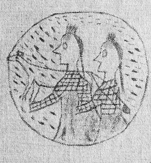
A second entry on the Long Soldier Winter Count cites a conflict at the Cannonball River between the Lakȟóta and Hóhe (Assiniboine) in 1862-63. Twenty Assiniboine came on the warpath, there was a battle there, and they hid behind the cannonball concretions. The circle tells us that the Assiniboine were surrounded and fired upon. The fox image which overlays the Assiniboine tells us they fought with guile.


Capt. Seth Eastman painted this scene of Fort Rice, Dakota Territory.

On July 29, 1864, after spending two weeks hastily constructing Fort Rice, General Sully took his command of 2200 soldiers, which included a detachment of Winnebago Indian scouts, and ascended the Cannonball River on the south bank, his punitive campaign on the Isáŋyathi Dakȟóta anew. Known or unknown, Sully also marched against the Thítȟuŋwaŋ Lakȟóta (Húŋkpapȟa, Itázipčho, Sihásapa, and Mnikȟóžu), and Iháŋktȟuŋwaŋna Dakȟóta, two Siouan groups who had nothing to do with the 1862 Minnesota Dakota Conflict. Sully received a dispatch from Fort Rice at midnight on July 22 that the Dakȟóta were on the Knife River. The next day Sully’s command crossed the Cannonball River near present-day communities of Porcupine and Shields, ND.


Gall was bayoneted by a soldier at Fort Berthold. 

A third entry from the Long Soldier Winter Count indicates that the Húŋkpapȟa were camped at the Cannonball River in 1866-67. Gall was taken by soldiers that winter to Fort Berthold where they stabbed him. Gall was left for dead and the camp moved on. What makes this tale remarkable is that Gall walked to the Húŋkpapȟa camp at the Cannonball River and recovered. 

In 1878, the Huŋkphápȟa chief, Ištá SápA (“Black Eye/s”), met with William Wade, a cattle rancher on the Cannonball River, and shared this about the terrible 1825 flood: “...we camped on this bottom land just below here...it was the Wolf Month [February] and it had been warm for a long time. One night the water started coming in over the ground from the river and before we could get to higher ground we were surrounded by water and ice chunks. Our only chance was to get to high ground before we would all be covered up with water. We tried to carry our tepees and supplies but finally had to leave them and many of the women were drowned trying to save their children. Most all our old people drowned and many others. Most all our horses went under and you can still see their heads (skulls) laying [sic] along at the foot of the hills after so many, many years. Two Bears (Mato Nopa) a Yankton chief [sic], saved the lives of several women and children by carrying them from camp to the higher ground.”

William Wade’s daughter, Mamie, met her share of pre-reservation Dakȟóta and Lakȟóta people. Among them was Annie Skye. Skye relayed to the younger Wade that smallpox struck the Lakȟóta in 1837. They were camped at the mouth of the Cannonball River when “out of a clear blue sky smallpox hit them. After the death of several of their number, who were put to rest up on platforms suspended in trees, they decided to move away from this infested locality.”

Dr. Harriett Skye, Annie Skye’s granddaughter, offers a contemporary perspective on current events near the Cannonball River: “I believe that as long as they remain peaceful and unarmed, and each day they are there, is a win. This kind of action confuses those who would come in with their guns and armor because their intent is to kill. They arrested people who were praying, but the powers that be know that the world is watching, but more importantly, know that our Ancestors are watching because they fought and died so we could be here. This struggle is everyone’s struggle to maintain our clean water. Water is life.” Dr. Skye was inducted into the North Dakota Heritage Center’s Native American Hall of Honor in September, 2016.


Dr. Fenn's "Encounters At The Heart Of The World." Get yourself a copy.

Dr. Elizabeth Fenn, Pulitzer Prize winning author of “Encounters at The Heart of The World: A History of The Mandan People,” writes that the Huff phase - located between the Cannonball River and Heart River in a time frame from about circa 1300 to about 1450 - was when and where the Mandan became the Mandan. They developed the Okipa ceremony in this location during this time. The South Cannonball site was unprotected, that is, there were no palisade walls, nor defensive moats surrounding their village there. The fortifications at the North Cannonball site may well represent a key transformation in plains village life, as drought caused strife in the Missouri River valley. This may have been cause for the Mandan to move closer together - and build fortifications - for safety. But we need archaeological study to sort these things out.

By the time Mandans moved north from the Cannonball area to Huff and the Heart River, they had embraced the key trait that made them Mandan: the Okipa ceremony, with its multi-day reenactment of their own rich history. The Cannonball area, according to Fenn, represents “the oldest Mandan cultural horizon.”


One of Deloria's thought-provoking works. Another one is "Custer Died For Your Sins." 

The late Vine Deloria Jr. essayed that for many Americans, “the first and most familiar kind of sacred lands are places to which we attribute sanctity because the location is a site where, within our own history, something of great importance has taken place. Unfortunately, many of these places are related to instances of human violence. Every society needs these kinds of sacred places because they help to instill a sense of social cohesion in the people and remind them of the passage of generations that have brought them to the present. A society that cannot remember and honor its past is in peril of losing its soul. Indians, because of our considerably longer tenure on this continent, have many more sacred places than do non-Indians.”

“A second category of sacred lands has a deeper, more profound sense of the sacred. It can be illustrated in…[when] Joshua led the Hebrews across the River Jordan into the Holy Land. After crossing, Joshua selected one man from each of the Twelve tribes and told him to find a large stone. The twelve stones were then placed together in a monument to mark the spot where the people had camped after having crossed the river successfully. In the crossing of the River Jordan, the sacred or higher powers have appeared in the lives of human beings...the essence of the event is that the sacred has become a part of our existence.”

“It is not likely that non-Indians have had many of these kinds of religious experiences, particularly because most churches and synagogues have special rituals that are designed to cleanse the buildings so that their services can be held there untainted by the natural world. Non-Indians simply have not been on this continent very long; their families have rarely settled in one place for any period of time so that no profound relationship with the environment has been possible.”

Deloria concluded: “The third kind of sacred lands are places of overwhelming holiness where the Higher Powers, on their own initiative, have revealed Themselves to human beings. We can illustrate this point in the Old Testament narrative. Moses spent time herding sheep on Mount Horeb. One day to his amazement [he] saw a bush burning with fire but not being consumed by it. Approaching this spot, Moses was startled when the Lord spoke to him. ‘Put off thy shoes, for the place where thou standest is holy ground.’ This tradition tells us that there are places of unquestionable, inherent sacredness on this earth, sites that are holy in and of themselves. These holy places are locations where people have always gone to communicate and commune with higher powers.”


Wood's book details the Huff Phase of the Mandan Indians, which also includes some narrative of the North Cannonball site. An aerial view of this site is within these pages.

Dr. Ray Wood, renowned expert in Plains Indian cultural and archaeological sites on the Upper Missouri River and whose first-hand field experience goes back before the dams of the 1950s, interprets the data from John Evans 1796 map in regard to the Cannonball River locality that what Evans recorded as “Jupiter’s Fort” is without a doubt a prehistoric Mandan village. According to Wood’s findings regarding the North Cannonball site, “Not only was it a defensive setting, but the village was also fortified by a curving ditch that isolated a level upland spur from the adjoining upland. The village today is badly disturbed by plowing, but from the air one can clearly see the fortification ditch and the numerous bastions protruding from it. Little wonder that Evans referred to it as a fort…” In his “Prologue To Lewis & Clark: The Mackay And Evans Expeditions,” Dr. Wood essays the number of remarkable Indian village sites north of the Cannonball River. Remarkable. Extraordinary. Outstanding. Significant.

The ND SHPO conducted a follow-up survey west of HWY 1806 and found that no significant sites were destroyed. The physical evidence, or lack thereof, cannot be disputed. According to the chief archaeologist’s published note, he and his associates were looking west of HWY 1806, perhaps because Mr. Tim Mentz conducted his own survey and called attention there with his findings. The North Cannonball site, and the mouth of the Cannonball River, the confluence of history and culture, is east of HWY 1806.


The Cannonball Ranch was a main stop in North Dakota's history. 

In 1999, the Cannonball Ranch was inducted into the North Dakota Cowboy Hall of Fame. It’s one of the oldest ranches in North Dakota. According the ND Cowboy of Fame, the ranch served as a gathering point as early as 1865. The ranch included a hotel, a general store, a ferry crossing, a steamboat landing and fueling station, a military telegraph station for Fort Rice, and a stage line to the Black Hills in the 1870’s and 1880s. The ranch also included two houses, a barn, a blacksmith shop, a bunk-house, an ice house, a laundry, and tennis court.

The North Dakota Cowboy Hall of Fame’s strict criteria for eligibility to be recognized is that a ranch must have been “instrumental in creating or developing the ranching business, traditions, and lifestyles of North Dakota’s western heritage and livestock industry.”

In 2010, Walmart planned to construct a supercenter near Wilderness Battlefield (a Civil War battle ground) and people invested in the history of that site grew concerned. Eventually, enough people held that ground as sacred and historical that plans for the supercenter were dropped in January 2011. Coincidentally, Walmart and state officials had argued that nothing significant occurred on that site. 

The sum of the north bank of the Cannonball River with a million years of geological history, 700 years of continual occupation, inter-tribal conflict, smallpox, botany, trade, steamboat traffic, US military history, and early ranching, have made that location significant.


Mr. Leroy Curly (Cheyenne River Sioux Tribe) developed a Lakota alphabet in the 1980's. I employed this alphabet executed in a brush script using acrylic on watercolor. 

Spiritual pilgrimages were conducted on the plateaus of the “Hummit.” There would be little to no traces of these vision quests, and there shouldn’t be. People went to pray, not leave evidence. In September of 2016, the Presiding Bishop of the Episcopal Church, Rt. Rev. Curry, made a pilgrimage of his own to the Cannonball. He listened and prayed with the community there. Curry’s visit calls to mind Psalm 99:9, “Exalt the Lord our God, and worship at his holy hill; for the Lord our God is Holy.” The mystery of creation can be seen there today as the early peoples beheld it.

The Cannonball River, and specifically the North Cannonball site, and its importance to the first nations, to North Dakota, must take into account its religious or spiritual significance, its role in inter-tribal conflicts, its role in the 1837 smallpox epidemic which struck the Húŋkpapȟa, its role as the starting point in Gen. Sully’s 1864 punitive campaign, and the historic Cannonball Ranch.

The Cannonball River, and all its attributes is important to all North Dakota citizens, to new citizens, and most importantly of all, the future. Let us put our minds together, to educate ourselves and one another about the things we hold dear, to resolve to respect our story, our histories, and our sites of significance.

Keúŋkeyapi. That’s what they said.