Showing posts with label The Edge Of The Village. Show all posts

Tuesday, July 29, 2014

Tipi Rings Or Stone Circles

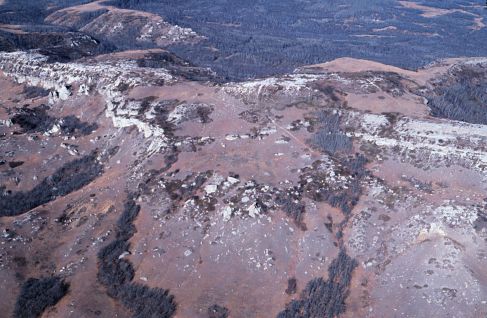
A foggy morning at Whitestone Hill, N.D. One stone is visible in the foreground, the remaining stones in this circle are nearly covered up by years of soil and grass. 
Tipi Rings, Stone Circles
Features Attributed To Trickster
Edited by Dakota Wind
GREAT PLAINS, N.D. – My good friend Aaron Barth, proprietor of The Edge Of The Village, recently asked me about stone circles, a feature regularly found on the Great Plains of North America.

In Memoir 19 of the Plains Anthropologist (1982), is a collection of papers about the “tipi ring” feature. Within those pages is an account of an archaeological survey of a tipi ring site; the tipi ring site, at least this one, featured a cache pit which seems to indicate to the writer to that people intended to return. I don’t believe that's entirely accurate. Another possibility is that food or other items were left as offerings to a higher power when someone long ago prayed there.

"...tipis were staked to the ground with pegs, not stones."

One thing for certain is that tipis were staked to the ground with pegs, not stones.

Next follows an edited excerpt from Colonel Alfred Welch’s papers about stone circles (references to locations have been removed). Welch had interviewed several people from the Standing Rock Sioux Indian Reservation and the Fort Berthold Indian Reservation to create this wonderful summation of stone circles (not tipi rings):

All through the Missouri river country may be found certain systemically formed “Stone Rings or Circles.” These round patterns, or mosaics, are formed by stones placed side by side, describing a more or less well-formed circle.

They are of various diameters, the largest which we have measured being forty feet across and the smallest twelve feet across. Some of these circles are formed with a single line of stones, others have two well-defined circles, one within the other, and a few have been found with three or more lines of stone laid closely together, forming a “circle” which was wide like a paved walk.

"...they are rocks which have been used to hold the bottom of the lodges from being flapped by the wind." 

The commonly accepted version of the farmers upon whose lands these are to be found is that they are rocks which have been used to hold the bottom of the lodges from being flapped by the wind.

This idea, however, is discarded for the rings, or circles, are to be found where lodges would not have been erected, in all probability. An examination of…many others [stone circles] confirms us in the belief that they are ceremonial places. 

The regularity of the position of the stones indicates that they were not used as weights for tipi edges, for stones used for that purpose would have been rolled out of line when breaking camp, and they are too heavy for that purpose.

Lodges would certainly not have been put up in those particular locations during the winter time and, if they were there during the summer, the complete circumference of the lodge would not have been weighted down, but would have been left free to open to the side from which the cool winds blew. No half circles have been found. There is generally no wood readily available, and only sometimes the stone circles are located conveniently close to water.

They are not of glacial formation, as the great number of them and their regularity as to shape and entrance clearly indicates the work of human hands.  Entrances are a space of some two or three feet across, entirely free from stone, and in most cases is in the direct eastern part of the circle, or nearly so, and shows a positive purpose or design. In the center of circles a larger stone is sometimes found, which also indicates a definite purpose.

The stones of the circles are, in many cases, almost covered with the accumulation of wind-blown dust and sand. A few have been seen, where no stones were seen at all, the only indication of the formation being by the grass-free spot over the rocks. The supposition is that they are of great age and the natives claim that they were here when they came into the country.

"Any peculiar form of rock is supposed to have been made by Iŋktómi, even the flint arrowheads were made by him."

Conversations with the Dakȟóta and Lakȟóta regarding them nearly always end with the remark that “Iŋktómi made them.” Among the Dakȟóta and Lakȟóta, Iŋktómi, the Spider or Trickster, was the wisest creature and possessed of wonderful powers of changing himself into any other form he desired. Great feats of strength are also ascribed to him. Any peculiar form of rock is supposed to have been made by Iŋktómi, even the flint arrowheads were made by him.

The Mandan, Hidatsa and Arikara do not claim to have built these rings and, in fact, say that they did not construct them but that they were made by some people who were here before any of their people came into this country.  The entrances all being toward the east, the fact that they appear to have been constructed both on high hills and low vales, the appearance of a stone altar in the middle of so many of them – are significant and of interest to all students of “ancient mysteries” and “land marks.” 

Wednesday, February 6, 2013

Fallen & Forgotten Veterans Of The Killdeer Mountain Conflict

A painting of the Killdeer Mountain Conflict of 1864 by Carl Boeckman.
1863 Killdeer Mountain: 150 Years Later
Fallen & Forgotten Veterans From The Past

By Aaron Barth, The Edge Of The Village
BISMARCK, N.D. - Tomorrow, Thursday, February 7, 2013, at 1400 hours (CST), North Dakota Senator Connie Triplett (District 18, Grand Forks)will collaboratively sponsor SB 2341, a bill that seeks to carry out an archaeological and historic-archaeological study on the Killdeer Mountains in Dunn County, western North Dakota. I’ll be attending this hearing (it will take place before the Senate Government & Veteran’s Affairs Committee in the Missouri River Room), and Triplett has circulated an e-mail asking historians, landowners, archaeologists, Natives and others for testimonies to support this bill. The Killdeer Mountains figure into our nation’s history and the US-Dakota Wars that spanned from 1862 in the Minnesota River Valley, and carried on through 1864 at Killdeer Mountains in western North Dakota.

Sitting Bull, great Hunkpapa Lakota leader, was present at Killdeer Mountain when General Sully decided to attack. The Hunkpapa had nothing to do with the Minnesota Dakota Conflict of 1862. Sitting Bull was among the leaders who took the Lakota west into Elk River country (Little Missouri today) in an attempt to escape an unwarrented attack. He never forgave the Union for the needless death of innocent women and children.

What we know right now about Killdeer from 1864 is limited (the State Historical Society of North Dakota has a nice and thoughtful write up of it here), and further archaeological and historical research is needed. It was an action between the Union Army and various Dakota nations, and some key players involved were Sitting Bull, Inkpaduta, Gall (among others), and General Alfred Sully and his Union soldiers. In many ways, just as this nation recognizes and respects fallen Union and Confederate combatants and non-combatants, this nation owes it to honor the Dakota soldiers and non-combatants killed in Dakota Territory during the Civil War. To extend this honor requires and necessitates a deliberate and culturally sensitive systematic archaeological and historical study like the one proposed in SB 2341. We understandably honor Americans that have fought and died in 21st century warfare, and we ought to also be honoring and rescuing those fallen and forgotten from the Killdeer Mountains from July 1864.

Pizi, or Chief Gall, led the Dakota and Lakota in a running battle from General Sibley at the conflicts of Dead Buffalo Lake, Stoney Lake and the Conflict at Apple Creek in 1863. Gall was present at the Killdeer Mountain Conflict and assisted the Lakota in a run west to Elk River (Little Missouri River) to escape Sully's advances.

Note: according to Sioux County Veterans Service Officer Roster, today in 2013 Standing Rock has a veteran population of 357.

Note: It is estimated that perhaps 150 Dakota and Lakota lost their lives at the Killdeer Mountain Conflict. The Dakota and Lakota would say, "Wokiksuya lo," "Remember This."

Friday, January 25, 2013

The Sanctuary of Killdeer Mountain

The Killdeer Mountains
Living History And Sacredness
By Aaron Barth, The Edge of The Village
KILLDEER, N.D. - The Killdeer Mountains in Dunn County, western North Dakota have been getting a lot of attention lately, especially after theNorth Dakota Industrial Commission decided to, well, industrialize the area, and allow the Hess Corporation to follow through with signed leases and drill and frack for oil there. The Grand Forks Herald reported on it here, and The Bismarck Tribune here. The Industrial Commission is composed of three individuals, including Jack Dalrymple, Wayne Stenehjem, and Doug Goehring. They have scheduled meetings with the Department of Mineral Resources and Lynn Helms, the sitting Director. It is important to remember that this was a public hearing, and at public hearings the public ought not to be shy about attending. This experiment America has going, our Democratic-Republic, necessitates these local meetings that have global implications.

On January 24, 2013, at 1:00pm (CST) the public hearing for the Killdeer Mountains was held in the capitol of Bismarck, North Dakota. It was Industrial Commission Case Number 18618 concerning sections 25 & 36, T. 146 N., R. 97 W, this about 30-35 miles north of Dickinson, North Dakota. Originally the hearing was scheduled in the Governor’s meeting room, a rather closed-off and secluded place. Because of the public turn-out, though, the hearing was relocated to the larger Brynhild Haugland room in the western wing of the capitol. I drove over from Fargo to Bismarck to attend the meeting, and while there scribbled down some notes and took some audio-video as well. The high-points, I thought, were in capturing two Native voices from two disparate cultures.

The first is a video from Theodora Birdbear of Mandaree, North Dakota (Mandaree is Mandan, Hidatsa and Arikara territory). The microphone on my Canon PowerShot SX260 HS captured the audio a bit, and just in case there are those of us hard-of-hearing, I provided transcript of Theodora’s testimony below.

Theodora Bird Bear explains the spiritual significance of Killdeer Mountains.

Transcript:
…and he expressed the impact of oil and gas development, the industrialization of an area, which impacts the quality of that spiritual experience. I guess it’s kind of equivalent to having an oil well right beside your Catholic church or something. It’s parallel to that. So I wanted the commission to know that Fort Berthold does have a living connection to that area, and to consider that in your decision making. As people have said prior to this, technology is evolving, and to keep it [oil] in the ground is not wasting it. They are going to be after it in the future. What’s the rush? The rush is quick decisions, unplanned decisions, and unplanned impacts. So I just wanted to make a comment about our relationship with that area. It is still living today.

Theodora remarks on how the Killdeer Mountains are a sanctuary, as sacred and sacrosanct as a Catholic Church, and to carry the analogy further, as a Lutheran or protestant church, a Synagogue, a Mosque, a Buddhist monastery, a Hindu temple, a Confucian temple, and so on. These spaces are sacrosanct in the sense that when an individual goes to the area to pray, they are really interested in having it as quiet. A library could also be considered a sacred space by this definition (libraries carry on that monastic-academic tradition of the deliberate contemplation of texts — this is arguably the antithesis of our hyper-industrial, full-throttle, 21st century world).

The hearing about opening up Killdeer Mountain for oil drilling was open to the general public. The Industrial Commission graciously opened the hearing to listen to concerns from the general public.

I explained that the Killdeer conflict was far larger than the delineated core, the designated North Dakota State Historical Site and involved a running battle from Killdeer Mountain west to the Little Missouri River.

There is estimated to be about 3 to 3.5 million barrels of oil under Killdeer Mountain, worth about $250 million. By not developing and extracting that mineral and oil deposit it is defined by the state of North Dakota as waste.

You, reader, can read about the Industrial Commission's decision to allow Hess Oil to drill within three miles of Medicine Hole and the Killdeer conflict site, at the Bismarck Tribune.